
| Memorials | : | 0 |
| Location | : | Constance, Boone County, USA |
| Coordinate | : | 39.0737306, -84.6356694 |
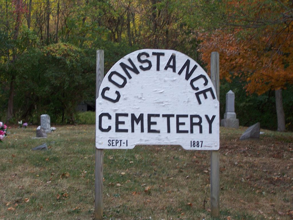
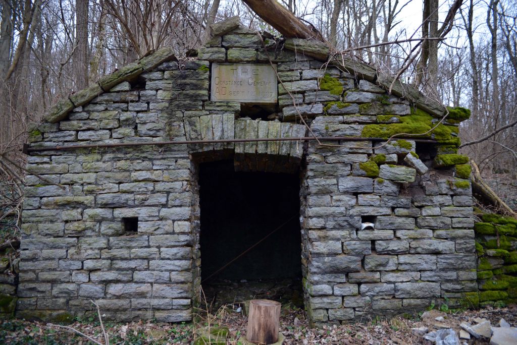
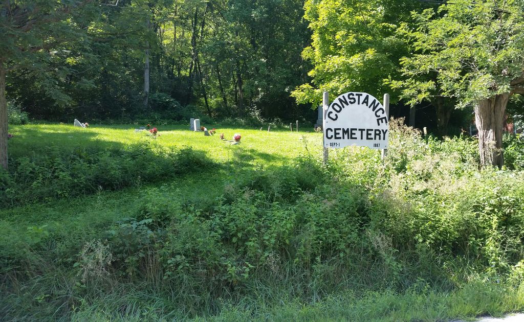
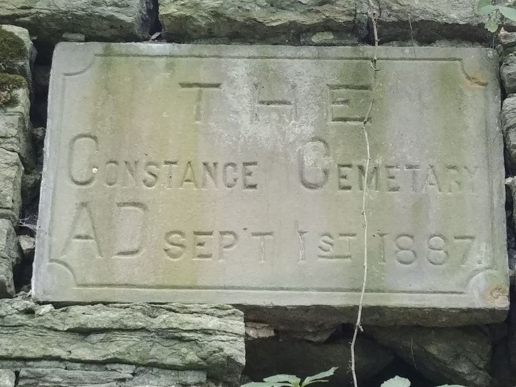
| Description | : | The cemetery is located on the north side of River Road (Kentucky State Highway 8) about 0.4 miles east of its intersection with Petersburg Road (Kentucky State Highway 20). The Boone County GIS unique ID assigned to this cemetery is 50 (Constance Cemetery). The cemetery has an index number of 51 (Constance) on the Boone County Kentucky Cemetery Map published in 2005 by the Boone County Planning Commission in conjunction with Johnson-Wilson Cemetery Stewards Association. The cemetery is identified as Constance in the index and listed as Constance Cemetery on page 59 of the book “Boone County, Kentucky Cemeteries” by Stephen W. Worrel,... Read More |
frequently asked questions (FAQ):
-
Where is Constance Cemetery?
Constance Cemetery is located at River Road (Kentucky State Highway 8) Constance, Boone County ,Kentucky , 41048USA.
-
Constance Cemetery cemetery's updated grave count on graveviews.com?
0 memorials
-
Where are the coordinates of the Constance Cemetery?
Latitude: 39.0737306
Longitude: -84.6356694
Nearby Cemetories:
1. Hood Cemetery
Hebron, Boone County, USA
Coordinate: 39.0708008, -84.6363983
2. Peeno Cemetery
Constance, Boone County, USA
Coordinate: 39.0752983, -84.6446991
3. Masters Cemetery #02
Constance, Boone County, USA
Coordinate: 39.0702780, -84.6441670
4. Peeno Cemetery #02
Constance, Boone County, USA
Coordinate: 39.0725000, -84.6455560
5. Masters Cemetery
Constance, Boone County, USA
Coordinate: 39.0675000, -84.6444440
6. Calvin Peeno Cemetery
Stringtown, Boone County, USA
Coordinate: 39.0815917, -84.6461861
7. Laycock Farm Cemetery
Anderson Ferry, Hamilton County, USA
Coordinate: 39.0877780, -84.6399190
8. Nancy Harper Cemetery (Defunct)
Stringtown, Boone County, USA
Coordinate: 39.0800000, -84.6550000
9. Brown Family Cemetery
Florence, Boone County, USA
Coordinate: 39.0548528, -84.6346639
10. McNeal Family Cemetery
Florence, Boone County, USA
Coordinate: 39.0638790, -84.6581350
11. Schumann Cemetery
Cincinnati, Hamilton County, USA
Coordinate: 39.0926860, -84.6464460
12. Klasserner-Wilson Family Cemetery
Taylorsport, Boone County, USA
Coordinate: 39.0895810, -84.6596880
13. Mount Alverno Cemetery (Defunct)
Delhi, Hamilton County, USA
Coordinate: 39.0863890, -84.6083330
14. Tupman Cemetery
Villa Hills, Kenton County, USA
Coordinate: 39.0528600, -84.6153440
15. Sisters of Charity Cemetery
Cincinnati, Hamilton County, USA
Coordinate: 39.0992700, -84.6476200
16. Saint Walburg Cemetery
Villa Hills, Kenton County, USA
Coordinate: 39.0671860, -84.6001990
17. Darby-Lee Cemetery
Delhi, Hamilton County, USA
Coordinate: 39.0995930, -84.6535850
18. Riggs Cemetery (Defunct)
Crescent Springs, Kenton County, USA
Coordinate: 39.0494440, -84.6138890
19. Walton Cemetery
Hebron, Boone County, USA
Coordinate: 39.0456700, -84.6198900
20. Shiloh United Methodist Church Cemetery
Delhi Hills, Hamilton County, USA
Coordinate: 39.1034450, -84.6169310
21. Our Lady of Victory Cemetery
Cincinnati, Hamilton County, USA
Coordinate: 39.1083100, -84.6345100
22. Passionist Monastery Cemetery
Erlanger, Kenton County, USA
Coordinate: 39.0350600, -84.6305300
23. Delphi Universalist Church Cemetery
Delhi Hills, Hamilton County, USA
Coordinate: 39.1058420, -84.6073340
24. Delhi Township Cemetery
Delhi Hills, Hamilton County, USA
Coordinate: 39.1133430, -84.6354500