
| Memorials | : | 0 |
| Location | : | Constance, Boone County, USA |
| Coordinate | : | 39.0675000, -84.6444440 |
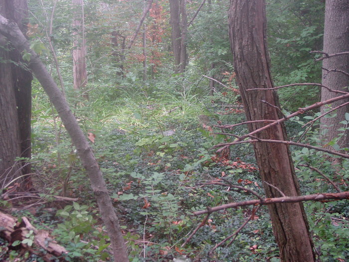
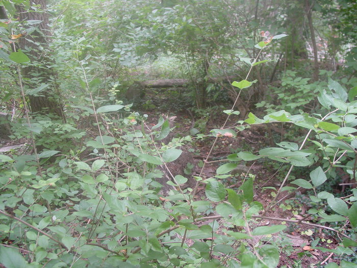
| Description | : | This cemetery is located about 650 feet east of I-275 and about 850 feet west of a power line cut west of Arbor Tech Drive. The Boone County GIS unique ID assigned to this cemetery is 112 (Masters Cemetery). The cemetery has an index number of 113 (Masters) on the Boone County Kentucky Cemetery Map published in 2005 by the Boone County Planning Commission in conjunction with Johnson-Wilson Cemetery Stewards Association. The cemetery is identified as Masters in the index and listed as Masters Cemetery on page 341 of the book “Boone County, Kentucky Cemeteries” by Stephen W. Worrel, M.A. & Anne... Read More |
frequently asked questions (FAQ):
-
Where is Masters Cemetery?
Masters Cemetery is located at Arbor Tech Drive Constance, Boone County ,Kentucky , 41048USA.
-
Masters Cemetery cemetery's updated grave count on graveviews.com?
0 memorials
-
Where are the coordinates of the Masters Cemetery?
Latitude: 39.0675000
Longitude: -84.6444440
Nearby Cemetories:
1. Masters Cemetery #02
Constance, Boone County, USA
Coordinate: 39.0702780, -84.6441670
2. Peeno Cemetery #02
Constance, Boone County, USA
Coordinate: 39.0725000, -84.6455560
3. Hood Cemetery
Hebron, Boone County, USA
Coordinate: 39.0708008, -84.6363983
4. Peeno Cemetery
Constance, Boone County, USA
Coordinate: 39.0752983, -84.6446991
5. Constance Cemetery
Constance, Boone County, USA
Coordinate: 39.0737306, -84.6356694
6. McNeal Family Cemetery
Florence, Boone County, USA
Coordinate: 39.0638790, -84.6581350
7. Calvin Peeno Cemetery
Stringtown, Boone County, USA
Coordinate: 39.0815917, -84.6461861
8. Brown Family Cemetery
Florence, Boone County, USA
Coordinate: 39.0548528, -84.6346639
9. Nancy Harper Cemetery (Defunct)
Stringtown, Boone County, USA
Coordinate: 39.0800000, -84.6550000
10. Laycock Farm Cemetery
Anderson Ferry, Hamilton County, USA
Coordinate: 39.0877780, -84.6399190
11. Klasserner-Wilson Family Cemetery
Taylorsport, Boone County, USA
Coordinate: 39.0895810, -84.6596880
12. Schumann Cemetery
Cincinnati, Hamilton County, USA
Coordinate: 39.0926860, -84.6464460
13. Tupman Cemetery
Villa Hills, Kenton County, USA
Coordinate: 39.0528600, -84.6153440
14. Walton Cemetery
Hebron, Boone County, USA
Coordinate: 39.0456700, -84.6198900
15. Riggs Cemetery (Defunct)
Crescent Springs, Kenton County, USA
Coordinate: 39.0494440, -84.6138890
16. Sisters of Charity Cemetery
Cincinnati, Hamilton County, USA
Coordinate: 39.0992700, -84.6476200
17. Christy Family Cemetery
Burlington, Boone County, USA
Coordinate: 39.0380790, -84.6617180
18. Brown Cemetery
Hebron, Boone County, USA
Coordinate: 39.0377780, -84.6613890
19. Darby-Lee Cemetery
Delhi, Hamilton County, USA
Coordinate: 39.0995930, -84.6535850
20. Mount Alverno Cemetery (Defunct)
Delhi, Hamilton County, USA
Coordinate: 39.0863890, -84.6083330
21. Passionist Monastery Cemetery
Erlanger, Kenton County, USA
Coordinate: 39.0350600, -84.6305300
22. Saint Walburg Cemetery
Villa Hills, Kenton County, USA
Coordinate: 39.0671860, -84.6001990
23. Garnet Cemetery
Florence, Boone County, USA
Coordinate: 39.0377998, -84.6694031
24. Ann Popham Cemetery
Limaburg, Boone County, USA
Coordinate: 39.0333330, -84.6633330