
| Memorials | : | 0 |
| Location | : | Florence, Boone County, USA |
| Coordinate | : | 39.0548528, -84.6346639 |
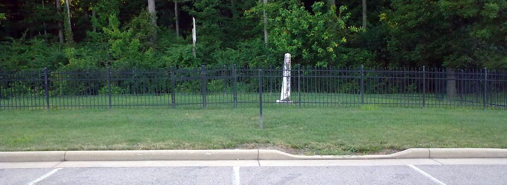
| Description | : | The cemetery is located in a fenced area on the west side of the parking lot of the METS Center at the north end of Olympic Boulevard. The land was formerly the property of the Point Pleasant Christian Church. The Boone County GIS unique ID assigned to this cemetery is 30 (Brown, Joseph Cemetery). The cemetery has an index number of 30 (Brown, Joseph) on the Boone County Kentucky Cemetery Map published in 2005 by the Boone County Planning Commission in conjunction with Johnson-Wilson Cemetery Stewards Association. The cemetery is identified as Brown (Schaeffer) in the index and listed as Brown Cemetery on... Read More |
frequently asked questions (FAQ):
-
Where is Brown Family Cemetery?
Brown Family Cemetery is located at 3861 Olympic Boulevard Florence, Boone County ,Kentucky , 41048USA.
-
Brown Family Cemetery cemetery's updated grave count on graveviews.com?
0 memorials
-
Where are the coordinates of the Brown Family Cemetery?
Latitude: 39.0548528
Longitude: -84.6346639
Nearby Cemetories:
1. Walton Cemetery
Hebron, Boone County, USA
Coordinate: 39.0456700, -84.6198900
2. Masters Cemetery
Constance, Boone County, USA
Coordinate: 39.0675000, -84.6444440
3. Tupman Cemetery
Villa Hills, Kenton County, USA
Coordinate: 39.0528600, -84.6153440
4. Hood Cemetery
Hebron, Boone County, USA
Coordinate: 39.0708008, -84.6363983
5. Riggs Cemetery (Defunct)
Crescent Springs, Kenton County, USA
Coordinate: 39.0494440, -84.6138890
6. Masters Cemetery #02
Constance, Boone County, USA
Coordinate: 39.0702780, -84.6441670
7. Constance Cemetery
Constance, Boone County, USA
Coordinate: 39.0737306, -84.6356694
8. Peeno Cemetery #02
Constance, Boone County, USA
Coordinate: 39.0725000, -84.6455560
9. Passionist Monastery Cemetery
Erlanger, Kenton County, USA
Coordinate: 39.0350600, -84.6305300
10. McNeal Family Cemetery
Florence, Boone County, USA
Coordinate: 39.0638790, -84.6581350
11. Peeno Cemetery
Constance, Boone County, USA
Coordinate: 39.0752983, -84.6446991
12. Saint Pius X Seminary Cemetery
Florence, Boone County, USA
Coordinate: 39.0289460, -84.6280990
13. Brown Cemetery
Hebron, Boone County, USA
Coordinate: 39.0377780, -84.6613890
14. Christy Family Cemetery
Burlington, Boone County, USA
Coordinate: 39.0380790, -84.6617180
15. Calvin Peeno Cemetery
Stringtown, Boone County, USA
Coordinate: 39.0815917, -84.6461861
16. Saint Walburg Cemetery
Villa Hills, Kenton County, USA
Coordinate: 39.0671860, -84.6001990
17. Nancy Harper Cemetery (Defunct)
Stringtown, Boone County, USA
Coordinate: 39.0800000, -84.6550000
18. Ann Popham Cemetery
Limaburg, Boone County, USA
Coordinate: 39.0333330, -84.6633330
19. Garnet Cemetery
Florence, Boone County, USA
Coordinate: 39.0377998, -84.6694031
20. Laycock Farm Cemetery
Anderson Ferry, Hamilton County, USA
Coordinate: 39.0877780, -84.6399190
21. Popham Cemetery #02 (Defunct)
Limaburg, Boone County, USA
Coordinate: 39.0309770, -84.6647720
22. Mount Alverno Cemetery (Defunct)
Delhi, Hamilton County, USA
Coordinate: 39.0863890, -84.6083330
23. Schumann Cemetery
Cincinnati, Hamilton County, USA
Coordinate: 39.0926860, -84.6464460
24. Limaburg Cemetery
Limaburg, Boone County, USA
Coordinate: 39.0303260, -84.6741860