
| Memorials | : | 0 |
| Location | : | Carrollton, Carroll County, USA |
| Coordinate | : | 33.5077080, -85.0020030 |
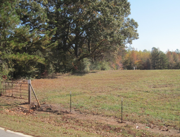
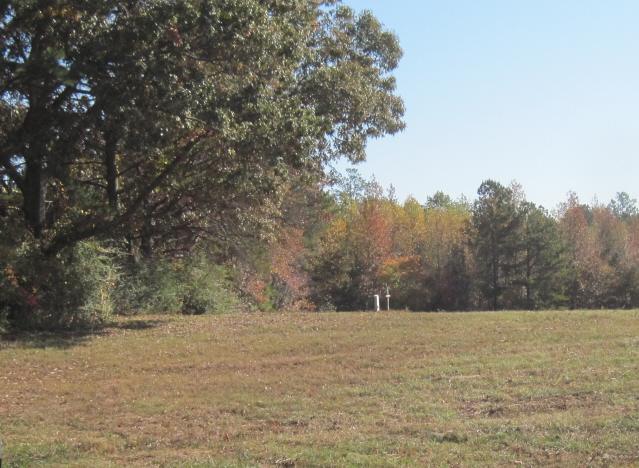
| Description | : | Map 137, Land District 4, Land Lot 25, Parcel 56 N33 30.462', W085 00.119' From Carrollton, go south on Highway 16, to Happy Hill Road, to Davis Road, to house No. 403 The cemetery is across the road and just west, 1.7 miles from the railroad crossing on Happy Hill Road Today, there is only one grave marker existing. This cemetery had previously contained six to eight graves, all marked by field stones. The stones were removed so that the grass could be cut with a bush hog. Last surveyed by J. P. ROWE and Sam PYLE, on January 19,2004. |
frequently asked questions (FAQ):
-
Where is Cook Family Cemetery?
Cook Family Cemetery is located at Map 137, Land District 4, Land Lot 25, Parcel 56, Happy Hill Road Carrollton, Carroll County ,Georgia ,USA.
-
Cook Family Cemetery cemetery's updated grave count on graveviews.com?
0 memorials
-
Where are the coordinates of the Cook Family Cemetery?
Latitude: 33.5077080
Longitude: -85.0020030
Nearby Cemetories:
1. Harper Cemetery
Clem, Carroll County, USA
Coordinate: 33.5132490, -84.9936250
2. Happy Hill Cemetery
Carrollton, Carroll County, USA
Coordinate: 33.5043983, -84.9888992
3. Gray Family Cemetery
Carrollton, Carroll County, USA
Coordinate: 33.5025160, -84.9822250
4. Davis Cemetery
Carroll County, USA
Coordinate: 33.4944000, -85.0152969
5. Clem Cemetery
Clem, Carroll County, USA
Coordinate: 33.5243988, -85.0160980
6. Antioch Missionary Baptist Church Cemetery
Carrollton, Carroll County, USA
Coordinate: 33.5311012, -85.0036011
7. Webb Cemetery
Lowell, Carroll County, USA
Coordinate: 33.4819610, -84.9931100
8. Ephesus Christian Church Cemetery
Whitesburg, Carroll County, USA
Coordinate: 33.4844017, -84.9828033
9. Mount Pleasant Baptist Church Cemetery
Carrollton, Carroll County, USA
Coordinate: 33.5266991, -85.0286026
10. Whooping Creek Primitive Baptist Church Cemetery
Carrollton, Carroll County, USA
Coordinate: 33.5147018, -85.0428009
11. Stallings Cemetery
Lowell, Carroll County, USA
Coordinate: 33.4813530, -85.0401020
12. Gilley Cemetery
Cross Plains, Carroll County, USA
Coordinate: 33.5459200, -84.9777460
13. Old Lutheran Cemetery
Carrollton, Carroll County, USA
Coordinate: 33.5395530, -85.0386640
14. Brown Family Cemetery
Lowell, Carroll County, USA
Coordinate: 33.4634540, -84.9922940
15. Dorris Cemetery
Lowell, Carroll County, USA
Coordinate: 33.4607510, -84.9992900
16. Driver-Boon-Bearden Family Cemetery
Carrollton, Carroll County, USA
Coordinate: 33.5353710, -84.9556820
17. Springer Family Cemetery
Lowell, Carroll County, USA
Coordinate: 33.4657500, -84.9695300
18. Mount Lowell Baptist Church Cemetery
Lowell, Carroll County, USA
Coordinate: 33.4751070, -85.0489210
19. Springer Cemetery
Carroll County, USA
Coordinate: 33.4660988, -84.9661026
20. Rotherwood First Congregational Methodist Church C
Lowell, Carroll County, USA
Coordinate: 33.4709000, -84.9554730
21. Lowell Congregational Holiness Church Cemetery
Lowell, Carroll County, USA
Coordinate: 33.4694680, -85.0478270
22. Gibson-McLucas Cemetery
Lowell, Carroll County, USA
Coordinate: 33.4680540, -85.0475690
23. Cross Plains Baptist Church Cemetery
Cross Plains, Carroll County, USA
Coordinate: 33.5583000, -84.9756012
24. Cross Plains Christian Church Cemetery
Carrollton, Carroll County, USA
Coordinate: 33.5600014, -84.9775009