
| Memorials | : | 0 |
| Location | : | Carrollton, Carroll County, USA |
| Coordinate | : | 33.5353710, -84.9556820 |
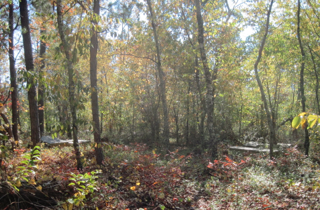
| Description | : | Map 159, Land District 5, Land Lot 67, Parcel 178-2. N33°32.123', W084°57.340'. From Carrollton, Carroll County, Georgia, take Highway 16 south to Old Driver Road. Turn east and go to Hardy Road and stop. On the north side of Old Driver Road is a gate; go in and follow the old road to Plantation Pipe Line. Turn left to the cemetery. There are about 25-30 graves in this cemetery. It was last surveyed by J. P. Rowe and Sam Pyle, on February 12, 2003. |
frequently asked questions (FAQ):
-
Where is Driver-Boon-Bearden Family Cemetery?
Driver-Boon-Bearden Family Cemetery is located at Map 159, Land District 5, Land Lot 67, Parcel 178-2 Carrollton, Carroll County ,Georgia ,USA.
-
Driver-Boon-Bearden Family Cemetery cemetery's updated grave count on graveviews.com?
0 memorials
-
Where are the coordinates of the Driver-Boon-Bearden Family Cemetery?
Latitude: 33.5353710
Longitude: -84.9556820
Nearby Cemetories:
1. Sparks Cemetery
Dingler Crossroads, Carroll County, USA
Coordinate: 33.5429840, -84.9445500
2. Gilley Cemetery
Cross Plains, Carroll County, USA
Coordinate: 33.5459200, -84.9777460
3. Wilson Cemetery
Carroll County, USA
Coordinate: 33.5567017, -84.9655991
4. Wilson Chapel Cemetery
Cross Plains, Carroll County, USA
Coordinate: 33.5582760, -84.9677470
5. Antioch Primitive Baptist Church Cemetery
Banning, Carroll County, USA
Coordinate: 33.5181007, -84.9321976
6. Cross Plains Baptist Church Cemetery
Cross Plains, Carroll County, USA
Coordinate: 33.5583000, -84.9756012
7. Corinth Baptist Church Cemetery
Whitesburg, Carroll County, USA
Coordinate: 33.5231018, -84.9233017
8. Cross Plains Christian Church Cemetery
Carrollton, Carroll County, USA
Coordinate: 33.5600014, -84.9775009
9. Hinesley Cemetery
Cross Plains, Carroll County, USA
Coordinate: 33.5675011, -84.9514008
10. Banning Church of God Cemetery
Whitesburg, Carroll County, USA
Coordinate: 33.5088340, -84.9296410
11. Kiser Cemetery
Carroll County, USA
Coordinate: 33.5692000, -84.9737660
12. Mount Calvary Cemetery
Carroll County, USA
Coordinate: 33.5085983, -84.9246979
13. Harper Cemetery
Clem, Carroll County, USA
Coordinate: 33.5132490, -84.9936250
14. Gray Family Cemetery
Carrollton, Carroll County, USA
Coordinate: 33.5025160, -84.9822250
15. Antioch Missionary Baptist Church Cemetery
Carrollton, Carroll County, USA
Coordinate: 33.5311012, -85.0036011
16. Saint Paul Methodist Church Cemetery
Whitesburg, Carroll County, USA
Coordinate: 33.5503006, -84.9094009
17. Happy Hill Cemetery
Carrollton, Carroll County, USA
Coordinate: 33.5043983, -84.9888992
18. Mount Carmel Church Cemetery
Cross Plains, Carroll County, USA
Coordinate: 33.5746994, -84.9744034
19. Jones Mill Cemetery
Whitesburg, Carroll County, USA
Coordinate: 33.5139008, -84.9116974
20. Whitesburg Cemetery
Whitesburg, Carroll County, USA
Coordinate: 33.5005989, -84.9180984
21. Cook Family Cemetery
Carrollton, Carroll County, USA
Coordinate: 33.5077080, -85.0020030
22. Mount Avery Missionary Baptist Memory Gardens
Whitesburg, Carroll County, USA
Coordinate: 33.5317001, -84.8966980
23. Consolation Baptist Church Cemetery
Whitesburg, Carroll County, USA
Coordinate: 33.5731010, -84.9171982
24. Ayers Cemetery
Whitesburg, Carroll County, USA
Coordinate: 33.5029340, -84.9100470