
| Memorials | : | 0 |
| Location | : | Lowell, Carroll County, USA |
| Coordinate | : | 33.4709000, -84.9554730 |
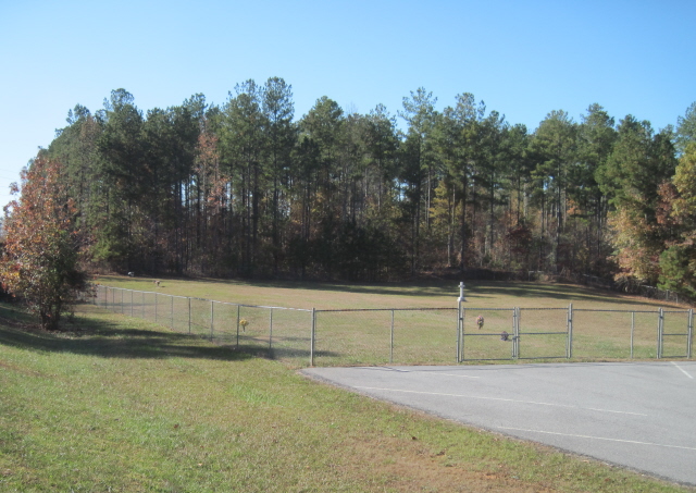
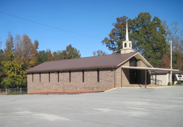
| Description | : | From the intersection of Highway 5 and Lowell Road, go east on Highway 5 for about 5.7 miles. The church and cemetery are on the left side of the road. A cross stands in the middle of the cemetery. |
frequently asked questions (FAQ):
-
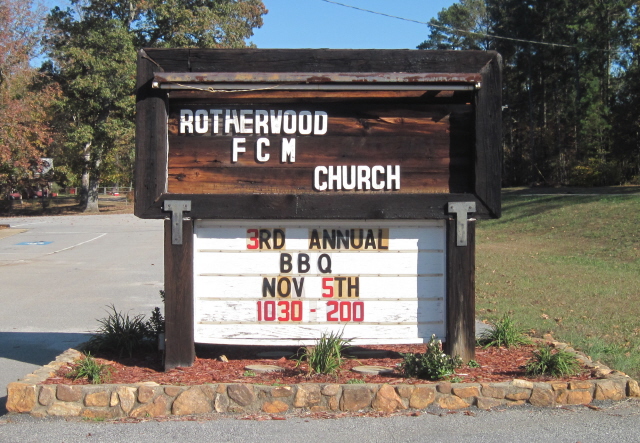
Where is Rotherwood First Congregational Methodist Church C?
Rotherwood First Congregational Methodist Church C is located at Lowell, Carroll County ,Georgia ,USA.
-
Rotherwood First Congregational Methodist Church C cemetery's updated grave count on graveviews.com?
0 memorials
-
Where are the coordinates of the Rotherwood First Congregational Methodist Church C?
Latitude: 33.4709000
Longitude: -84.9554730
Nearby Cemetories:
1. Springer Cemetery
Carroll County, USA
Coordinate: 33.4660988, -84.9661026
2. Springer Family Cemetery
Lowell, Carroll County, USA
Coordinate: 33.4657500, -84.9695300
3. Culpepper Cemetery
Whitesburg, Carroll County, USA
Coordinate: 33.4870620, -84.9352600
4. McIntosh Reserve
Carroll County, USA
Coordinate: 33.4455000, -84.9563400
5. Ephesus Christian Church Cemetery
Whitesburg, Carroll County, USA
Coordinate: 33.4844017, -84.9828033
6. Brown Family Cemetery
Lowell, Carroll County, USA
Coordinate: 33.4634540, -84.9922940
7. Webb Cemetery
Lowell, Carroll County, USA
Coordinate: 33.4819610, -84.9931100
8. Dillard Cemetery
Whitesburg, Carroll County, USA
Coordinate: 33.4920640, -84.9213980
9. Dorris Cemetery
Lowell, Carroll County, USA
Coordinate: 33.4607510, -84.9992900
10. Gray Family Cemetery
Carrollton, Carroll County, USA
Coordinate: 33.5025160, -84.9822250
11. Shiloh Full Gospel Church Cemetery
Carroll County, USA
Coordinate: 33.4505997, -84.9972000
12. Whitesburg Cemetery
Whitesburg, Carroll County, USA
Coordinate: 33.5005989, -84.9180984
13. Mount Avery Missionary Baptist Church Cemetery
Whitesburg, Carroll County, USA
Coordinate: 33.4867220, -84.9074080
14. Johnson Family Cemetery
Lowell, Carroll County, USA
Coordinate: 33.4482010, -84.9998040
15. Happy Hill Cemetery
Carrollton, Carroll County, USA
Coordinate: 33.5043983, -84.9888992
16. Banning Church of God Cemetery
Whitesburg, Carroll County, USA
Coordinate: 33.5088340, -84.9296410
17. Mount Calvary Cemetery
Carroll County, USA
Coordinate: 33.5085983, -84.9246979
18. New Lebanon Cemetery
Sargent, Coweta County, USA
Coordinate: 33.4488983, -84.9060974
19. Ayers Cemetery
Whitesburg, Carroll County, USA
Coordinate: 33.5029340, -84.9100470
20. Taylor Cemetery
Whitesburg, Carroll County, USA
Coordinate: 33.4875450, -84.8988030
21. Antioch Primitive Baptist Church Cemetery
Banning, Carroll County, USA
Coordinate: 33.5181007, -84.9321976
22. Harper Cemetery
Clem, Carroll County, USA
Coordinate: 33.5132490, -84.9936250
23. Cook Family Cemetery
Carrollton, Carroll County, USA
Coordinate: 33.5077080, -85.0020030
24. Johnson Chapel Cemetery
Carroll County, USA
Coordinate: 33.4380989, -85.0085983