
| Memorials | : | 49 |
| Location | : | Lavinia, Carroll County, USA |
| Coordinate | : | 35.9036470, -88.5789430 |
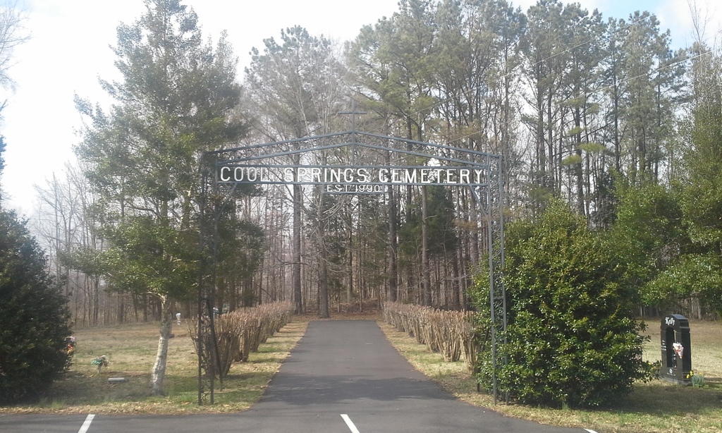
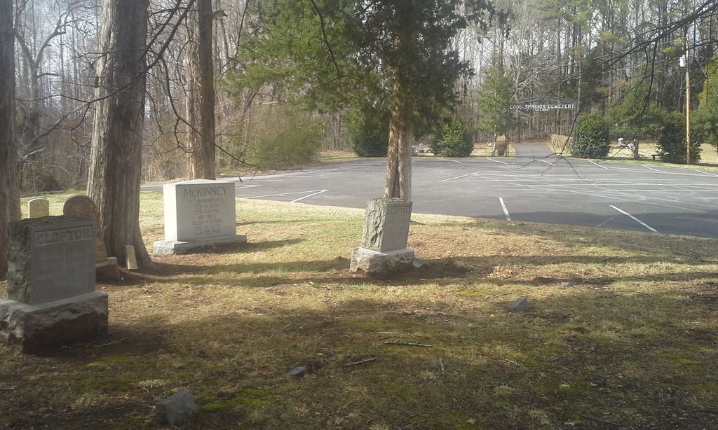
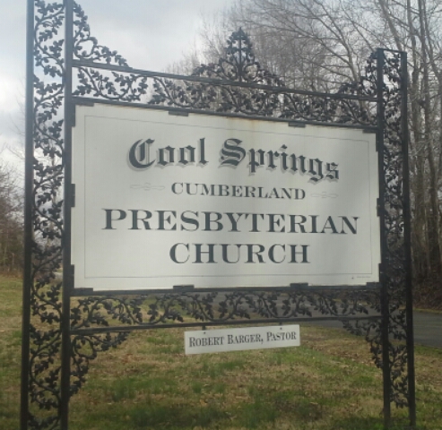
| Description | : | From the intersection of Parker Store Rd. & US-70 E, travel west on Parker Store Rd. for 2.5 mi., turning south (left) onto Terry Rd., going 150 yd., turning west (right) onto Little Grove Rd., going 0.3 mi., turning north (right) into the Cool Springs C.P. Church & parking lot. The main cemetery is to the west of the church & in the woods to the northwest of the parking lot, with a few older memorials located between the road & parking lot. |
frequently asked questions (FAQ):
-
Where is Cool Springs Cumberland Presbyterian Cemetery?
Cool Springs Cumberland Presbyterian Cemetery is located at 155 Little Grove Rd Lavinia, Carroll County ,Tennessee ,USA.
-
Cool Springs Cumberland Presbyterian Cemetery cemetery's updated grave count on graveviews.com?
2 memorials
-
Where are the coordinates of the Cool Springs Cumberland Presbyterian Cemetery?
Latitude: 35.9036470
Longitude: -88.5789430
Nearby Cemetories:
1. Zion Church Cemetery
Lavinia, Carroll County, USA
Coordinate: 35.8947920, -88.5787710
2. Obion Chapel Church Cemetery
Cedar Grove, Carroll County, USA
Coordinate: 35.9198630, -88.5673110
3. Pearson Cemetery
Cedar Grove, Carroll County, USA
Coordinate: 35.9003660, -88.5531730
4. Carters Chapel Cemetery
Carroll County, USA
Coordinate: 35.9247017, -88.5727997
5. Little Grove Cemetery
Lavinia, Carroll County, USA
Coordinate: 35.9142220, -88.6096250
6. Furgerson Cemetery
Cedar Grove, Carroll County, USA
Coordinate: 35.8730830, -88.5732250
7. Leach Seventh Day Adventist Cemetery
Leach, Carroll County, USA
Coordinate: 35.8909988, -88.5358963
8. Brooks Cemetery
Atwood, Carroll County, USA
Coordinate: 35.9430920, -88.5980040
9. Hopewell Baptist Church Cemetery
Hopewell, Carroll County, USA
Coordinate: 35.8977100, -88.6333600
10. Kitty Wright Cemetery
McLemoresville, Carroll County, USA
Coordinate: 35.9455850, -88.5982510
11. Woodard Cemetery
Cedar Grove, Carroll County, USA
Coordinate: 35.8574250, -88.5639770
12. Burns Family Cemetery
Terry, Carroll County, USA
Coordinate: 35.8650700, -88.6197200
13. Old Woodard Cemetery
Cedar Grove, Carroll County, USA
Coordinate: 35.8570180, -88.5457830
14. Shiloh Cemetery
Whitthorne, Carroll County, USA
Coordinate: 35.9108009, -88.6474991
15. Moore-Jones Cemetery
Carroll County, USA
Coordinate: 35.9543870, -88.6158080
16. Clay Family Cemetery
Atwood, Carroll County, USA
Coordinate: 35.9597400, -88.6012900
17. Leach Cemetery
Atwood, Carroll County, USA
Coordinate: 35.9359000, -88.6448800
18. Christian Chapel Cemetery
Cedar Grove, Carroll County, USA
Coordinate: 35.9180984, -88.5038986
19. Pleasant Hill Church Cemetery
Lavinia, Carroll County, USA
Coordinate: 35.8481670, -88.6147370
20. Price Cemetery
Trezevant, Carroll County, USA
Coordinate: 35.9534410, -88.5290640
21. New Reedy Creek Baptist Church Cemetery
McLemoresville, Carroll County, USA
Coordinate: 35.9693570, -88.5737870
22. New Independence Church Cemetery
Huntingdon, Carroll County, USA
Coordinate: 35.9513120, -88.5213620
23. Clark Family Cemetery
Atwood, Carroll County, USA
Coordinate: 35.9556900, -88.6333900
24. Howse Cemetery
Howse, Carroll County, USA
Coordinate: 35.9499600, -88.6458800