
| Memorials | : | 5 |
| Location | : | Huntingdon, Carroll County, USA |
| Coordinate | : | 35.9513120, -88.5213620 |
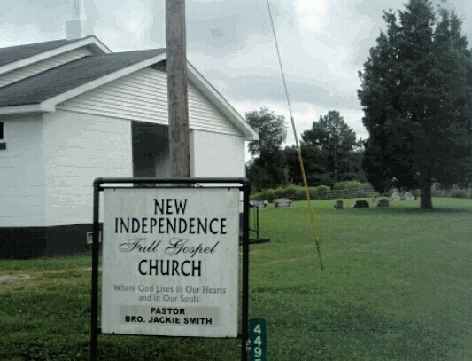
| Description | : | From the intersection of Main & College St., in McLemoresville, travel east, then southeast on McLemoresville Rd. for 4.5 mi., to the New Independence M.B. Church on the east (left) side of the road & to the cemetery just beyond. |
frequently asked questions (FAQ):
-
Where is New Independence Church Cemetery?
New Independence Church Cemetery is located at McLemoresville Rd Huntingdon, Carroll County ,Tennessee ,USA.
-
New Independence Church Cemetery cemetery's updated grave count on graveviews.com?
4 memorials
-
Where are the coordinates of the New Independence Church Cemetery?
Latitude: 35.9513120
Longitude: -88.5213620
Nearby Cemetories:
1. Price Cemetery
Trezevant, Carroll County, USA
Coordinate: 35.9534410, -88.5290640
2. Mount Olive Cemetery
McLemoresville, Carroll County, USA
Coordinate: 35.9685900, -88.5205840
3. Giles Cemetery
Carroll County, USA
Coordinate: 35.9536018, -88.4918976
4. Pleasant Hill Cemetery
Leach, Carroll County, USA
Coordinate: 35.9374770, -88.4971760
5. Leach Full Gospel Church Cemetery
Leach, Carroll County, USA
Coordinate: 35.9337950, -88.4917900
6. Carroll County Poor Farm Cemetery
McLemoresville, Carroll County, USA
Coordinate: 35.9760000, -88.4982000
7. Christian Chapel Cemetery
Cedar Grove, Carroll County, USA
Coordinate: 35.9180984, -88.5038986
8. Antioch Cemetery
Leach, Carroll County, USA
Coordinate: 35.9249992, -88.4852982
9. New Reedy Creek Baptist Church Cemetery
McLemoresville, Carroll County, USA
Coordinate: 35.9693570, -88.5737870
10. Oak Grove Congregational Methodist Church Cemetery
Huntingdon, Carroll County, USA
Coordinate: 35.9576500, -88.4631500
11. Obion Chapel Church Cemetery
Cedar Grove, Carroll County, USA
Coordinate: 35.9198630, -88.5673110
12. Liberty All Church Cemetery
Huntingdon, Carroll County, USA
Coordinate: 35.9849180, -88.4772700
13. Carters Chapel Cemetery
Carroll County, USA
Coordinate: 35.9247017, -88.5727997
14. Everett Family Cemetery
Lakewood, Carroll County, USA
Coordinate: 35.9984900, -88.4878500
15. New Spring Hill Cemetery
Huntingdon, Carroll County, USA
Coordinate: 36.0058030, -88.5012580
16. Pearson Cemetery
Cedar Grove, Carroll County, USA
Coordinate: 35.9003660, -88.5531730
17. McLeod Cemetery
Huntingdon, Carroll County, USA
Coordinate: 35.9460500, -88.4500700
18. O'Conner Cemetery
McLemoresville, Carroll County, USA
Coordinate: 36.0094400, -88.5325400
19. McLemoresville Cemetery
McLemoresville, Carroll County, USA
Coordinate: 35.9882400, -88.5788000
20. Reedy Creek Church Cemetery
McLemoresville, Carroll County, USA
Coordinate: 35.9888440, -88.5807860
21. Leach Seventh Day Adventist Cemetery
Leach, Carroll County, USA
Coordinate: 35.8909988, -88.5358963
22. Kitty Wright Cemetery
McLemoresville, Carroll County, USA
Coordinate: 35.9455850, -88.5982510
23. Brooks Cemetery
Atwood, Carroll County, USA
Coordinate: 35.9430920, -88.5980040
24. Clay Family Cemetery
Atwood, Carroll County, USA
Coordinate: 35.9597400, -88.6012900