
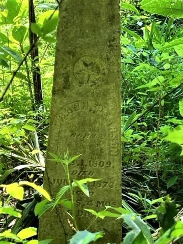
| Memorials | : | 0 |
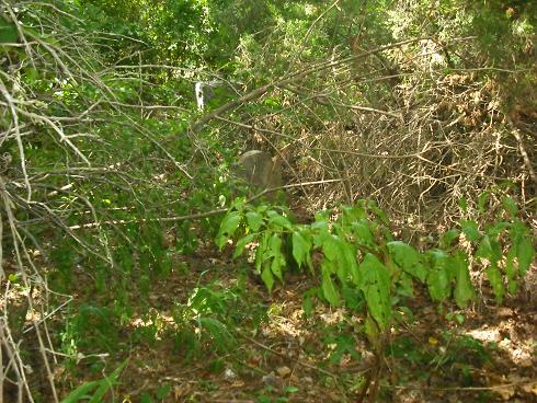
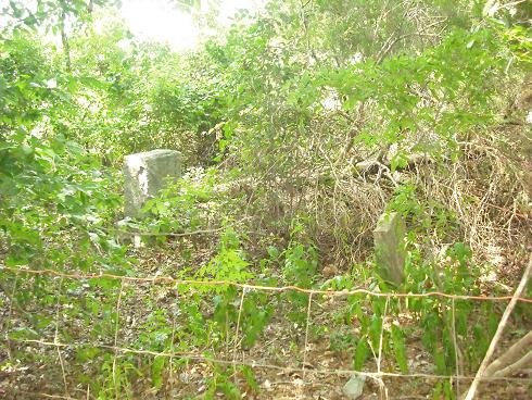
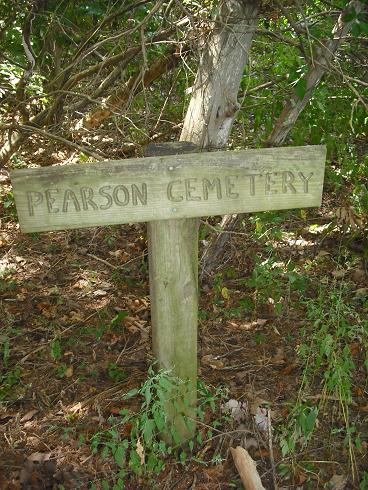
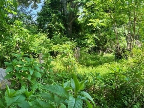
| Location | : | Cedar Grove, Carroll County, USA |
| Coordinate | : | 35.9003660, -88.5531730 |
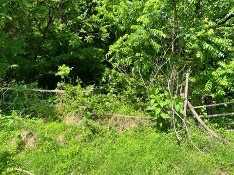
| Description | : | From the intersection of Parker Store Rd. & US-70, travel northwest on Parker Store Rd. for 1.2 mi., turning north (right) onto Jones Ln., going 0.2 mi to the cemetery in a clump of trees on the southwest (left) side of the road. |
frequently asked questions (FAQ):
-
Where is Pearson Cemetery?
Pearson Cemetery is located at 205 Jones Lane Cedar Grove, Carroll County ,Tennessee ,USA.
-
Pearson Cemetery cemetery's updated grave count on graveviews.com?
0 memorials
-
Where are the coordinates of the Pearson Cemetery?
Latitude: 35.9003660
Longitude: -88.5531730
Nearby Cemetories:
1. Leach Seventh Day Adventist Cemetery
Leach, Carroll County, USA
Coordinate: 35.8909988, -88.5358963
2. Cool Springs Cumberland Presbyterian Cemetery
Lavinia, Carroll County, USA
Coordinate: 35.9036470, -88.5789430
3. Zion Church Cemetery
Lavinia, Carroll County, USA
Coordinate: 35.8947920, -88.5787710
4. Obion Chapel Church Cemetery
Cedar Grove, Carroll County, USA
Coordinate: 35.9198630, -88.5673110
5. Carters Chapel Cemetery
Carroll County, USA
Coordinate: 35.9247017, -88.5727997
6. Furgerson Cemetery
Cedar Grove, Carroll County, USA
Coordinate: 35.8730830, -88.5732250
7. Christian Chapel Cemetery
Cedar Grove, Carroll County, USA
Coordinate: 35.9180984, -88.5038986
8. Old Woodard Cemetery
Cedar Grove, Carroll County, USA
Coordinate: 35.8570180, -88.5457830
9. Woodard Cemetery
Cedar Grove, Carroll County, USA
Coordinate: 35.8574250, -88.5639770
10. Little Grove Cemetery
Lavinia, Carroll County, USA
Coordinate: 35.9142220, -88.6096250
11. Brooks Cemetery
Atwood, Carroll County, USA
Coordinate: 35.9430920, -88.5980040
12. Price Cemetery
Trezevant, Carroll County, USA
Coordinate: 35.9534410, -88.5290640
13. New Independence Church Cemetery
Huntingdon, Carroll County, USA
Coordinate: 35.9513120, -88.5213620
14. Kitty Wright Cemetery
McLemoresville, Carroll County, USA
Coordinate: 35.9455850, -88.5982510
15. Pleasant Hill Cemetery
Leach, Carroll County, USA
Coordinate: 35.9374770, -88.4971760
16. Leach Full Gospel Church Cemetery
Leach, Carroll County, USA
Coordinate: 35.9337950, -88.4917900
17. Antioch Cemetery
Leach, Carroll County, USA
Coordinate: 35.9249992, -88.4852982
18. New Liberty Church Cemetery
Carroll County, USA
Coordinate: 35.8779730, -88.4817660
19. Burns Family Cemetery
Terry, Carroll County, USA
Coordinate: 35.8650700, -88.6197200
20. Hopewell Baptist Church Cemetery
Hopewell, Carroll County, USA
Coordinate: 35.8977100, -88.6333600
21. Morning Sun Cemetery
Cedar Grove, Carroll County, USA
Coordinate: 35.8335550, -88.5556430
22. New Reedy Creek Baptist Church Cemetery
McLemoresville, Carroll County, USA
Coordinate: 35.9693570, -88.5737870
23. Clay Family Cemetery
Atwood, Carroll County, USA
Coordinate: 35.9597400, -88.6012900
24. New Bethel Cemetery
Cedar Grove, Carroll County, USA
Coordinate: 35.8319016, -88.5286636