
| Memorials | : | 0 |
| Location | : | Hodgenville, LaRue County, USA |
| Coordinate | : | 37.5826200, -85.6316060 |
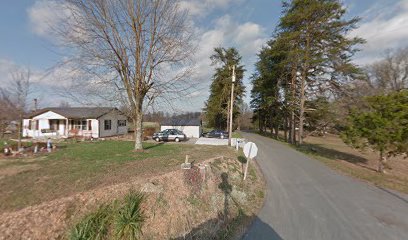
| Description | : | The county farm was a place that took in paupers around the turn of the last century. The farm was also referred to as sending folks to the "poorhouse". Most of the people here were elderly. The 1899 old farm map of Larue County shows the county farm to be on Hwy 84 between White City and Howardstown. farmhouse is the first one on the left on Plouvier Road. Chapman Thompson was the manager of the farm for some time. |
frequently asked questions (FAQ):
-
Where is County Farm Cemetery?
County Farm Cemetery is located at Hodgenville, LaRue County ,Kentucky ,USA.
-
County Farm Cemetery cemetery's updated grave count on graveviews.com?
0 memorials
-
Where are the coordinates of the County Farm Cemetery?
Latitude: 37.5826200
Longitude: -85.6316060
Nearby Cemetories:
1. Saint Joachim Cemetery
Hodgenville, LaRue County, USA
Coordinate: 37.5828018, -85.6466980
2. George Redmon Family Cemetery
LaRue County, USA
Coordinate: 37.5988700, -85.6419210
3. Reuben Brown Cemetery
Leafdale, LaRue County, USA
Coordinate: 37.5594220, -85.6243860
4. Pleasant Grove Cemetery
Hodgenville, LaRue County, USA
Coordinate: 37.5874040, -85.6630170
5. Oak Grove Church Cemetery
LaRue County, USA
Coordinate: 37.5631030, -85.6636670
6. Saint Ann Cemetery
Nelson County, USA
Coordinate: 37.5780983, -85.5903015
7. Masonic Hall Cemetery
LaRue County, USA
Coordinate: 37.5365170, -85.6027740
8. Beech Grove Methodist Cemetery
Howardstown, Nelson County, USA
Coordinate: 37.5449480, -85.5856950
9. Friendship Baptist Church Cemetery
Hodgenville, LaRue County, USA
Coordinate: 37.6144000, -85.6863000
10. Stonehouse Loop Cemetery
Hodgenville, LaRue County, USA
Coordinate: 37.5855052, -85.7014367
11. Union Band Baptist Cemetery
Howardstown, Nelson County, USA
Coordinate: 37.5405140, -85.5780820
12. Salem Christian Church Cemetery
LaRue County, USA
Coordinate: 37.6299660, -85.6852540
13. Hodgenville Pentecostal Church Cemetery
LaRue County, USA
Coordinate: 37.5586440, -85.7156480
14. Stillwell Family Cemetery
Hodgenville, LaRue County, USA
Coordinate: 37.5314950, -85.5675530
15. Potts Spring Cemetery
LaRue County, USA
Coordinate: 37.6481018, -85.6817017
16. Red Hill Cemetery
Hodgenville, LaRue County, USA
Coordinate: 37.5717010, -85.7307968
17. Phillip's Fort Cemetery
Hodgenville, LaRue County, USA
Coordinate: 37.5834940, -85.7325840
18. Our Lady of Mercy Catholic Church Cemetery
Hodgenville, LaRue County, USA
Coordinate: 37.5675200, -85.7312080
19. Rolling Fork Baptist Cemetery
Gleanings, LaRue County, USA
Coordinate: 37.5606120, -85.5320700
20. Riverview Cemetery
New Haven, Nelson County, USA
Coordinate: 37.6612200, -85.5930600
21. Saint Catherine Cemetery
New Haven, Nelson County, USA
Coordinate: 37.6611470, -85.5912580
22. Neff Cemetery
LaRue County, USA
Coordinate: 37.6575012, -85.6883011
23. Howell Family Cemetery
Ginseng, LaRue County, USA
Coordinate: 37.5037500, -85.5834500
24. Buffalo Baptist Cemetery
Buffalo, LaRue County, USA
Coordinate: 37.5141100, -85.7018990