
| Memorials | : | 0 |
| Location | : | Ginseng, LaRue County, USA |
| Coordinate | : | 37.5037500, -85.5834500 |
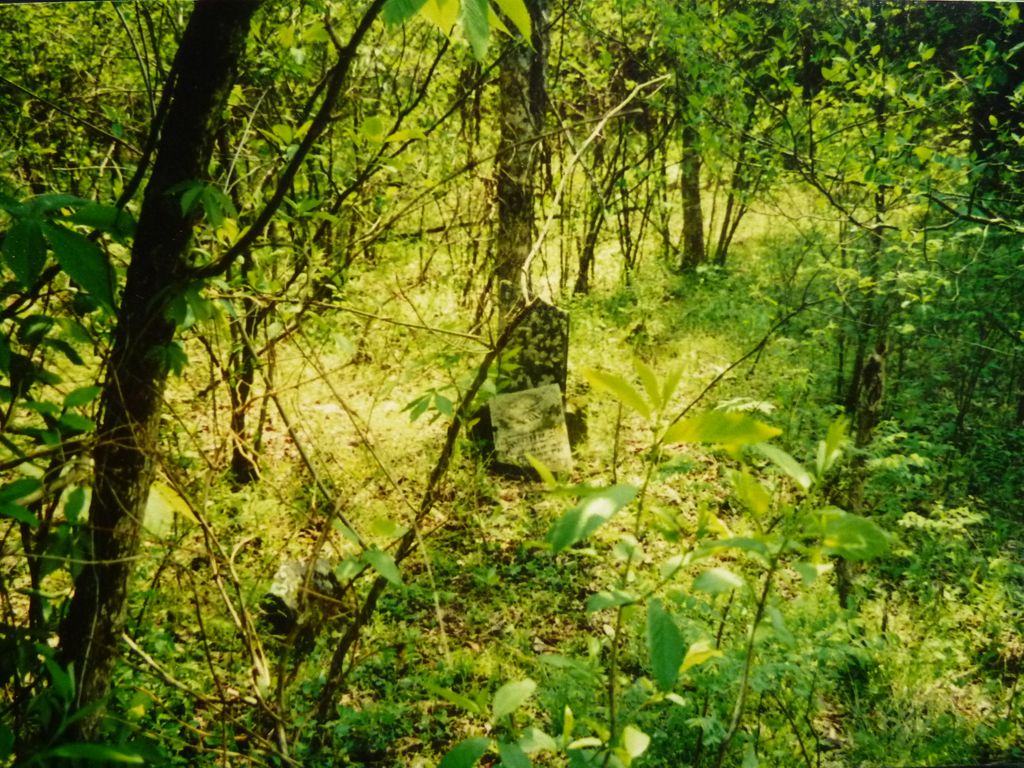
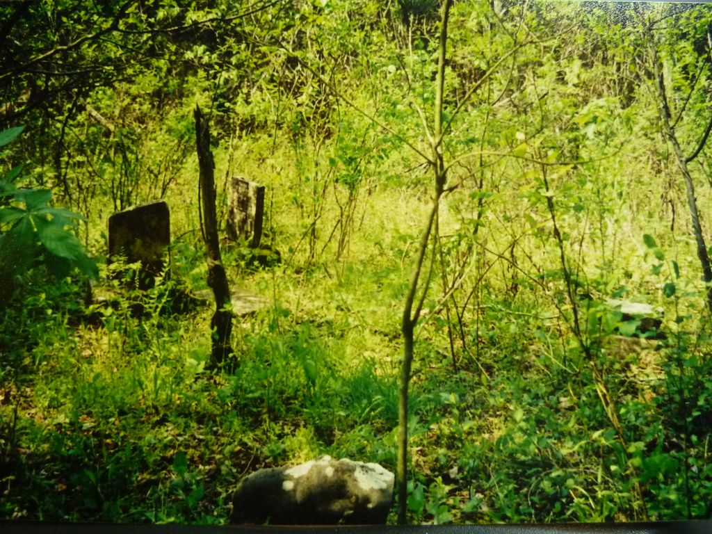
| Description | : | The Howell Family Cemetery is located near the banks of Otter Creek a short distance from where the creek empties into the Rolling Fork River. The Ginseng store and Post Office was less than 1/4 mile from the cemetery. See the accompanying map to see the satellite location. The Howell family members buried here are; the patriarch of the Howell Family at Ginseng, Kentucky in LaRue County and his descendants. James (Jimmy) Howell along with his sister Amelia, her small son William D. Ferrill, her husband and James' brother John settled in... Read More |
frequently asked questions (FAQ):
-
Where is Howell Family Cemetery?
Howell Family Cemetery is located at Ginseng, LaRue County ,Kentucky ,USA.
-
Howell Family Cemetery cemetery's updated grave count on graveviews.com?
0 memorials
-
Where are the coordinates of the Howell Family Cemetery?
Latitude: 37.5037500
Longitude: -85.5834500
Nearby Cemetories:
1. Baird Family Cemetery
Ginseng, LaRue County, USA
Coordinate: 37.5025390, -85.5613310
2. Houston Cemetery
Buffalo, LaRue County, USA
Coordinate: 37.4858410, -85.5957320
3. Levelwoods Methodist Cemetery
LaRue County, USA
Coordinate: 37.5030880, -85.5470290
4. Ball Hollow Cemetery
Ginseng, LaRue County, USA
Coordinate: 37.4810700, -85.6070600
5. Stillwell Family Cemetery
Hodgenville, LaRue County, USA
Coordinate: 37.5314950, -85.5675530
6. Corinth Baptist Church Cemetery
Hodgenville, LaRue County, USA
Coordinate: 37.4689160, -85.5827680
7. Masonic Hall Cemetery
LaRue County, USA
Coordinate: 37.5365170, -85.6027740
8. Union Band Baptist Cemetery
Howardstown, Nelson County, USA
Coordinate: 37.5405140, -85.5780820
9. Beech Grove Methodist Cemetery
Howardstown, Nelson County, USA
Coordinate: 37.5449480, -85.5856950
10. Otter Creek Baptist Cemetery
Buffalo, LaRue County, USA
Coordinate: 37.4663460, -85.5544770
11. Pleasant Ridge Baptist Church Cemetery
LaRue County, USA
Coordinate: 37.4677310, -85.6151200
12. DeSpain Cemetery
Bloyd, Green County, USA
Coordinate: 37.4571120, -85.5945680
13. DeSpain Cemetery
Green County, USA
Coordinate: 37.4605120, -85.6106990
14. Bethel Baptist Church Cemetery
LaRue County, USA
Coordinate: 37.5033330, -85.5147110
15. Mount Tabor Church Cemetery
Buffalo, LaRue County, USA
Coordinate: 37.4889100, -85.6584200
16. New Bethlehem Baptist Church Cemetery
Attilla, LaRue County, USA
Coordinate: 37.4983400, -85.5033100
17. Reuben Brown Cemetery
Leafdale, LaRue County, USA
Coordinate: 37.5594220, -85.6243860
18. Skaggs Cemetery
Attilla, LaRue County, USA
Coordinate: 37.4821600, -85.5026800
19. Rolling Fork Baptist Cemetery
Gleanings, LaRue County, USA
Coordinate: 37.5606120, -85.5320700
20. Saint Ann Cemetery
Nelson County, USA
Coordinate: 37.5780983, -85.5903015
21. Mount Sherman Cemetery
LaRue County, USA
Coordinate: 37.4479810, -85.6539730
22. Highview United Methodist Church Cemetery
Raywick, Marion County, USA
Coordinate: 37.5537100, -85.4983150
23. Dezarn Cemetery
Green County, USA
Coordinate: 37.4247017, -85.6271973
24. Oak Grove Church Cemetery
LaRue County, USA
Coordinate: 37.5631030, -85.6636670