
| Memorials | : | 0 |
| Location | : | Moultonborough, Carroll County, USA |
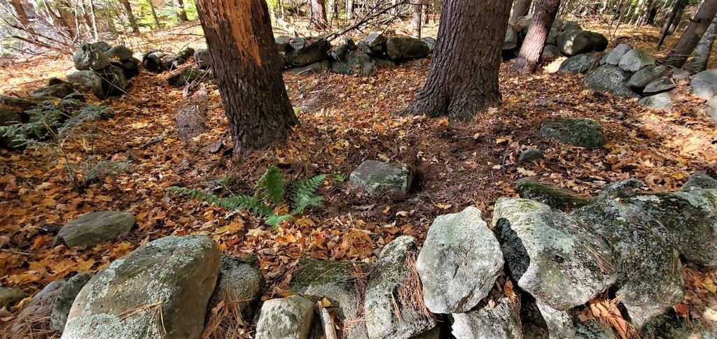
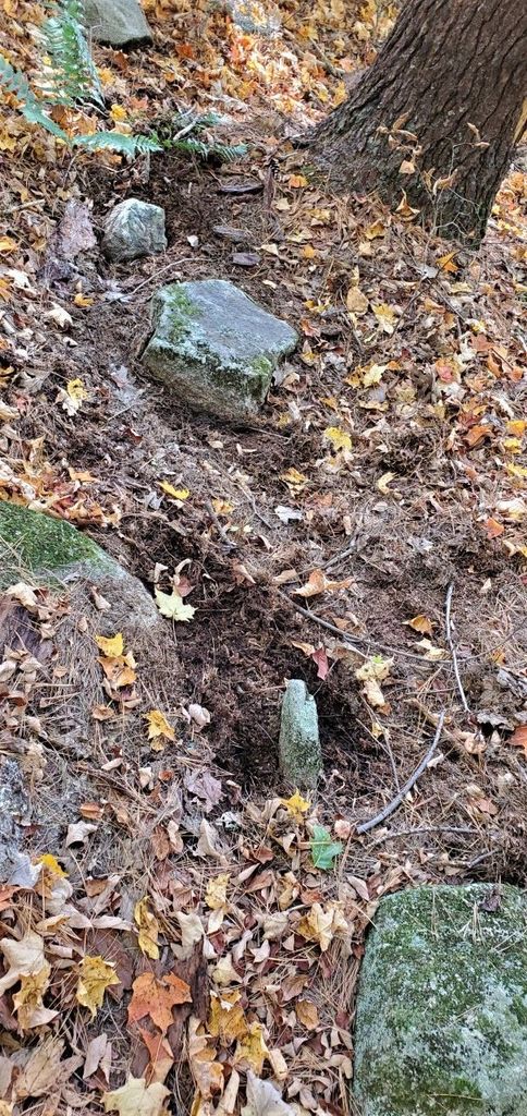
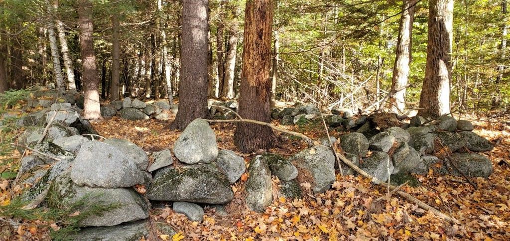
| Description | : | This is a small, enclosed burial plot on the north side of Randall Road, about 200 yards from the Ossipee Mountain Road junction. Approximately 24 by 16 feet, oriented NW-SE along its long axis, it is surrounded by field stone walls. It lies on a slight rise of ground about 200 feet east of the house and barn built by Daniel Lee in the late 18th century. |
frequently asked questions (FAQ):
-
Where is Daniel Lee Cemetery?
Daniel Lee Cemetery is located at No GPS information available Add GPS44 Randall Road Moultonborough, Carroll County ,New Hampshire , 03254USA.
-
Daniel Lee Cemetery cemetery's updated grave count on graveviews.com?
0 memorials
Nearby Cemetories:
1. Doctors Cemetery
Bartlett, Carroll County, USA
Coordinate: 43.8542000, -71.4426000
2. Garland Ridge Cemetery
Bartlett, Carroll County, USA
Coordinate: 43.8385671, -71.5158940
3. Glidden Field Cemetery
Bartlett, Carroll County, USA
Coordinate: 43.8410750, -71.3953610
4. Hill Cemetery
Bartlett, Carroll County, USA
Coordinate: 43.8607300, -71.3636400
5. Moulton Cemetery
Bartlett, Carroll County, USA
Coordinate: 43.8433000, -71.4148000
6. Old Catholic Cemetery
Bartlett, Carroll County, USA
Coordinate: 43.8567140, -71.3907470
7. Rogers Cemetery
Bartlett, Carroll County, USA
Coordinate: 43.8678460, -71.3950260
8. Saint Josephs Cemetery
Bartlett, Carroll County, USA
Coordinate: 43.8754000, -71.2187000
9. Stillings-Towle Cemetery
Bartlett, Carroll County, USA
Coordinate: 43.8810309, -71.2175539
10. Harmon Farm Cemetery
East Madison, Carroll County, USA
Coordinate: 43.8554370, -71.3204530
11. Atwood Cemetery
North Sandwich, Carroll County, USA
Coordinate: 43.8959600, -71.3004300
12. G.G. Smith Cemetery
North Sandwich, Carroll County, USA
Coordinate: 43.8267000, -71.2344000
13. Mason Cemetery
North Sandwich, Carroll County, USA
Coordinate: 43.8542000, -71.4426000
14. Mount Delight Burying Ground
North Sandwich, Carroll County, USA
Coordinate: 43.8385671, -71.5158940
15. North Sandwich Cemetery
North Sandwich, Carroll County, USA
Coordinate: 43.8410750, -71.3953610
16. North Sandwich Friends Cemetery
North Sandwich, Carroll County, USA
Coordinate: 43.8607300, -71.3636400
17. Quinby Cemetery
North Sandwich, Carroll County, USA
Coordinate: 43.8433000, -71.4148000
18. Weed Cemetery
North Sandwich, Carroll County, USA
Coordinate: 43.8567140, -71.3907470
19. Weeds Mills Cemetery
North Sandwich, Carroll County, USA
Coordinate: 43.8678460, -71.3950260
20. Chapman Cemetery
Tamworth, Carroll County, USA
Coordinate: 43.8754000, -71.2187000
21. Chocorua Cemetery
Tamworth, Carroll County, USA
Coordinate: 43.8810309, -71.2175539
22. Cleveland Family Cemetery
Tamworth, Carroll County, USA
Coordinate: 43.8554370, -71.3204530
23. Fowlers Mill Cemetery
Tamworth, Carroll County, USA
Coordinate: 43.8959600, -71.3004300
24. Gilman Cemetery
Tamworth, Carroll County, USA
Coordinate: 43.8267000, -71.2344000