| Memorials | : | 0 |
| Location | : | Lincoln County, USA |
| Coordinate | : | 36.8870811, -114.2647934 |
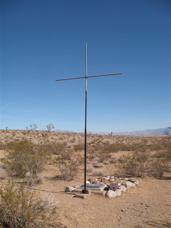
| Description | : | Originally this grave site was described as being on the Mormon Mesa near Overton, Nevada. Although still on the vast Mesa it was found 20 miles from Overton. The grave site is 3 miles inside Lincoln County and is 15 miles from Mesquite. A faint trail off the dirt road leads to the grave site but without a GPS this site will not be found. In May 2009 this cemetery entry was moved to Lincoln County from the original entry in Clark County. The parents and son were buried where they were found. The son... Read More |
frequently asked questions (FAQ):
-
Where is Davidson Family Gravesite?
Davidson Family Gravesite is located at Lincoln County ,Nevada ,USA.
-
Davidson Family Gravesite cemetery's updated grave count on graveviews.com?
0 memorials
-
Where are the coordinates of the Davidson Family Gravesite?
Latitude: 36.8870811
Longitude: -114.2647934
Nearby Cemetories:
1. New Mesquite City Cemetery
Mesquite, Clark County, USA
Coordinate: 36.8192700, -114.1186000
2. Bunkerville Cemetery
Bunkerville, Clark County, USA
Coordinate: 36.7742996, -114.1182022
3. Mesquite City Cemetery
Mesquite, Clark County, USA
Coordinate: 36.8117104, -114.0617905
4. Littlefield Cemetery
Littlefield, Mohave County, USA
Coordinate: 36.8902016, -113.9279480
5. Beaver Dam Cemetery
Mohave County, USA
Coordinate: 36.9020157, -113.9256287
6. Logandale Cemetery
Logandale, Clark County, USA
Coordinate: 36.5998993, -114.4748001
7. Saint Joseph Cemetery
Logandale, Clark County, USA
Coordinate: 36.5863991, -114.4623032
8. Pioneer Hill Cemetery
Overton, Clark County, USA
Coordinate: 36.5607986, -114.4399033
9. Westpoint Cemetery
Moapa, Clark County, USA
Coordinate: 36.6645584, -114.6408768
10. Moapa Paiute Indian Cemetery
Moapa, Clark County, USA
Coordinate: 36.6613007, -114.6594009
11. Warm Springs Cemetery
Moapa, Clark County, USA
Coordinate: 36.7079010, -114.6985016
12. Saint Thomas Cemetery
Overton, Clark County, USA
Coordinate: 36.5205994, -114.4359970
13. Warm Spring Ranch Burial Site
Moapa, Clark County, USA
Coordinate: 36.7114840, -114.7135450
14. Nay Ranch Cemetery
Riverside, Clark County, USA
Coordinate: 36.5230100, -114.0573700
15. Clark Memorial
Overton, Clark County, USA
Coordinate: 36.4253880, -114.4690970
16. Shivwits Cemetery
Washington County, USA
Coordinate: 37.1825981, -113.7650986
17. Santa Clara Cemetery
Santa Clara, Washington County, USA
Coordinate: 37.1408005, -113.6667023
18. Ivins City Cemetery
Ivins, Washington County, USA
Coordinate: 37.1750984, -113.6834030
19. Shepherd of the Hills UMC Memorial Garden
Saint George, Washington County, USA
Coordinate: 37.0734030, -113.6039450
20. Tonaquint Cemetery
Saint George, Washington County, USA
Coordinate: 37.0789986, -113.6011963
21. Gunlock Cemetery
Gunlock, Washington County, USA
Coordinate: 37.2907982, -113.7583008
22. Saint George City Cemetery
Saint George, Washington County, USA
Coordinate: 37.1068993, -113.5686035
23. Grace Episcopal Church Rose Garden
Saint George, Washington County, USA
Coordinate: 37.0921350, -113.5607433
24. Gold Butte Cemetery
Clark County, USA
Coordinate: 36.2802505, -114.1996994

