
| Memorials | : | 1 |
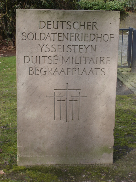
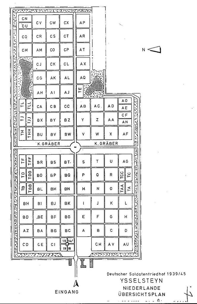
| Location | : | Ysselsteyn, Venray Municipality, Netherlands |
| Coordinate | : | 51.4691940, 5.8975980 |
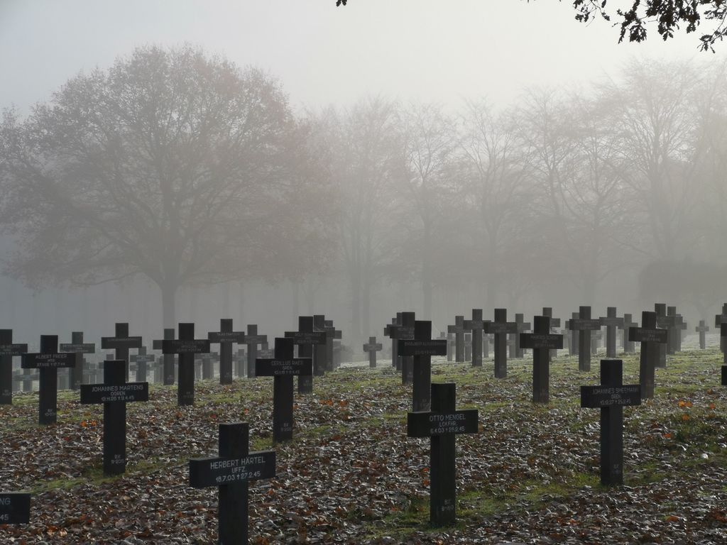
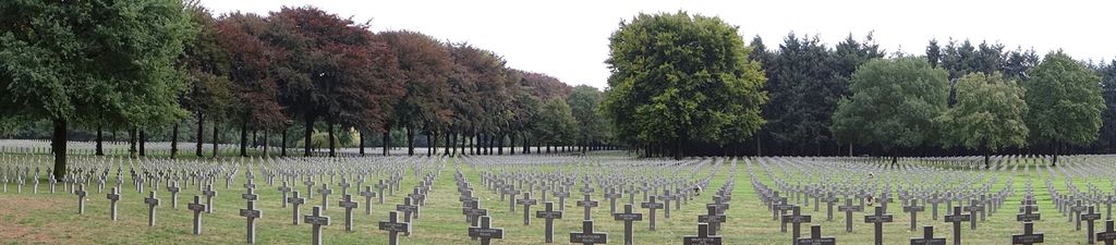
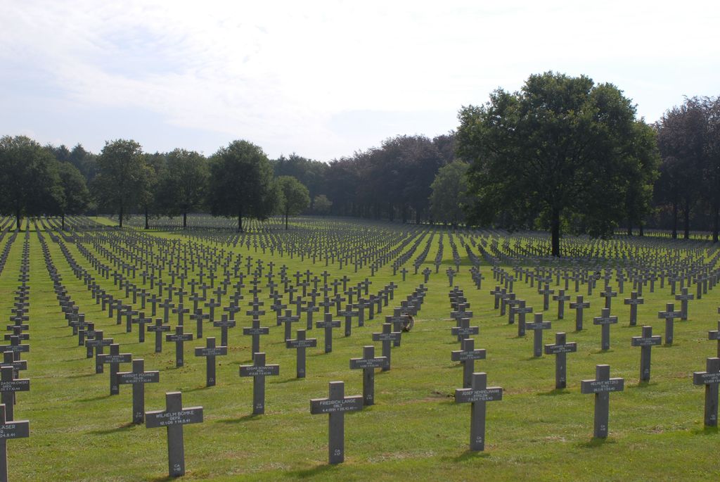
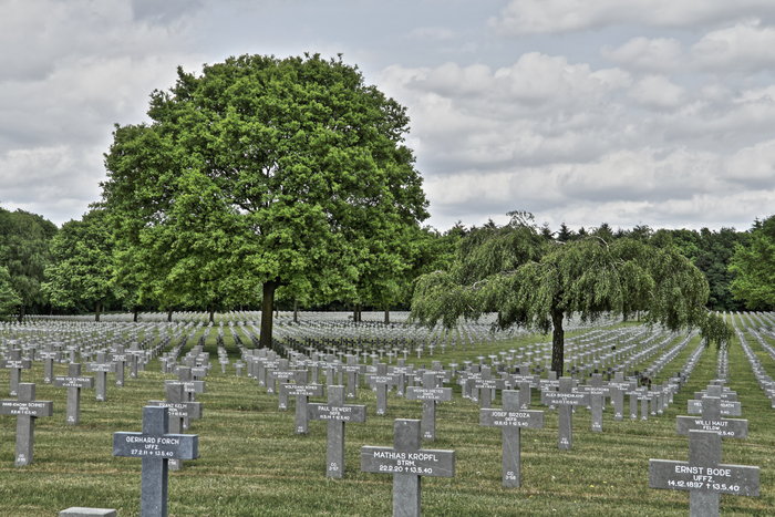
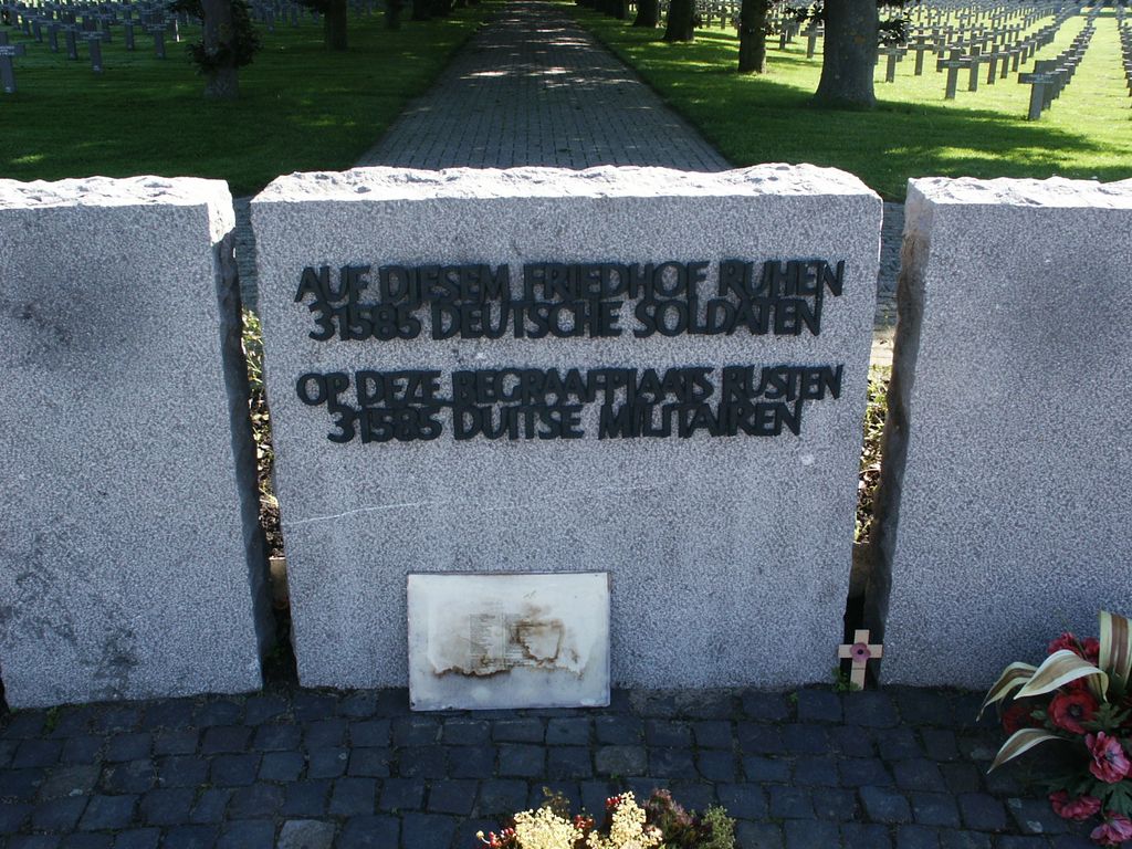
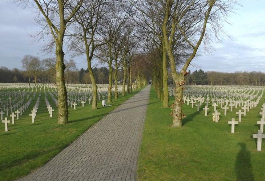
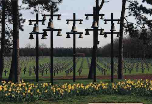
| Description | : | Search by surname or first character of surname. The goal of these memorials is to be a tribute to the fallen soldiers and civilians. These memorials don't include fascist ideas and they don't glorify war.They should honour the fallen and they should remember those still alive that peace is the greatest good on earth. This cemetery is the only German military cemetery in the Netherlands. 85 killed soldiers from the First World War and over 32.000 Soldiers and Civilians from the Second World War are buried here on a territory of 30 hectares.(74.13-acre) For most killed Soldiers and Civilians one cross... Read More |
frequently asked questions (FAQ):
-
Where is Deutscher Soldatenfriedhof Ysselsteyn?
Deutscher Soldatenfriedhof Ysselsteyn is located at Timmermansweg 73 Ysselsteyn, Venray Municipality ,Limburg , 5813AMNetherlands.
-
Deutscher Soldatenfriedhof Ysselsteyn cemetery's updated grave count on graveviews.com?
1 memorials
-
Where are the coordinates of the Deutscher Soldatenfriedhof Ysselsteyn?
Latitude: 51.4691940
Longitude: 5.8975980


Nearby Cemetories:
1. Joodse Begraafplaats
Deurne Municipality, Netherlands
Coordinate: 51.4637800, 5.7928100
2. Venray War Cemetery
Venray, Venray Municipality, Netherlands
Coordinate: 51.5291100, 5.9558900
3. Trans Cedron
Oostrum, Venray Municipality, Netherlands
Coordinate: 51.5269351, 6.0206018
4. Sint-Gertrudiskerk
Oirlo, Venray Municipality, Netherlands
Coordinate: 51.5106399, 6.0367345
5. Boschhuizen Cemetery
Oostrum, Venray Municipality, Netherlands
Coordinate: 51.5454100, 5.9999200
6. RK Begraafplaats Horst
Horst, Horst aan de Maas Municipality, Netherlands
Coordinate: 51.4562126, 6.0561646
7. Overloon War Cemetery
Overloon, Boxmeer Municipality, Netherlands
Coordinate: 51.5741500, 5.9576600
8. Westerbeek Roman Catholic Cemetery
Westerbeek, Sint Anthonis Municipality, Netherlands
Coordinate: 51.5825900, 5.8631600
9. Kerkhof Sint-Anthonius Abtkerk
Maashees, Boxmeer Municipality, Netherlands
Coordinate: 51.5713400, 6.0333100
10. Rooms Katholieke Begraafplaats
Swolgen, Horst aan de Maas Municipality, Netherlands
Coordinate: 51.4917400, 6.1167600
11. Joodse Begraafplaats
Vierlingsbeek, Boxmeer Municipality, Netherlands
Coordinate: 51.5961600, 6.0010200
12. Rooms Katholieke begraafplaats
Helmond, Helmond Municipality, Netherlands
Coordinate: 51.4782400, 5.6680400
13. Maasbree Roman Catholic Cemetery
Maasbree, Peel en Maas Municipality, Netherlands
Coordinate: 51.3590600, 6.0498800
14. Panningen cemetery
Panningen, Peel en Maas Municipality, Netherlands
Coordinate: 51.3291100, 5.9756400
15. Natuurbegraafplaats Maasbree
Venlo, Venlo Municipality, Netherlands
Coordinate: 51.3578618, 6.0560217
16. Begraafplaats Missieklooster Heilig Bloed
Aarle-Rixtel, Laarbeek Municipality, Netherlands
Coordinate: 51.5258926, 5.6629537
17. Sint Anthonis Roman Catholic Churchyard
Sint Anthonis, Sint Anthonis Municipality, Netherlands
Coordinate: 51.6269800, 5.8830600
18. Gemert War Memorial Grave
Gemert, Gemert-Bakel Municipality, Netherlands
Coordinate: 51.5538200, 5.6821400
19. Begraafplaats Wellerlooi
Wellerlooi, Bergen Municipality, Netherlands
Coordinate: 51.5343955, 6.1371499
20. Helden Begraafplaats
Helden, Peel en Maas Municipality, Netherlands
Coordinate: 51.3177900, 6.0008200
21. Sint-Lucia Rooms-Katholieke Begraafplaats
Mierlo-Hout, Helmond Municipality, Netherlands
Coordinate: 51.4669500, 5.6329900
22. Lottum Kerkhof
Lottum, Horst aan de Maas Municipality, Netherlands
Coordinate: 51.4617400, 6.1624400
23. Aarle-Rixtel kerkhof
Aarle-Rixtel, Laarbeek Municipality, Netherlands
Coordinate: 51.5102394, 5.6384168
24. Heibloem Cemetery
Heibloem, Leudal Municipality, Netherlands
Coordinate: 51.3004231, 5.9025150