
| Memorials | : | 0 |
| Location | : | Maashees, Boxmeer Municipality, Netherlands |
| Coordinate | : | 51.5713400, 6.0333100 |
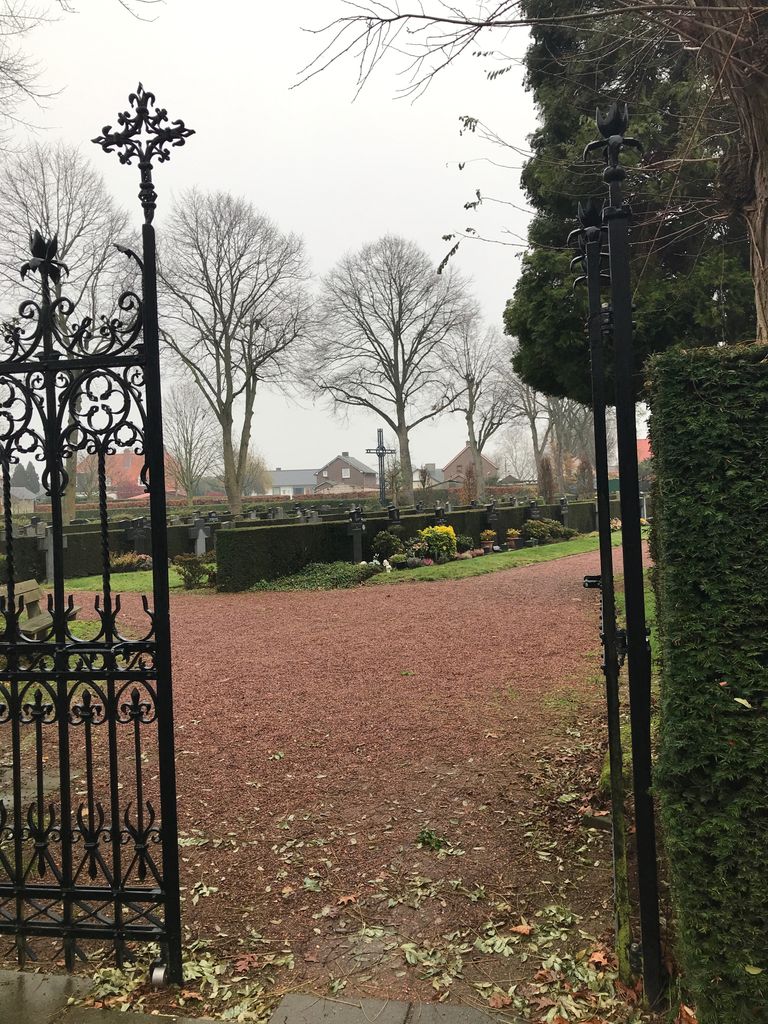
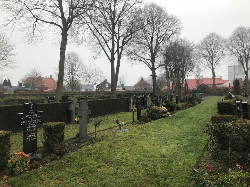
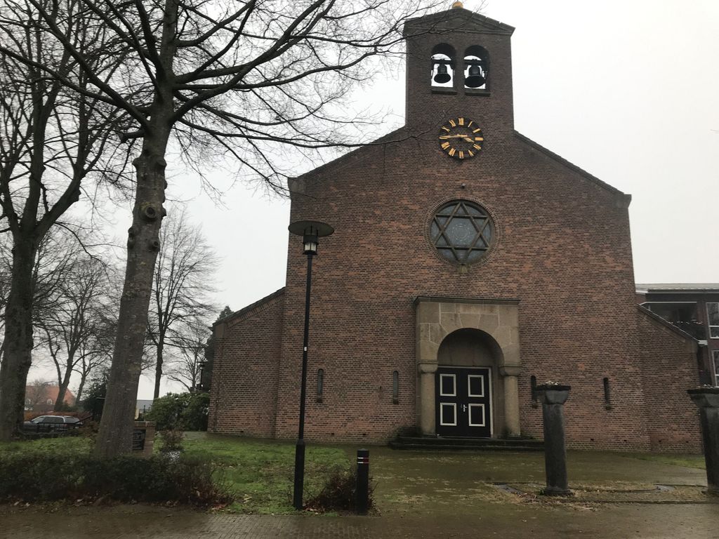
| Description | : | Roman Catholic graveyard located next to the Roman Catholic church in Maashees, the Sint-Anthonius Abtkerk. |
frequently asked questions (FAQ):
-
Where is Kerkhof Sint-Anthonius Abtkerk?
Kerkhof Sint-Anthonius Abtkerk is located at De Goeijstraat 2 Maashees, Boxmeer Municipality ,Noord-Brabant , 5823 AHNetherlands.
-
Kerkhof Sint-Anthonius Abtkerk cemetery's updated grave count on graveviews.com?
0 memorials
-
Where are the coordinates of the Kerkhof Sint-Anthonius Abtkerk?
Latitude: 51.5713400
Longitude: 6.0333100

Nearby Cemetories:
1. Joodse Begraafplaats
Vierlingsbeek, Boxmeer Municipality, Netherlands
Coordinate: 51.5961600, 6.0010200
2. Boschhuizen Cemetery
Oostrum, Venray Municipality, Netherlands
Coordinate: 51.5454100, 5.9999200
3. Trans Cedron
Oostrum, Venray Municipality, Netherlands
Coordinate: 51.5269351, 6.0206018
4. Overloon War Cemetery
Overloon, Boxmeer Municipality, Netherlands
Coordinate: 51.5741500, 5.9576600
5. Sint-Gertrudiskerk
Oirlo, Venray Municipality, Netherlands
Coordinate: 51.5106399, 6.0367345
6. Venray War Cemetery
Venray, Venray Municipality, Netherlands
Coordinate: 51.5291100, 5.9558900
7. Afferden Begraafplaats
Afferden, Bergen Municipality, Netherlands
Coordinate: 51.6349100, 6.0131700
8. Begraafplaats Wellerlooi
Wellerlooi, Bergen Municipality, Netherlands
Coordinate: 51.5343955, 6.1371499
9. Boxmeer Roman Catholic Churchyard
Boxmeer, Boxmeer Municipality, Netherlands
Coordinate: 51.6427910, 5.9497830
10. Rooms Katholieke Begraafplaats
Swolgen, Horst aan de Maas Municipality, Netherlands
Coordinate: 51.4917400, 6.1167600
11. Westerbeek Roman Catholic Cemetery
Westerbeek, Sint Anthonis Municipality, Netherlands
Coordinate: 51.5825900, 5.8631600
12. Sint Anthonis Roman Catholic Churchyard
Sint Anthonis, Sint Anthonis Municipality, Netherlands
Coordinate: 51.6269800, 5.8830600
13. RK Begraafplaats Horst
Horst, Horst aan de Maas Municipality, Netherlands
Coordinate: 51.4562126, 6.0561646
14. Arcen Roman Catholic Cemetery
Arcen, Venlo Municipality, Netherlands
Coordinate: 51.4812200, 6.1809700
15. Saint Vincentius Kath. Asperden
Asperden, Kreis Kleve, Germany
Coordinate: 51.6929200, 6.1134800
16. Deutscher Soldatenfriedhof Ysselsteyn
Ysselsteyn, Venray Municipality, Netherlands
Coordinate: 51.4691940, 5.8975980
17. Ottersum Roman Catholic Cemetery
Ottersum, Gennep Municipality, Netherlands
Coordinate: 51.7020800, 5.9824600
18. Lottum Kerkhof
Lottum, Horst aan de Maas Municipality, Netherlands
Coordinate: 51.4617400, 6.1624400
19. Milsbeek War Cemetery
Milsbeek, Gennep Municipality, Netherlands
Coordinate: 51.7254400, 5.9511900
20. Reichswald Forest War Cemetery
Kleve, Kreis Kleve, Germany
Coordinate: 51.7406464, 6.0824242
21. Joodse Begraafplaats
Deurne Municipality, Netherlands
Coordinate: 51.4637800, 5.7928100
22. Pfarrkirche Sankt Maria Magdalena
Geldern, Kreis Kleve, Germany
Coordinate: 51.5176890, 6.3210030
23. Beers Rooms Katholieke Begraafplaats
Beers, Cuijk Municipality, Netherlands
Coordinate: 51.7261800, 5.8265400
24. Mook-en-Middelaar Roman Catholic Churchyard
Mook, Mook en Middelaar Municipality, Netherlands
Coordinate: 51.7531600, 5.8854200