
| Memorials | : | 0 |
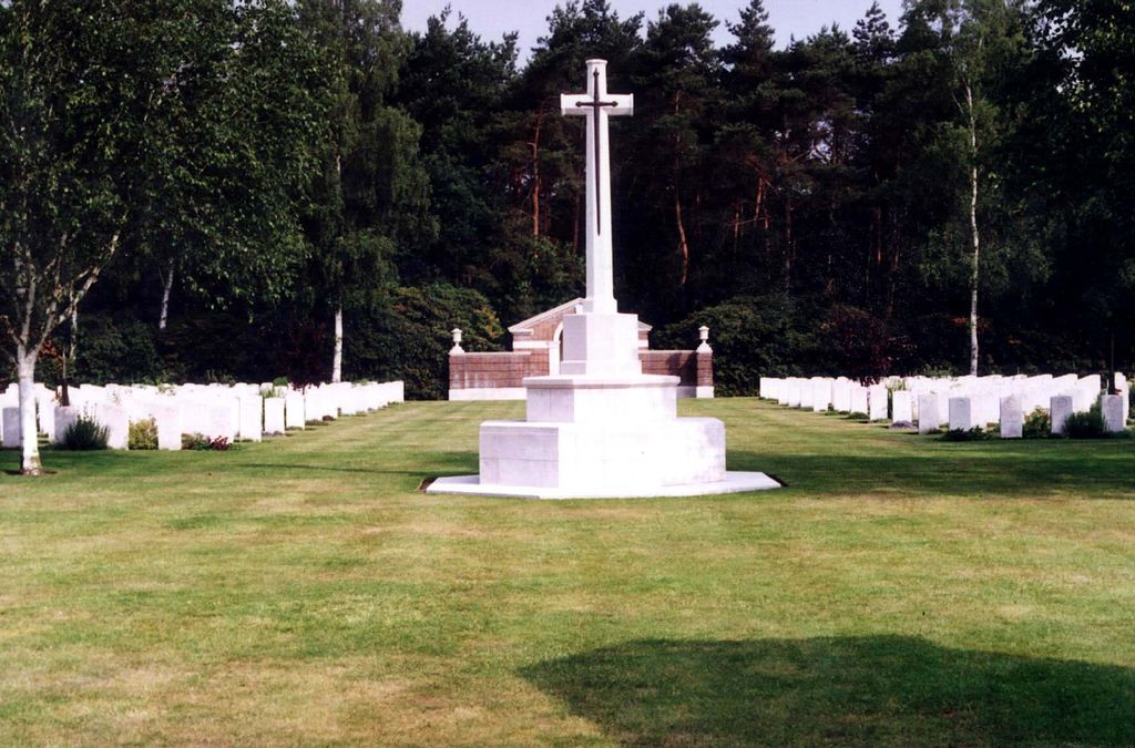
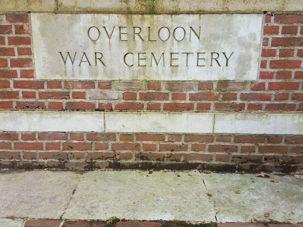
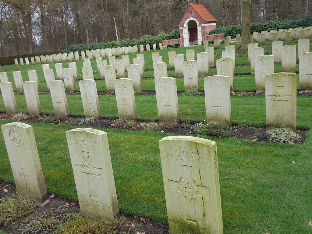
| Location | : | Overloon, Boxmeer Municipality, Netherlands |
| Coordinate | : | 51.5741500, 5.9576600 |
| Description | : | The town of Overloon lies in the south of the Netherlands approx 40kms to the south of Nijmegen. From the A73 Nijmegen to Venlo motorway take exit 7 (Afrit 7) VIERLINGSBEEK / OVERLOON and follow the direction OVERLOON. Continue for approx 2kms along the VIERLINGSBEEKSEWEG and on entering the village of Overloon turn left (CWGC sign). The cemetery can be found after approx 100m on the left. The cemetery address is:- Vierlingsbeekseweg 5825 Overloon Netherlands GPS Location is:- N 51 34 26 E 05 57 27 Historical Information: The Netherlands fell to the Germans in May 1940 and was not... Read More |
frequently asked questions (FAQ):
-
Where is Overloon War Cemetery?
Overloon War Cemetery is located at Overloon, Boxmeer Municipality ,Noord-Brabant ,Netherlands.
-
Overloon War Cemetery cemetery's updated grave count on graveviews.com?
0 memorials
-
Where are the coordinates of the Overloon War Cemetery?
Latitude: 51.5741500
Longitude: 5.9576600


Nearby Cemetories:
1. Joodse Begraafplaats
Vierlingsbeek, Boxmeer Municipality, Netherlands
Coordinate: 51.5961600, 6.0010200
2. Boschhuizen Cemetery
Oostrum, Venray Municipality, Netherlands
Coordinate: 51.5454100, 5.9999200
3. Venray War Cemetery
Venray, Venray Municipality, Netherlands
Coordinate: 51.5291100, 5.9558900
4. Kerkhof Sint-Anthonius Abtkerk
Maashees, Boxmeer Municipality, Netherlands
Coordinate: 51.5713400, 6.0333100
5. Westerbeek Roman Catholic Cemetery
Westerbeek, Sint Anthonis Municipality, Netherlands
Coordinate: 51.5825900, 5.8631600
6. Trans Cedron
Oostrum, Venray Municipality, Netherlands
Coordinate: 51.5269351, 6.0206018
7. Boxmeer Roman Catholic Churchyard
Boxmeer, Boxmeer Municipality, Netherlands
Coordinate: 51.6427910, 5.9497830
8. Afferden Begraafplaats
Afferden, Bergen Municipality, Netherlands
Coordinate: 51.6349100, 6.0131700
9. Sint Anthonis Roman Catholic Churchyard
Sint Anthonis, Sint Anthonis Municipality, Netherlands
Coordinate: 51.6269800, 5.8830600
10. Sint-Gertrudiskerk
Oirlo, Venray Municipality, Netherlands
Coordinate: 51.5106399, 6.0367345
11. Deutscher Soldatenfriedhof Ysselsteyn
Ysselsteyn, Venray Municipality, Netherlands
Coordinate: 51.4691940, 5.8975980
12. Begraafplaats Wellerlooi
Wellerlooi, Bergen Municipality, Netherlands
Coordinate: 51.5343955, 6.1371499
13. Rooms Katholieke Begraafplaats
Swolgen, Horst aan de Maas Municipality, Netherlands
Coordinate: 51.4917400, 6.1167600
14. Ottersum Roman Catholic Cemetery
Ottersum, Gennep Municipality, Netherlands
Coordinate: 51.7020800, 5.9824600
15. RK Begraafplaats Horst
Horst, Horst aan de Maas Municipality, Netherlands
Coordinate: 51.4562126, 6.0561646
16. Joodse Begraafplaats
Deurne Municipality, Netherlands
Coordinate: 51.4637800, 5.7928100
17. Milsbeek War Cemetery
Milsbeek, Gennep Municipality, Netherlands
Coordinate: 51.7254400, 5.9511900
18. Saint Vincentius Kath. Asperden
Asperden, Kreis Kleve, Germany
Coordinate: 51.6929200, 6.1134800
19. Arcen Roman Catholic Cemetery
Arcen, Venlo Municipality, Netherlands
Coordinate: 51.4812200, 6.1809700
20. Lottum Kerkhof
Lottum, Horst aan de Maas Municipality, Netherlands
Coordinate: 51.4617400, 6.1624400
21. Beers Rooms Katholieke Begraafplaats
Beers, Cuijk Municipality, Netherlands
Coordinate: 51.7261800, 5.8265400
22. Gemert War Memorial Grave
Gemert, Gemert-Bakel Municipality, Netherlands
Coordinate: 51.5538200, 5.6821400
23. Odiliapeel Roman Catholic Cemetery
Odiliapeel, Uden Municipality, Netherlands
Coordinate: 51.6435700, 5.7031100
24. Reichswald Forest War Cemetery
Kleve, Kreis Kleve, Germany
Coordinate: 51.7406464, 6.0824242