
| Memorials | : | 1 |
| Location | : | Stephens County, USA |
| Coordinate | : | 34.3319016, -98.0550003 |
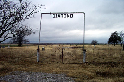
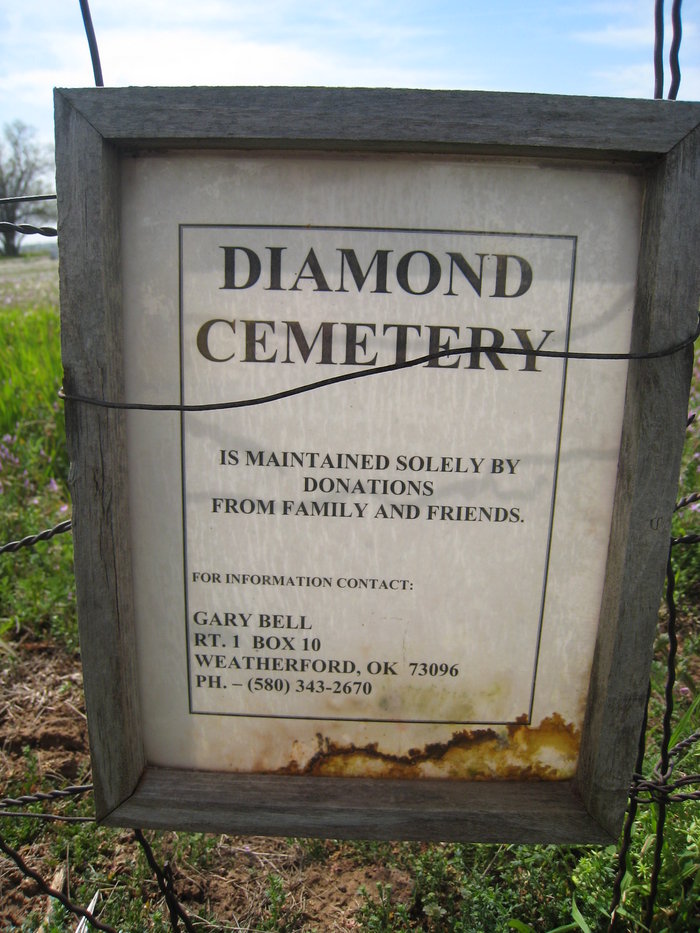
| Description | : | Directions to cemetery: In Comanche from the junction of US Highway 81 and Oklahoma Highway 53, go 5.2 miles west and turn south at the Grandview sign and go two miles. Then turn west and go 1/4 mile. The cemetery is on the south side of the road. |
frequently asked questions (FAQ):
-
Where is Diamond Cemetery?
Diamond Cemetery is located at Stephens County ,Oklahoma ,USA.
-
Diamond Cemetery cemetery's updated grave count on graveviews.com?
1 memorials
-
Where are the coordinates of the Diamond Cemetery?
Latitude: 34.3319016
Longitude: -98.0550003
Nearby Cemetories:
1. Corum Cemetery
Stephens County, USA
Coordinate: 34.3697014, -98.1222000
2. Oak Grove Cemetery
Empire City, Stephens County, USA
Coordinate: 34.4195300, -98.0350500
3. Fairlawn Cemetery
Comanche, Stephens County, USA
Coordinate: 34.3903008, -97.9589005
4. Hastings Cemetery
Hastings, Jefferson County, USA
Coordinate: 34.2380981, -98.1232986
5. Addington Cemetery
Addington, Jefferson County, USA
Coordinate: 34.2285995, -97.9606018
6. Monument Hill Burial Site
Addington, Jefferson County, USA
Coordinate: 34.2453200, -97.9222600
7. Tucker Cemetery
Comanche, Stephens County, USA
Coordinate: 34.4139000, -97.9159400
8. Eschiti Family Cemetery
Stephens County, USA
Coordinate: 34.4858100, -98.1263400
9. Henderson-Harris Cemetery
Duncan, Stephens County, USA
Coordinate: 34.4716988, -97.9460983
10. Temple Masonic Cemetery
Temple, Cotton County, USA
Coordinate: 34.2538986, -98.2358017
11. Waurika Cemetery
Waurika, Jefferson County, USA
Coordinate: 34.1581001, -98.0314026
12. Duncan Municipal Cemetery
Duncan, Stephens County, USA
Coordinate: 34.4963989, -97.9738998
13. Shackelford Cemetery
Fivemile Corner, Cotton County, USA
Coordinate: 34.4217400, -98.2429500
14. Lone Star Cemetery
Hooper, Cotton County, USA
Coordinate: 34.1758080, -98.1758881
15. First Christian Church Columbarium
Duncan, Stephens County, USA
Coordinate: 34.5027890, -97.9591140
16. Stoner Cemetery
Stephens County, USA
Coordinate: 34.4343987, -97.8606033
17. Woolsey Cemetery
Stephens County, USA
Coordinate: 34.3205986, -97.8242035
18. All Saints Episcopal Church Cemetery
Duncan, Stephens County, USA
Coordinate: 34.5116400, -97.9568600
19. Perry Grove Cemetery
Waurika, Jefferson County, USA
Coordinate: 34.1448420, -97.9766540
20. Weaver Chapel Cemetery
Comanche, Stephens County, USA
Coordinate: 34.3905983, -97.8067017
21. Old Duncan Cemetery
Duncan, Stephens County, USA
Coordinate: 34.5181900, -97.9258300
22. Rock Creek Cemetery
Duncan, Stephens County, USA
Coordinate: 34.5499992, -98.1055984
23. Walters Cemetery
Walters, Cotton County, USA
Coordinate: 34.3666992, -98.3292007
24. Resthaven Memorial Gardens
Duncan, Stephens County, USA
Coordinate: 34.5516700, -97.9651800