
| Memorials | : | 0 |
| Location | : | Dongen, Dongen Municipality, Netherlands |
| Coordinate | : | 51.6323900, 4.9389800 |
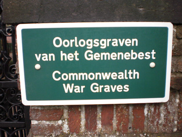
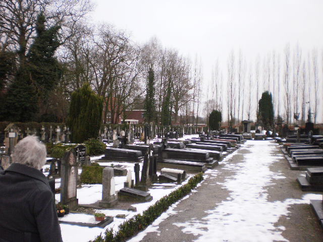
| Description | : | Dongen is a village 13.5 kilometres north-west of Tilburg. The cemetery is situated next to the police station on the northern outskirts of the village, in a road called Bolkensteeg. |
frequently asked questions (FAQ):
-
Where is Dongen Roman Catholic Cemetery?
Dongen Roman Catholic Cemetery is located at Dongen, Dongen Municipality ,Noord-Brabant ,Netherlands.
-
Dongen Roman Catholic Cemetery cemetery's updated grave count on graveviews.com?
0 memorials
-
Where are the coordinates of the Dongen Roman Catholic Cemetery?
Latitude: 51.6323900
Longitude: 4.9389800
Nearby Cemetories:
1. Dongen De Kremer Cemetery
Dongen, Dongen Municipality, Netherlands
Coordinate: 51.6300790, 4.9118010
2. R.K.Begraafplaats St Joannes de Doper
Oosteind, Oosterhout Municipality, Netherlands
Coordinate: 51.6451595, 4.9015936
3. St. Theresia van Lisieux Cemetery
Waspik-Boven, Waalwijk Municipality, Netherlands
Coordinate: 51.6757453, 4.9602146
4. St. John the Baptist Cemetery
Oosterhout, Oosterhout Municipality, Netherlands
Coordinate: 51.6410220, 4.8616900
5. St. Bartholomeuskerk Cemetery
Waspik, Waalwijk Municipality, Netherlands
Coordinate: 51.6863970, 4.9465918
6. Oosterhout Protestant Cemetery
Oosterhout, Oosterhout Municipality, Netherlands
Coordinate: 51.6415100, 4.8510800
7. Waspik Protestant Churchyard
Waspik, Waalwijk Municipality, Netherlands
Coordinate: 51.6878900, 4.9465900
8. Raamsdonk Roman Catholic Cemetery
Raamsdonk, Geertruidenberg Municipality, Netherlands
Coordinate: 51.6875200, 4.9059100
9. Loonschedijk Protestant Cemetery
Loon op Zand, Loon op Zand Municipality, Netherlands
Coordinate: 51.6700400, 5.0130500
10. de Roonlaan Cemetery
Waspik, Waalwijk Municipality, Netherlands
Coordinate: 51.6924608, 4.9421490
11. Begraafplaats St Marcoen
Dorst, Oosterhout Municipality, Netherlands
Coordinate: 51.5906301, 4.8581754
12. Kaatsheuvel Sint-Jozef Kerkhof
Kaatsheuvel, Loon op Zand Municipality, Netherlands
Coordinate: 51.6570600, 5.0470500
13. Joodse Begraafplaats
Oosterhout, Oosterhout Municipality, Netherlands
Coordinate: 51.6396000, 4.8201600
14. Begraafplaats Teteringen
Teteringen, Breda Municipality, Netherlands
Coordinate: 51.6112929, 4.8165026
15. R.K. Begraafplaats Heilige Cornelius
Den Hout, Oosterhout Municipality, Netherlands
Coordinate: 51.6600504, 4.8136076
16. Gilze-en-rijen Gilze Roman Catholic Cemetery
Gilze, Gilze en Rijen Municipality, Netherlands
Coordinate: 51.5401500, 4.9430200
17. Bavel Katholieke Begraafplaats
Bavel, Breda Municipality, Netherlands
Coordinate: 51.5659700, 4.8294800
18. Joodes Begraafplaats
Tilburg Municipality, Netherlands
Coordinate: 51.5590130, 5.0418920
19. St. Johannes Roman Catholic Churchyard
Waalwijk, Waalwijk Municipality, Netherlands
Coordinate: 51.6894300, 5.0676600
20. Made-en-Drimmelen Protestant Churchyard
Made, Drimmelen Municipality, Netherlands
Coordinate: 51.6790700, 4.7977900
21. Gilzerbaan General Cemetery
Tilburg, Tilburg Municipality, Netherlands
Coordinate: 51.5544500, 5.0463600
22. Begraafplaats van de Bernardusparochie
Made, Drimmelen Municipality, Netherlands
Coordinate: 51.6823618, 4.7934563
23. Oude Begraafplaats
Made, Drimmelen Municipality, Netherlands
Coordinate: 51.6722400, 4.7854625
24. RK begraafplaats Hasselt
Tilburg Municipality, Netherlands
Coordinate: 51.5712940, 5.0756710