
| Memorials | : | 12 |
| Location | : | Columbia, Richland County, USA |
| Coordinate | : | 34.0180340, -81.0492810 |
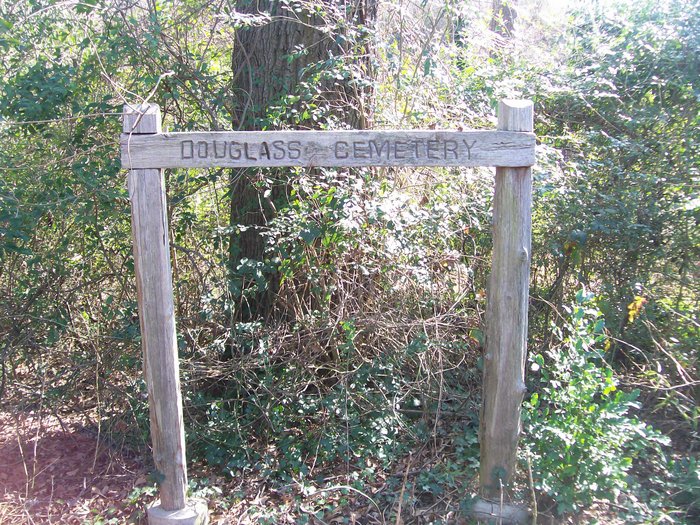
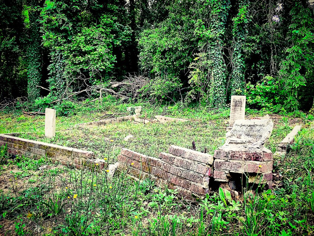
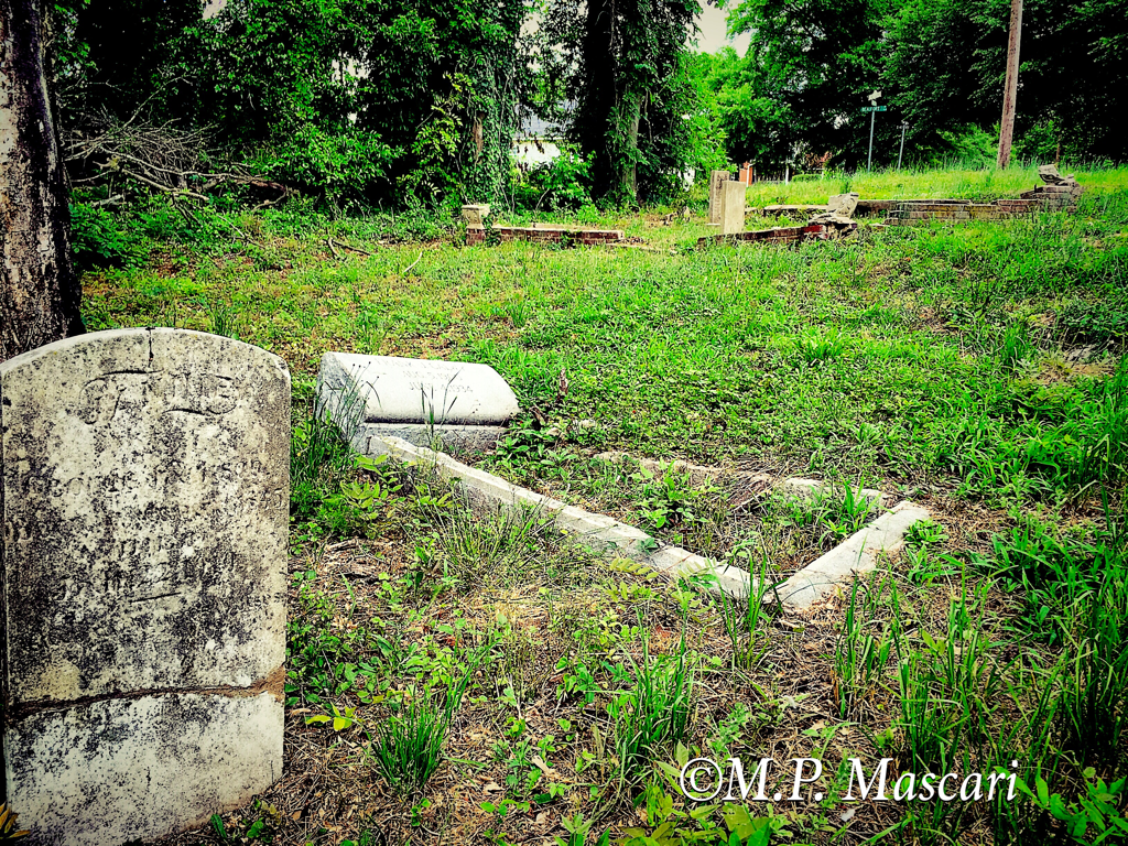
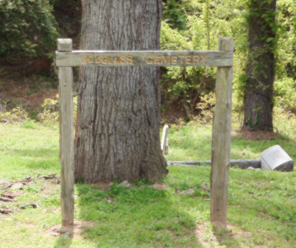
| Description | : | The original Douglass Cemetery, started in 1908, had over 1,000 graves. It covered more than nine acres, but most is now gone. In the early 1950s, about half the cemetery was destroyed to make way for a church and subdivision on Bernard Circle. Then in the late 1980s, the City of Columbia bought the remaining five acres in order to relocate the CSX Railroad line. The Bernard Circle subdivision was also bought and destroyed for the same project. Today, the Church of Christ Park Street is located where the subdivision used to be. Today, only two sections still remain. The smaller... Read More |
frequently asked questions (FAQ):
-
Where is Douglass Cemetery?
Douglass Cemetery is located at Bend of Gadsden & Beaufort St. Columbia, Richland County ,South Carolina , 29201USA.
-
Douglass Cemetery cemetery's updated grave count on graveviews.com?
12 memorials
-
Where are the coordinates of the Douglass Cemetery?
Latitude: 34.0180340
Longitude: -81.0492810
Nearby Cemetories:
1. Saint Peter's Cemetery
Columbia, Richland County, USA
Coordinate: 34.0119200, -81.0488700
2. Elmwood Memorial Gardens
Columbia, Richland County, USA
Coordinate: 34.0121000, -81.0523200
3. Geiger Avenue Cemetery
Columbia, Richland County, USA
Coordinate: 34.0228050, -81.0394590
4. Randolph Cemetery
Columbia, Richland County, USA
Coordinate: 34.0093500, -81.0540800
5. Lower Cemetery
Columbia, Richland County, USA
Coordinate: 34.0093900, -81.0571990
6. Ebenezer Lutheran Church Cemetery
Columbia, Richland County, USA
Coordinate: 34.0113680, -81.0361220
7. Hebrew Benevolent Society Cemetery
Columbia, Richland County, USA
Coordinate: 34.0049780, -81.0435680
8. Mount Pleasant United Methodist Church Cemetery
Columbia, Richland County, USA
Coordinate: 34.0101996, -81.0350037
9. Saint Peter's Catholic Church Cemetery
Columbia, Richland County, USA
Coordinate: 34.0052900, -81.0384100
10. Miller Cemetery
Columbia, Richland County, USA
Coordinate: 34.0321999, -81.0391998
11. Church of the Good Shepherd Memorial Gardens
Columbia, Richland County, USA
Coordinate: 34.0096610, -81.0316160
12. First Baptist Church Cemetery
Columbia, Richland County, USA
Coordinate: 34.0062460, -81.0321850
13. First Presbyterian Churchyard
Columbia, Richland County, USA
Coordinate: 34.0041110, -81.0293900
14. Colored Asylum Cemetery
Columbia, Richland County, USA
Coordinate: 34.0244050, -81.0220490
15. Saint Lukes Episcopal Church Memorial Garden
Columbia, Richland County, USA
Coordinate: 34.0082060, -81.0180940
16. Lincoln Cemetery
Columbia, Richland County, USA
Coordinate: 34.0400009, -81.0214005
17. Barhamville Cemetery
Columbia, Richland County, USA
Coordinate: 34.0236870, -81.0107570
18. Crescent Hill Memorial Gardens and Mausoleum
Columbia, Richland County, USA
Coordinate: 34.0297012, -81.0089035
19. Fridig Cemetery
Lexington County, USA
Coordinate: 33.9961600, -81.0836350
20. Lincoln Memorial Cemetery
Columbia, Richland County, USA
Coordinate: 34.0532990, -81.0385971
21. Palmetto Cemetery
Columbia, Richland County, USA
Coordinate: 34.0521785, -81.0290293
22. All Saints Episcopal Church Garden
Cayce, Lexington County, USA
Coordinate: 33.9810790, -81.0695250
23. Dent Cemetery
Columbia, Richland County, USA
Coordinate: 34.0560620, -81.0276490
24. Gunter's Chapel Baptist Church Cemetery
Columbia, Richland County, USA
Coordinate: 34.0394590, -81.0028790