
| Memorials | : | 2 |
| Location | : | Columbia, Richland County, USA |
| Website | : | localhistory.richlandlibrary.com/digital/collection/p16817coll12/id/5 |
| Coordinate | : | 34.0228050, -81.0394590 |
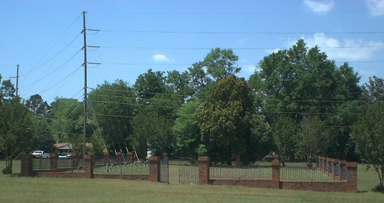
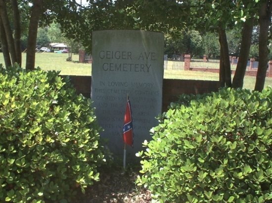
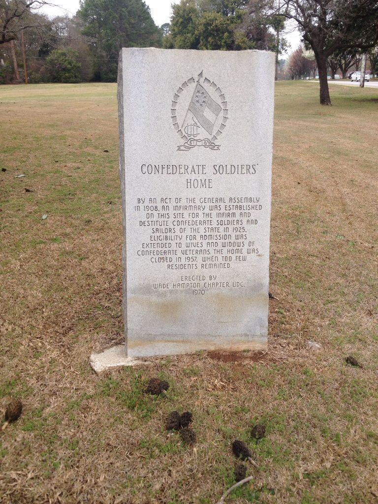
| Description | : | The fenced area within the cemetery is known as Confederate Home Cemetery and contains the graves of Confederate soldiers and their spouses. Surrounding the fenced area are the graves of State Hospital patients. The South Carolina Confederate Soldiers' Home was previously located in front of the cemetery on the corner of Confederate Avenue and Bull Street. The Home opened in 1909 and was built on land owned by the State Hospital. The Home was closed in 1958. Most of the graves for State Hospital patients are only marked with plot numbers. As of November 13, 2013, all of the gravemarkers with names... Read More |
frequently asked questions (FAQ):
-
Where is Geiger Avenue Cemetery?
Geiger Avenue Cemetery is located at Geiger Avenue Columbia, Richland County ,South Carolina ,USA.
-
Geiger Avenue Cemetery cemetery's updated grave count on graveviews.com?
2 memorials
-
Where are the coordinates of the Geiger Avenue Cemetery?
Latitude: 34.0228050
Longitude: -81.0394590
Nearby Cemetories:
1. Miller Cemetery
Columbia, Richland County, USA
Coordinate: 34.0321999, -81.0391998
2. Douglass Cemetery
Columbia, Richland County, USA
Coordinate: 34.0180340, -81.0492810
3. Ebenezer Lutheran Church Cemetery
Columbia, Richland County, USA
Coordinate: 34.0113680, -81.0361220
4. Mount Pleasant United Methodist Church Cemetery
Columbia, Richland County, USA
Coordinate: 34.0101996, -81.0350037
5. Saint Peter's Cemetery
Columbia, Richland County, USA
Coordinate: 34.0119200, -81.0488700
6. Colored Asylum Cemetery
Columbia, Richland County, USA
Coordinate: 34.0244050, -81.0220490
7. Church of the Good Shepherd Memorial Gardens
Columbia, Richland County, USA
Coordinate: 34.0096610, -81.0316160
8. Elmwood Memorial Gardens
Columbia, Richland County, USA
Coordinate: 34.0121000, -81.0523200
9. Saint Peter's Catholic Church Cemetery
Columbia, Richland County, USA
Coordinate: 34.0052900, -81.0384100
10. First Baptist Church Cemetery
Columbia, Richland County, USA
Coordinate: 34.0062460, -81.0321850
11. Randolph Cemetery
Columbia, Richland County, USA
Coordinate: 34.0093500, -81.0540800
12. Hebrew Benevolent Society Cemetery
Columbia, Richland County, USA
Coordinate: 34.0049780, -81.0435680
13. Lower Cemetery
Columbia, Richland County, USA
Coordinate: 34.0093900, -81.0571990
14. First Presbyterian Churchyard
Columbia, Richland County, USA
Coordinate: 34.0041110, -81.0293900
15. Lincoln Cemetery
Columbia, Richland County, USA
Coordinate: 34.0400009, -81.0214005
16. Saint Lukes Episcopal Church Memorial Garden
Columbia, Richland County, USA
Coordinate: 34.0082060, -81.0180940
17. Barhamville Cemetery
Columbia, Richland County, USA
Coordinate: 34.0236870, -81.0107570
18. Crescent Hill Memorial Gardens and Mausoleum
Columbia, Richland County, USA
Coordinate: 34.0297012, -81.0089035
19. Lincoln Memorial Cemetery
Columbia, Richland County, USA
Coordinate: 34.0532990, -81.0385971
20. Palmetto Cemetery
Columbia, Richland County, USA
Coordinate: 34.0521785, -81.0290293
21. Gunter's Chapel Baptist Church Cemetery
Columbia, Richland County, USA
Coordinate: 34.0394590, -81.0028790
22. Dent Cemetery
Columbia, Richland County, USA
Coordinate: 34.0560620, -81.0276490
23. Antioch Baptist Church Cemetery
Columbia, Richland County, USA
Coordinate: 34.0525790, -81.0114780
24. Pine Ridge Cemetery
Columbia, Richland County, USA
Coordinate: 34.0539017, -81.0124969