
| Memorials | : | 22 |
| Location | : | Columbia, Richland County, USA |
| Coordinate | : | 34.0093900, -81.0571990 |
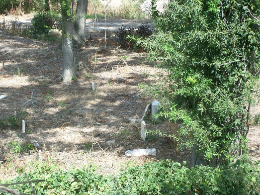
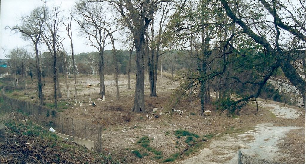
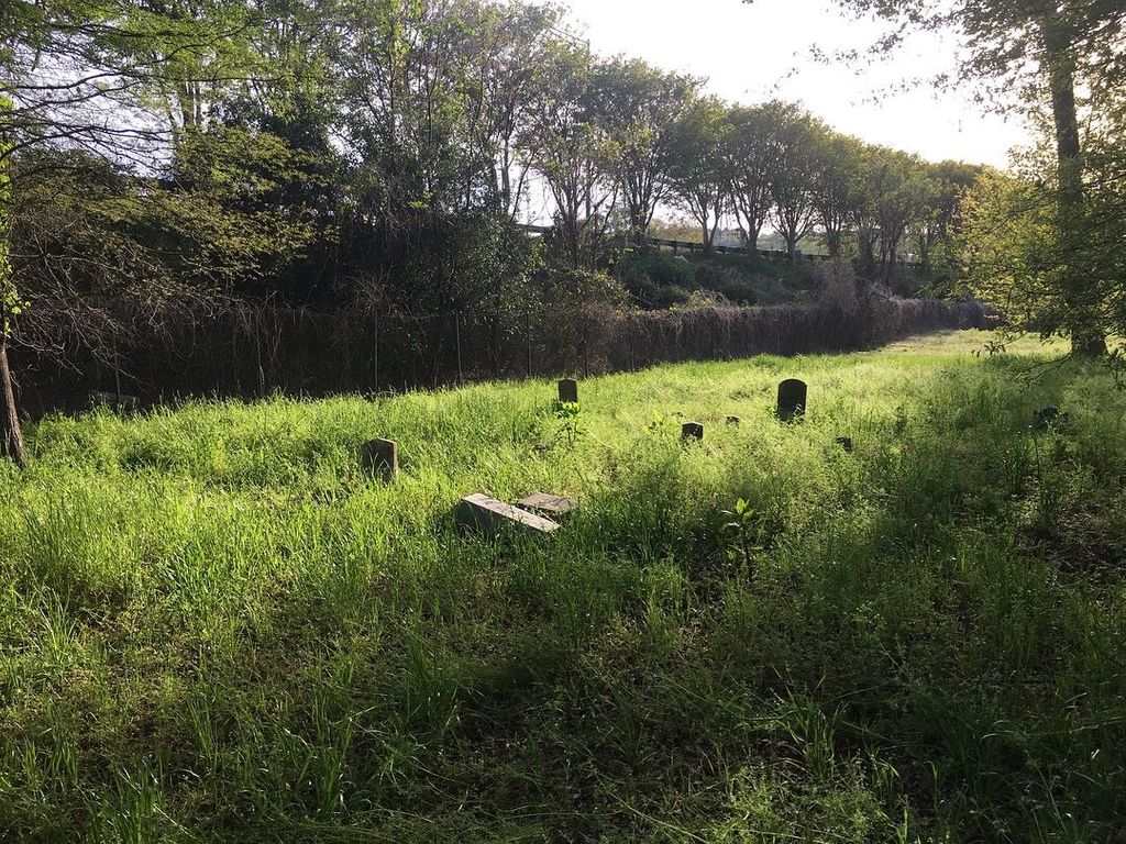
| Description | : | Between the Columbia Canal and Randolph Cemetery. The cemetery can be accessed from Pinckney St from a tunnel under I-126, if the gate is unlocked. This cemetery, containing burials of both white and black indigent and poor, was started as the third "potter's field" after the Columbia Public Burying Ground closed in 1856; it was used for over 100 years. From death certificate records, it appears more than 12,000 burials took place. Several graves were moved in the 1950s to the State Penitentiary Cemetery (just to the north) by McCormick Funeral Home when I-126 was widened, and more were moved in... Read More |
frequently asked questions (FAQ):
-
Where is Lower Cemetery?
Lower Cemetery is located at At the end of Elmwood Ave. off I-126 Columbia, Richland County ,South Carolina , 29201USA.
-
Lower Cemetery cemetery's updated grave count on graveviews.com?
22 memorials
-
Where are the coordinates of the Lower Cemetery?
Latitude: 34.0093900
Longitude: -81.0571990


Nearby Cemetories:
1. Randolph Cemetery
Columbia, Richland County, USA
Coordinate: 34.0093500, -81.0540800
2. Elmwood Memorial Gardens
Columbia, Richland County, USA
Coordinate: 34.0121000, -81.0523200
3. Saint Peter's Cemetery
Columbia, Richland County, USA
Coordinate: 34.0119200, -81.0488700
4. Douglass Cemetery
Columbia, Richland County, USA
Coordinate: 34.0180340, -81.0492810
5. Hebrew Benevolent Society Cemetery
Columbia, Richland County, USA
Coordinate: 34.0049780, -81.0435680
6. Saint Peter's Catholic Church Cemetery
Columbia, Richland County, USA
Coordinate: 34.0052900, -81.0384100
7. Ebenezer Lutheran Church Cemetery
Columbia, Richland County, USA
Coordinate: 34.0113680, -81.0361220
8. Mount Pleasant United Methodist Church Cemetery
Columbia, Richland County, USA
Coordinate: 34.0101996, -81.0350037
9. Geiger Avenue Cemetery
Columbia, Richland County, USA
Coordinate: 34.0228050, -81.0394590
10. First Baptist Church Cemetery
Columbia, Richland County, USA
Coordinate: 34.0062460, -81.0321850
11. Church of the Good Shepherd Memorial Gardens
Columbia, Richland County, USA
Coordinate: 34.0096610, -81.0316160
12. First Presbyterian Churchyard
Columbia, Richland County, USA
Coordinate: 34.0041110, -81.0293900
13. Fridig Cemetery
Lexington County, USA
Coordinate: 33.9961600, -81.0836350
14. Miller Cemetery
Columbia, Richland County, USA
Coordinate: 34.0321999, -81.0391998
15. All Saints Episcopal Church Garden
Cayce, Lexington County, USA
Coordinate: 33.9810790, -81.0695250
16. Saint Lukes Episcopal Church Memorial Garden
Columbia, Richland County, USA
Coordinate: 34.0082060, -81.0180940
17. Colored Asylum Cemetery
Columbia, Richland County, USA
Coordinate: 34.0244050, -81.0220490
18. Granby Gardens Park Pavilion Cemetery
Cayce, Lexington County, USA
Coordinate: 33.9712890, -81.0677060
19. Cayce Burial Gnd
Cayce, Lexington County, USA
Coordinate: 33.9693510, -81.0675840
20. Barhamville Cemetery
Columbia, Richland County, USA
Coordinate: 34.0236870, -81.0107570
21. Faith Lutheran Church Cemetery
Lexington County, USA
Coordinate: 33.9739810, -81.0825880
22. Earl Cemetery
Cayce, Lexington County, USA
Coordinate: 33.9677560, -81.0646100
23. Lincoln Cemetery
Columbia, Richland County, USA
Coordinate: 34.0400009, -81.0214005
24. Arthur Cemetery
Cayce, Lexington County, USA
Coordinate: 33.9666730, -81.0573280