
| Memorials | : | 49 |
| Location | : | Stoutsville, Fairfield County, USA |
| Coordinate | : | 39.5608978, -82.8262863 |
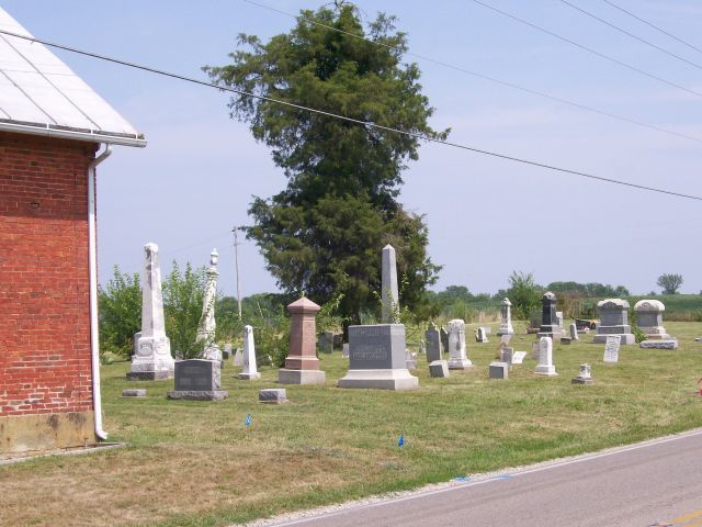
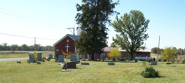
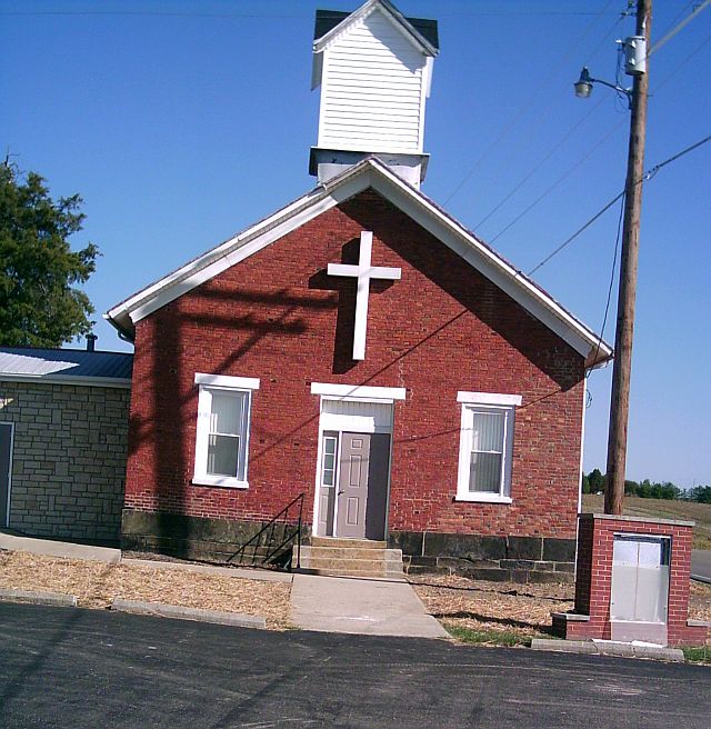
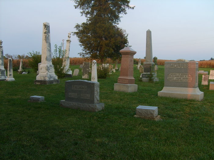
| Description | : | Located on the Fairfield / Pickaway Co. Line, Tarlton Road, at the curve in the road around the church building (formerly Dresbach United Brethren Church). The cemetery is located on the north side of Tarlton Road about 0.3 miles west of its intersection with Dozer Road SW. The cemetery is located in Clear Creek Township, Fairfield County, Ohio, and is # 3124 (Dresbach Cemetery / Dresbach Church Cemetery) in “Ohio Cemeteries 1803-2003”, compiled by the Ohio Genealogical Society. The U.S. Geological Survey (USGS) Geographic Names Information System (GNIS) feature ID for the cemetery is 1806805 (Dresbach Cemetery). |
frequently asked questions (FAQ):
-
Where is Dresbach Cemetery?
Dresbach Cemetery is located at Tarlton Road Stoutsville, Fairfield County ,Ohio , 43154USA.
-
Dresbach Cemetery cemetery's updated grave count on graveviews.com?
49 memorials
-
Where are the coordinates of the Dresbach Cemetery?
Latitude: 39.5608978
Longitude: -82.8262863
Nearby Cemetories:
1. Spengler Cemetery
Stoutsville, Fairfield County, USA
Coordinate: 39.5653290, -82.8241650
2. Neff Cemetery
Stoutsville, Fairfield County, USA
Coordinate: 39.5821991, -82.8106003
3. Bunker Hill Cemetery
Stoutsville, Fairfield County, USA
Coordinate: 39.5855100, -82.8308600
4. Wolf Cemetery
Stoutsville, Fairfield County, USA
Coordinate: 39.5901600, -82.8070200
5. Rice and Black Cemetery
Pickaway County, USA
Coordinate: 39.5430984, -82.8644028
6. Tarlton United Brethren Cemetery
Stoutsville, Fairfield County, USA
Coordinate: 39.5576530, -82.7792140
7. Maple Hill Cemetery
Stoutsville, Fairfield County, USA
Coordinate: 39.6006012, -82.8227997
8. Tarlton Cemetery
Tarlton, Pickaway County, USA
Coordinate: 39.5550630, -82.7737820
9. Heidelberg Reformed Church Cemetery
Stoutsville, Fairfield County, USA
Coordinate: 39.6047783, -82.8269348
10. Imler Cemetery
Saltcreek Township, Pickaway County, USA
Coordinate: 39.5168991, -82.8143997
11. Saint Pauls Evangelical Church Cemetery
Pickaway County, USA
Coordinate: 39.5925600, -82.8718400
12. Morris Chapel Cemetery
Thacher, Pickaway County, USA
Coordinate: 39.5643959, -82.8915253
13. Shelby Farm Cemetery
Pickaway County, USA
Coordinate: 39.5522003, -82.8974991
14. Augustus Cemetery
Fairfield County, USA
Coordinate: 39.5677986, -82.7493973
15. Zion Cemetery
Circleville, Pickaway County, USA
Coordinate: 39.6119003, -82.8688965
16. Stout Family Cemetery
Washington Township, Pickaway County, USA
Coordinate: 39.6241989, -82.8439026
17. Pontius Chapel Cemetery
Pickaway County, USA
Coordinate: 39.6009000, -82.8932300
18. Infirmary Cemetery
Pickaway County, USA
Coordinate: 39.6183014, -82.8675003
19. Julian Cemetery (Defunct)
Clearcreek Township, Fairfield County, USA
Coordinate: 39.5635986, -82.7403030
20. Meade Cemetery
Circleville, Pickaway County, USA
Coordinate: 39.5042300, -82.8762900
21. Golden Valley Lights Cemetery
Whisler, Pickaway County, USA
Coordinate: 39.4922170, -82.8345940
22. Hitler-Ludwig Cemetery
Circleville, Pickaway County, USA
Coordinate: 39.5724983, -82.9206009
23. Old Conrad Cemetery
Amanda, Fairfield County, USA
Coordinate: 39.6153720, -82.7594120
24. Gay-Dreisbach-Kerns Family Farm Cemetery
Pickaway Township, Pickaway County, USA
Coordinate: 39.5436020, -82.9225090