
| Memorials | : | 5 |
| Location | : | Thacher, Pickaway County, USA |
| Coordinate | : | 39.5643959, -82.8915253 |
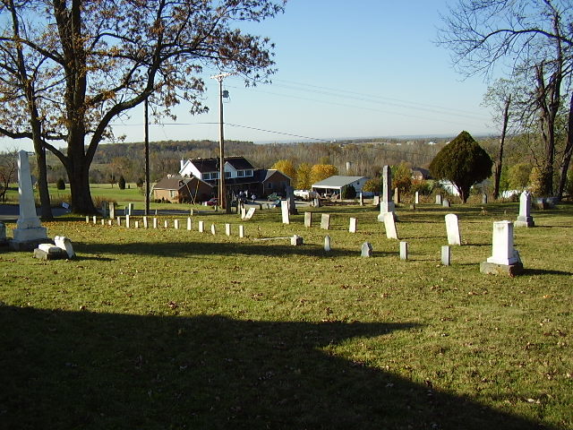
| Description | : | The cemetery is located on the northwest corner of the intersection of Morris Salem Road (County Road 53) and Tarlton Road (County Road 16). The cemetery is located in Washington Township, Pickaway County, Ohio, and is # 12115 (Morris United Brethren Cemetery) in “Ohio Cemeteries 1803-2003”, compiled by the Ohio Genealogical Society. The U.S. Geological Survey (USGS) Geographic Names Information System (GNIS) feature ID for the cemetery is 1963381 (Morris United Brethren Cemetery). |
frequently asked questions (FAQ):
-
Where is Morris Chapel Cemetery?
Morris Chapel Cemetery is located at Morris Salem Road (County Road 53) and Tarlton Road (County Road 16) Thacher, Pickaway County ,Ohio , 43113USA.
-
Morris Chapel Cemetery cemetery's updated grave count on graveviews.com?
4 memorials
-
Where are the coordinates of the Morris Chapel Cemetery?
Latitude: 39.5643959
Longitude: -82.8915253
Nearby Cemetories:
1. Shelby Farm Cemetery
Pickaway County, USA
Coordinate: 39.5522003, -82.8974991
2. Hitler-Ludwig Cemetery
Circleville, Pickaway County, USA
Coordinate: 39.5724983, -82.9206009
3. Kingston Cemetery
Circleville Township, Pickaway County, USA
Coordinate: 39.5753610, -82.9247050
4. Rice and Black Cemetery
Pickaway County, USA
Coordinate: 39.5430984, -82.8644028
5. Gay-Dreisbach-Kerns Family Farm Cemetery
Pickaway Township, Pickaway County, USA
Coordinate: 39.5436020, -82.9225090
6. Saint Pauls Evangelical Church Cemetery
Pickaway County, USA
Coordinate: 39.5925600, -82.8718400
7. Pontius Chapel Cemetery
Pickaway County, USA
Coordinate: 39.6009000, -82.8932300
8. Ebenezer Cemetery
Circleville, Pickaway County, USA
Coordinate: 39.5367012, -82.9225006
9. Della Phillips Cemetery
Pickaway Township, Pickaway County, USA
Coordinate: 39.5617050, -82.9510720
10. Jefferson Cemetery
Logan Elm Village, Pickaway County, USA
Coordinate: 39.5619060, -82.9512750
11. Dresbach Cemetery
Stoutsville, Fairfield County, USA
Coordinate: 39.5608978, -82.8262863
12. Zion Cemetery
Circleville, Pickaway County, USA
Coordinate: 39.6119003, -82.8688965
13. Bunker Hill Cemetery
Stoutsville, Fairfield County, USA
Coordinate: 39.5855100, -82.8308600
14. Spengler Cemetery
Stoutsville, Fairfield County, USA
Coordinate: 39.5653290, -82.8241650
15. High Street Cemetery
Circleville, Pickaway County, USA
Coordinate: 39.6027985, -82.9400024
16. Evangelical Lutheran Cemetery (Defunct)
Circleville, Pickaway County, USA
Coordinate: 39.5991400, -82.9449950
17. Doctor James Rowland Burial Site
Circleville, Pickaway County, USA
Coordinate: 39.5996100, -82.9448040
18. Saint Philips Memorial Garden
Circleville, Pickaway County, USA
Coordinate: 39.5998330, -82.9471380
19. Infirmary Cemetery
Pickaway County, USA
Coordinate: 39.6183014, -82.8675003
20. Emerson Cemetery
Pickaway Township, Pickaway County, USA
Coordinate: 39.5333250, -82.9570360
21. Meade Cemetery
Circleville, Pickaway County, USA
Coordinate: 39.5042300, -82.8762900
22. Ice House Cemetery
Circleville, Pickaway County, USA
Coordinate: 39.6088510, -82.9474440
23. John Graffis Farm Cemetery
Circleville, Pickaway County, USA
Coordinate: 39.6280070, -82.8891730
24. Heidelberg Reformed Church Cemetery
Stoutsville, Fairfield County, USA
Coordinate: 39.6047783, -82.8269348