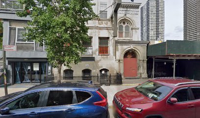
| Memorials | : | 0 |
| Location | : | Manhattan, New York County (Manhattan), USA |
| Coordinate | : | 40.8015520, -73.9382390 |
| Description | : | The Dutch Reformed Church of Harlem was located at 3rd Avenue and 121st Street. The burials in its churchyard were relocated to a plot in Woodlawn Cemetery purchased in 1869. Relocation of the burials in the churchyard and in the church’s cemetery on 1st Avenue between 124th Street and 125th Street was completed by 1875. |
frequently asked questions (FAQ):
-
Where is Dutch Reformed Church of Harlem Churchyard?
Dutch Reformed Church of Harlem Churchyard is located at 3rd Avenue and 121st Street Manhattan, New York County (Manhattan) ,New York , 10035USA.
-
Dutch Reformed Church of Harlem Churchyard cemetery's updated grave count on graveviews.com?
0 memorials
-
Where are the coordinates of the Dutch Reformed Church of Harlem Churchyard?
Latitude: 40.8015520
Longitude: -73.9382390
Nearby Cemetories:
1. Dutch Reformed Church Cemetery of Harlem (Defunct)
Harlem, New York County (Manhattan), USA
Coordinate: 40.8014950, -73.9317320
2. Saint Andrews Episcopal Churchyard
Harlem, New York County (Manhattan), USA
Coordinate: 40.8066430, -73.9374220
3. New York House of Refuge Grounds Cemetery
Manhattan, New York County (Manhattan), USA
Coordinate: 40.7931683, -73.9279023
4. Schomburg Center for Research in Black Culture
Harlem, New York County (Manhattan), USA
Coordinate: 40.8145820, -73.9409100
5. Mother AME Zion Church
Harlem, New York County (Manhattan), USA
Coordinate: 40.8161000, -73.9417200
6. Randalls Island Burial Ground
Randalls Island, New York County (Manhattan), USA
Coordinate: 40.7912970, -73.9226250
7. Saint Ann's Episcopal Church Graveyard
Bronx, Bronx County, USA
Coordinate: 40.8081100, -73.9167700
8. Wards Island Cemetery
Wards Island, New York County (Manhattan), USA
Coordinate: 40.7846000, -73.9293100
9. Saint Pauls Chapel
New York, New York County (Manhattan), USA
Coordinate: 40.8078520, -73.9609550
10. Cathedral Church of Saint John the Divine
Manhattan, New York County (Manhattan), USA
Coordinate: 40.8041100, -73.9626600
11. Saint Mary's Episcopal Church Vault
Harlem, New York County (Manhattan), USA
Coordinate: 40.8149200, -73.9562250
12. Yorkville Cemetery
Manhattan, New York County (Manhattan), USA
Coordinate: 40.7829450, -73.9489660
13. Harlem Heights Battlefield
Manhattan, New York County (Manhattan), USA
Coordinate: 40.8096000, -73.9635000
14. Riverside Church Columbarium
New York, New York County (Manhattan), USA
Coordinate: 40.8116824, -73.9633167
15. Brick Presbyterian Church Cemetery
Manhattan, New York County (Manhattan), USA
Coordinate: 40.7836110, -73.9550000
16. General Grant National Memorial
Manhattan, New York County (Manhattan), USA
Coordinate: 40.8134400, -73.9630000
17. St. Claire Pollock Gravesite
Manhattan, New York County (Manhattan), USA
Coordinate: 40.8147400, -73.9630700
18. Riverside Park
Manhattan, New York County (Manhattan), USA
Coordinate: 40.8138740, -73.9639310
19. Episcopal Church of the Heavenly Rest Columbarium
Manhattan, New York County (Manhattan), USA
Coordinate: 40.7838300, -73.9584400
20. Anshe Chesed Hebrew Cemetery
Manhattan, New York County (Manhattan), USA
Coordinate: 40.7828400, -73.9572330
21. New York City 88th Street Cemetery
Manhattan, New York County (Manhattan), USA
Coordinate: 40.7821730, -73.9578320
22. Bensonia Cemetery
Morrisania, Bronx County, USA
Coordinate: 40.8174070, -73.9124690
23. Rapelje Cemetery
Queens County, USA
Coordinate: 40.7827820, -73.9146340
24. Berrien Island Cemetery
Astoria, Queens County, USA
Coordinate: 40.7842070, -73.9120700

