| Memorials | : | 0 |
| Location | : | Astoria, Queens County, USA |
| Coordinate | : | 40.7842070, -73.9120700 |
| Description | : | Berrien Island Cemetery is non-existant, but once was located on Berrian's Island. Berrien Island was land filled into the mainland in what would now be the northern part of the town of Astoria, where Con Ed is located. Part of the Berrien property is where Steinway Co. is located. The cemetery was obliterated in 1902 for construction of a gas manufacturing plant. Gravestones dated from the eighteenth century to 1810. The map location is approximate. The cemetery is identified as the Berrien-Remsen Family Burial Ground on pages 17-18 of The Graveyard Shift: A Family Historian’s Guide to... Read More |
frequently asked questions (FAQ):
-
Where is Berrien Island Cemetery?
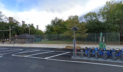
Berrien Island Cemetery is located at 20th Avenue and 21st Street Astoria, Queens County ,New York , 11105USA.
-
Berrien Island Cemetery cemetery's updated grave count on graveviews.com?
0 memorials
-
Where are the coordinates of the Berrien Island Cemetery?
Latitude: 40.7842070
Longitude: -73.9120700
Nearby Cemetories:
1. Rapelje Cemetery
Queens County, USA
Coordinate: 40.7827820, -73.9146340
2. Lawrence Cemetery
Astoria, Queens County, USA
Coordinate: 40.7773800, -73.9056200
3. Randalls Island Burial Ground
Randalls Island, New York County (Manhattan), USA
Coordinate: 40.7912970, -73.9226250
4. Wards Island Cemetery
Wards Island, New York County (Manhattan), USA
Coordinate: 40.7846000, -73.9293100
5. Our Lady of Mount Carmel Catholic Cemetery
Astoria, Queens County, USA
Coordinate: 40.7737122, -73.9250183
6. New York House of Refuge Grounds Cemetery
Manhattan, New York County (Manhattan), USA
Coordinate: 40.7931683, -73.9279023
7. Saint George Church Cemetery
Astoria, Queens County, USA
Coordinate: 40.7726540, -73.9286140
8. Riker-Lent Burial Ground
Astoria, Queens County, USA
Coordinate: 40.7734100, -73.8922120
9. Hallett's Burying Ground (Defunct)
Astoria, Queens County, USA
Coordinate: 40.7721460, -73.9321570
10. Saint Michael's Cemetery
East Elmhurst, Queens County, USA
Coordinate: 40.7647018, -73.8993988
11. Dutch Reformed Church Cemetery of Harlem (Defunct)
Harlem, New York County (Manhattan), USA
Coordinate: 40.8014950, -73.9317320
12. Bowery Bay Cemetery (Defunct)
Queens, Queens County, USA
Coordinate: 40.7733730, -73.8849560
13. Saint Ann's Episcopal Church Graveyard
Bronx, Bronx County, USA
Coordinate: 40.8081100, -73.9167700
14. Isamu Noguchi Garden Museum
Long Island City, Queens County, USA
Coordinate: 40.7667020, -73.9379410
15. Dutch Reformed Church of Harlem Churchyard
Manhattan, New York County (Manhattan), USA
Coordinate: 40.8015520, -73.9382390
16. Yorkville Cemetery
Manhattan, New York County (Manhattan), USA
Coordinate: 40.7829450, -73.9489660
17. Moore-Jackson Cemetery
Woodside, Queens County, USA
Coordinate: 40.7559180, -73.9074160
18. Saint Andrews Episcopal Churchyard
Harlem, New York County (Manhattan), USA
Coordinate: 40.8066430, -73.9374220
19. Trains Meadow Road Folk Burying Ground
Elmhurst, Queens County, USA
Coordinate: 40.7613966, -73.8850268
20. Blackwell Burial Ground (Defunct)
Astoria, Queens County, USA
Coordinate: 40.7613350, -73.9425380
21. Brick Presbyterian Church Cemetery
Manhattan, New York County (Manhattan), USA
Coordinate: 40.7836110, -73.9550000
22. Bensonia Cemetery
Morrisania, Bronx County, USA
Coordinate: 40.8174070, -73.9124690
23. Anshe Chesed Hebrew Cemetery
Manhattan, New York County (Manhattan), USA
Coordinate: 40.7828400, -73.9572330
24. Hunts Point Slave Burial Ground
Bronx, Bronx County, USA
Coordinate: 40.8103500, -73.8826760

