
| Memorials | : | 0 |
| Location | : | Morrisania, Bronx County, USA |
| Coordinate | : | 40.8174070, -73.9124690 |
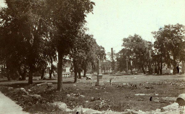
| Description | : | "the cemetery was bounded by Benson Street (now East 149th Street) on the south and by Beck Street (now East 156th Street) on the north. Its western boundary was the Mill Brook (Brook Avenue) and its eastern boundary was the crest of Eagle Avenue." Education and Culture in The Bronx: A Research Guide. NY: Bronx County Historical Society, 2013. http://www.bronxhistoricalsociety.org/educationandculture.pdf |
frequently asked questions (FAQ):
-
Where is Bensonia Cemetery?
Bensonia Cemetery is located at St. Ann's Avenue Morrisania, Bronx County ,New York , 10455USA.
-
Bensonia Cemetery cemetery's updated grave count on graveviews.com?
0 memorials
-
Where are the coordinates of the Bensonia Cemetery?
Latitude: 40.8174070
Longitude: -73.9124690
Nearby Cemetories:
1. Saint Ann's Episcopal Church Graveyard
Bronx, Bronx County, USA
Coordinate: 40.8081100, -73.9167700
2. Corpus Christi Monastery
Bronx, Bronx County, USA
Coordinate: 40.8159170, -73.8902750
3. Dutch Reformed Church Cemetery of Harlem (Defunct)
Harlem, New York County (Manhattan), USA
Coordinate: 40.8014950, -73.9317320
4. Schomburg Center for Research in Black Culture
Harlem, New York County (Manhattan), USA
Coordinate: 40.8145820, -73.9409100
5. Saint Andrews Episcopal Churchyard
Harlem, New York County (Manhattan), USA
Coordinate: 40.8066430, -73.9374220
6. Mother AME Zion Church
Harlem, New York County (Manhattan), USA
Coordinate: 40.8161000, -73.9417200
7. Hunts Point Slave Burial Ground
Bronx, Bronx County, USA
Coordinate: 40.8103500, -73.8826760
8. Joseph Rodman Drake Park
Bronx, Bronx County, USA
Coordinate: 40.8103447, -73.8825531
9. Dutch Reformed Church of Harlem Churchyard
Manhattan, New York County (Manhattan), USA
Coordinate: 40.8015520, -73.9382390
10. New York House of Refuge Grounds Cemetery
Manhattan, New York County (Manhattan), USA
Coordinate: 40.7931683, -73.9279023
11. Randalls Island Burial Ground
Randalls Island, New York County (Manhattan), USA
Coordinate: 40.7912970, -73.9226250
12. Church of the Intercession
Manhattan, New York County (Manhattan), USA
Coordinate: 40.8321900, -73.9453300
13. Trinity Church Cemetery and Mausoleum
Manhattan, New York County (Manhattan), USA
Coordinate: 40.8333200, -73.9489600
14. Old Dutch Burying Ground
Manhattan, New York County (Manhattan), USA
Coordinate: 40.8331100, -73.9492400
15. Berrien Island Cemetery
Astoria, Queens County, USA
Coordinate: 40.7842070, -73.9120700
16. Saint Mary's Episcopal Church Vault
Harlem, New York County (Manhattan), USA
Coordinate: 40.8149200, -73.9562250
17. Rapelje Cemetery
Queens County, USA
Coordinate: 40.7827820, -73.9146340
18. Wards Island Cemetery
Wards Island, New York County (Manhattan), USA
Coordinate: 40.7846000, -73.9293100
19. West Farms Soldier Cemetery
West Farms, Bronx County, USA
Coordinate: 40.8435826, -73.8793190
20. Old Presbyterian Church Cemetery
West Farms, Bronx County, USA
Coordinate: 40.8439960, -73.8797820
21. Holy Cross Armenian Church
Manhattan, New York County (Manhattan), USA
Coordinate: 40.8527500, -73.9304100
22. Saint Pauls Chapel
New York, New York County (Manhattan), USA
Coordinate: 40.8078520, -73.9609550
23. St. Claire Pollock Gravesite
Manhattan, New York County (Manhattan), USA
Coordinate: 40.8147400, -73.9630700
24. General Grant National Memorial
Manhattan, New York County (Manhattan), USA
Coordinate: 40.8134400, -73.9630000