| Memorials | : | 0 |
| Location | : | Clay County, USA |
| Coordinate | : | 39.4462210, -86.9724190 |
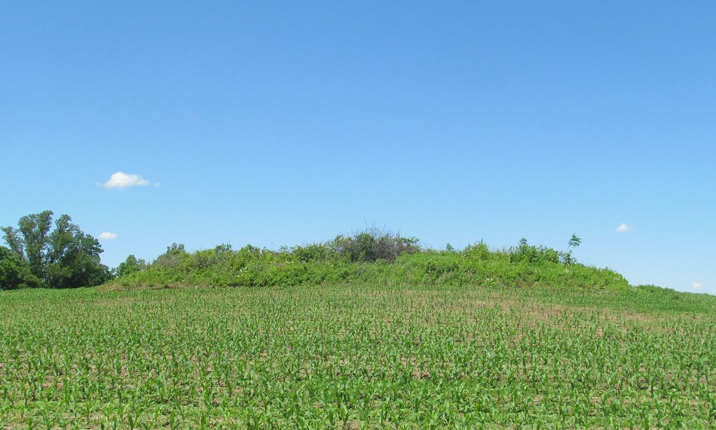
| Description | : | The Dyer cemetery, as the map shows, is located near SR 42 and Candlestick Corner Rd; it is in Section 28, Township 12N, Range 5W, in Cass Township, Clay County. It is in the middle of a crop field and there is no access other than on foot. It is completely overgrown with weeds and brush. Could find no official records for the cemetery; the Clay County Genealogical Society in Center Point does have some reconstructed records but they seem to be recollections of long-time residents, and are almost certainly incomplete. Indiana Cemetery Locations, Volume 4, published by... Read More |
frequently asked questions (FAQ):
-
Where is Dyar Cemetery?
Dyar Cemetery is located at N Candlestick Corner Road Clay County ,Indiana , 47840USA.
-
Dyar Cemetery cemetery's updated grave count on graveviews.com?
0 memorials
-
Where are the coordinates of the Dyar Cemetery?
Latitude: 39.4462210
Longitude: -86.9724190
Nearby Cemetories:
1. Wilkinson-Nees Cemetery
Poland, Clay County, USA
Coordinate: 39.4407997, -86.9794006
2. Cagle Cemetery
Clay County, USA
Coordinate: 39.4514008, -86.9630966
3. Poland Chapel Cemetery
Poland, Clay County, USA
Coordinate: 39.4445152, -86.9535599
4. Anderson Cemetery
Poland, Clay County, USA
Coordinate: 39.4420000, -86.9534700
5. Cromwell Cemetery
Clay County, USA
Coordinate: 39.4469400, -86.9955700
6. Latham-Lucas Cemetery
Poland, Clay County, USA
Coordinate: 39.4573900, -86.9950300
7. Rizley Cemetery
Clay County, USA
Coordinate: 39.4375000, -87.0008000
8. Zion United Church Of Christ Cemetery
Poland, Clay County, USA
Coordinate: 39.4288445, -86.9506683
9. Mace Cemetery
Putnam County, USA
Coordinate: 39.4771996, -86.9617004
10. Mustard Cemetery
Poland, Clay County, USA
Coordinate: 39.4222000, -87.0003000
11. McCullough-Stigler Cemetery
Putnam County, USA
Coordinate: 39.4768300, -86.9896500
12. Schoppenhorst Cemetery
Poland, Clay County, USA
Coordinate: 39.4103000, -86.9614000
13. Grable Cemetery
Putnam County, USA
Coordinate: 39.4907990, -86.9543991
14. Saint John's Cemetery
Brazil, Clay County, USA
Coordinate: 39.4443130, -87.0429688
15. Fertig Cemetery
Owen County, USA
Coordinate: 39.4647790, -86.9038080
16. Athey Cemetery
Washington Township, Putnam County, USA
Coordinate: 39.5029182, -86.9622116
17. Matkins Cemetery
Pleasant Gardens, Putnam County, USA
Coordinate: 39.5064327, -86.9605682
18. Neidlinger Cemetery
Harmony, Clay County, USA
Coordinate: 39.4599991, -87.0543976
19. Bowling Green Cemetery
Bowling Green, Clay County, USA
Coordinate: 39.3856888, -87.0073395
20. Reeves Cemetery (Defunct)
Cloverdale, Putnam County, USA
Coordinate: 39.4791700, -86.8972200
21. Croys Creek Cemetery
Reelsville, Putnam County, USA
Coordinate: 39.5060768, -87.0130157
22. Barnett Cemetery
Reelsville, Putnam County, USA
Coordinate: 39.5075000, -87.0142000
23. Allen Cemetery
Reelsville, Putnam County, USA
Coordinate: 39.5168170, -86.9666830
24. Moyers Cemetery
Reelsville, Putnam County, USA
Coordinate: 39.5130692, -87.0061646


