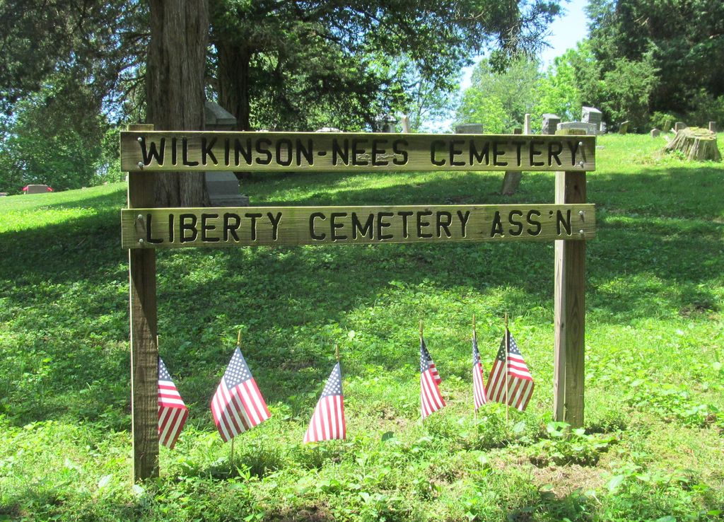
| Memorials | : | 2 |
| Location | : | Poland, Clay County, USA |
| Coordinate | : | 39.4407997, -86.9794006 |
| Description | : | The cemetery is located in Cass Township (E half of the NE quadrant of Section 32 Township 12N Range 5W) on the west side of N County Road 700 E about 0.25 miles south of its intersection with Indiana State Highway 42. Indiana Cemetery Locations, Volume 4, published by the Indiana Genealogical Society (April 2009), gives the primary cemetery name as Webster Cemetery. The cemetery is listed in the Cemetery and Burial Grounds Registry of the Indiana Department of Natural Resources (DNR) and in the State Historical Architectural and Archaeological Research Database (SHAARD) with Cemetery Record Number CR-11-11... Read More |
frequently asked questions (FAQ):
-
Where is Wilkinson-Nees Cemetery?
Wilkinson-Nees Cemetery is located at N County Road 700 E Poland, Clay County ,Indiana , 47868USA.
-
Wilkinson-Nees Cemetery cemetery's updated grave count on graveviews.com?
0 memorials
-
Where are the coordinates of the Wilkinson-Nees Cemetery?
Latitude: 39.4407997
Longitude: -86.9794006
Nearby Cemetories:
1. Dyar Cemetery
Clay County, USA
Coordinate: 39.4462210, -86.9724190
2. Cromwell Cemetery
Clay County, USA
Coordinate: 39.4469400, -86.9955700
3. Cagle Cemetery
Clay County, USA
Coordinate: 39.4514008, -86.9630966
4. Rizley Cemetery
Clay County, USA
Coordinate: 39.4375000, -87.0008000
5. Anderson Cemetery
Poland, Clay County, USA
Coordinate: 39.4420000, -86.9534700
6. Poland Chapel Cemetery
Poland, Clay County, USA
Coordinate: 39.4445152, -86.9535599
7. Latham-Lucas Cemetery
Poland, Clay County, USA
Coordinate: 39.4573900, -86.9950300
8. Mustard Cemetery
Poland, Clay County, USA
Coordinate: 39.4222000, -87.0003000
9. Zion United Church Of Christ Cemetery
Poland, Clay County, USA
Coordinate: 39.4288445, -86.9506683
10. Schoppenhorst Cemetery
Poland, Clay County, USA
Coordinate: 39.4103000, -86.9614000
11. McCullough-Stigler Cemetery
Putnam County, USA
Coordinate: 39.4768300, -86.9896500
12. Mace Cemetery
Putnam County, USA
Coordinate: 39.4771996, -86.9617004
13. Saint John's Cemetery
Brazil, Clay County, USA
Coordinate: 39.4443130, -87.0429688
14. Grable Cemetery
Putnam County, USA
Coordinate: 39.4907990, -86.9543991
15. Bowling Green Cemetery
Bowling Green, Clay County, USA
Coordinate: 39.3856888, -87.0073395
16. Neidlinger Cemetery
Harmony, Clay County, USA
Coordinate: 39.4599991, -87.0543976
17. Fertig Cemetery
Owen County, USA
Coordinate: 39.4647790, -86.9038080
18. Athey Cemetery
Washington Township, Putnam County, USA
Coordinate: 39.5029182, -86.9622116
19. Killion Cemetery
Bowling Green, Clay County, USA
Coordinate: 39.3931007, -87.0355988
20. Matkins Cemetery
Pleasant Gardens, Putnam County, USA
Coordinate: 39.5064327, -86.9605682
21. Kaelber Cemetery
Clay County, USA
Coordinate: 39.4455986, -87.0667038
22. Croys Creek Cemetery
Reelsville, Putnam County, USA
Coordinate: 39.5060768, -87.0130157
23. Barnett Cemetery
Reelsville, Putnam County, USA
Coordinate: 39.5075000, -87.0142000
24. Reeves Cemetery (Defunct)
Cloverdale, Putnam County, USA
Coordinate: 39.4791700, -86.8972200

