| Memorials | : | 0 |
| Location | : | Brownfield, Oxford County, USA |
| Coordinate | : | 43.8948700, -70.8974400 |
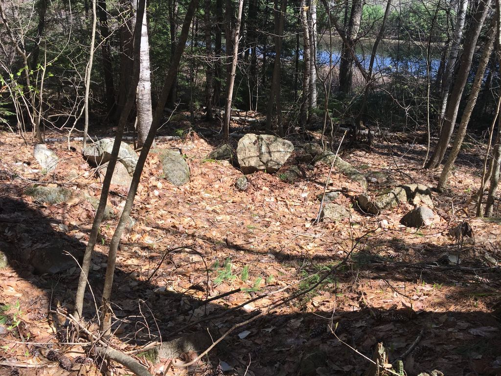
| Description | : | From its intersection with 160, drive west on Sewell Day Road 0.4 miles. The dirt road goes next to Dyer Pond. The cemetery, which contains two fieldstones, is on the right (east) side just past the pond. It is enclosed in a stone wall but barely recognizable as a cemetery. The old Simeon Dyer place was on the left. The graves are of his parents, James and Ann (Hartford) Dyer. |
frequently asked questions (FAQ):
-
Where is Dyer Cemetery?
Dyer Cemetery is located at Brownfield, Oxford County ,Maine ,USA.
-
Dyer Cemetery cemetery's updated grave count on graveviews.com?
0 memorials
-
Where are the coordinates of the Dyer Cemetery?
Latitude: 43.8948700
Longitude: -70.8974400
Nearby Cemetories:
1. Day Farm Cemetery
Brownfield, Oxford County, USA
Coordinate: 43.8959200, -70.9005900
2. Cole Cemetery
Porterfield, Oxford County, USA
Coordinate: 43.8838600, -70.9017400
3. Stuart Cemetery
Brownfield, Oxford County, USA
Coordinate: 43.9031500, -70.8863500
4. Porterfield Cemetery
Porterfield, Oxford County, USA
Coordinate: 43.8769700, -70.9130800
5. Sargent-Rounds Cemetery
Porter, Oxford County, USA
Coordinate: 43.8794200, -70.9224200
6. Johnson Cemetery
Brownfield, Oxford County, USA
Coordinate: 43.8880600, -70.9355600
7. Clemons Pond Cemetery
Hiram, Oxford County, USA
Coordinate: 43.8692100, -70.8786900
8. Joshua Sargent Cemetery
Hiram, Oxford County, USA
Coordinate: 43.8755300, -70.8669400
9. Jonathan Clemons Cemetery
Hiram, Oxford County, USA
Coordinate: 43.8765800, -70.8656100
10. Durgin-Walker Cemetery
Porter, Oxford County, USA
Coordinate: 43.8671600, -70.9117400
11. Quint Cemetery
Brownfield, Oxford County, USA
Coordinate: 43.8984700, -70.9408400
12. Norton Gravesite
Brownfield, Oxford County, USA
Coordinate: 43.9180400, -70.8659200
13. Ricker Cemetery
Brownfield, Oxford County, USA
Coordinate: 43.9061540, -70.9425500
14. William Cotton II Cemetery
Hiram, Oxford County, USA
Coordinate: 43.8730400, -70.8572900
15. Hartford Cemetery
Brownfield, Oxford County, USA
Coordinate: 43.9150009, -70.8546982
16. Tripp Cemetery
Porter, Oxford County, USA
Coordinate: 43.8567200, -70.9109500
17. Blake Cemetery
Brownfield, Oxford County, USA
Coordinate: 43.9063988, -70.9514008
18. Storer Cemetery
Hiram, Oxford County, USA
Coordinate: 43.8863800, -70.8401600
19. Gilpatrick Cemetery
Hiram, Oxford County, USA
Coordinate: 43.8548500, -70.8788900
20. Pine Grove Cemetery
Brownfield, Oxford County, USA
Coordinate: 43.9375000, -70.9041977
21. Fred Chapman Cemetery
Porter, Oxford County, USA
Coordinate: 43.8541600, -70.9178800
22. Lowell Burial Site
Hiram, Oxford County, USA
Coordinate: 43.8807000, -70.8404500
23. Eastman Gravesite
Hiram, Oxford County, USA
Coordinate: 43.8614800, -70.8574100
24. Binford Cemetery
Brownfield, Oxford County, USA
Coordinate: 43.8936250, -70.9597380

