
| Memorials | : | 0 |
| Location | : | Brownfield, Oxford County, USA |
| Coordinate | : | 43.9031500, -70.8863500 |
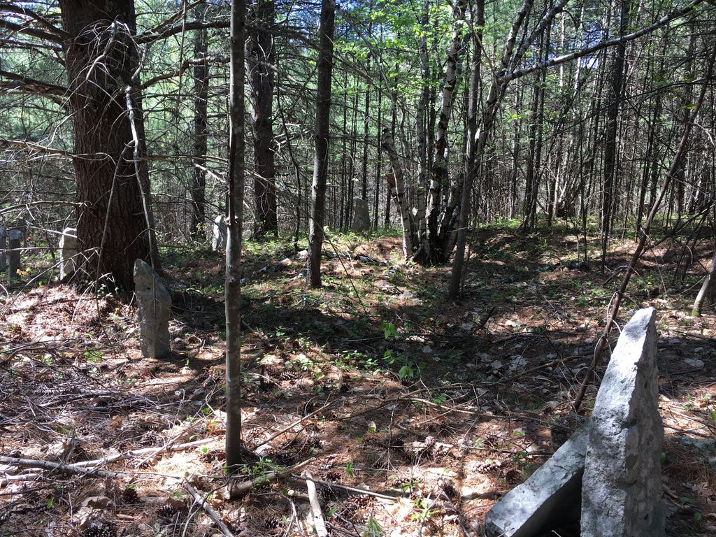
| Description | : | From its intersection with Burnt Meadow Road, drive south on 160 2.3 miles to #679 on the right (west) side of the road. The cemetery is in the woods about 165 feet north of the house. All that remains of this good-sized cemetery are granite posts and many large grave depressions. Many of the graves were moved to Pine Grove and some were moved to Spring Cemetery in Hiram. Others are unaccounted for. Old records refer to this cemetery as being on the Roscoe Lord place. There are currently no gravestones at this location. Any grave photographs on these memorials were... Read More |
frequently asked questions (FAQ):
-
Where is Stuart Cemetery?
Stuart Cemetery is located at Brownfield, Oxford County ,Maine ,USA.
-
Stuart Cemetery cemetery's updated grave count on graveviews.com?
0 memorials
-
Where are the coordinates of the Stuart Cemetery?
Latitude: 43.9031500
Longitude: -70.8863500
Nearby Cemetories:
1. Dyer Cemetery
Brownfield, Oxford County, USA
Coordinate: 43.8948700, -70.8974400
2. Day Farm Cemetery
Brownfield, Oxford County, USA
Coordinate: 43.8959200, -70.9005900
3. Norton Gravesite
Brownfield, Oxford County, USA
Coordinate: 43.9180400, -70.8659200
4. Cole Cemetery
Porterfield, Oxford County, USA
Coordinate: 43.8838600, -70.9017400
5. Hartford Cemetery
Brownfield, Oxford County, USA
Coordinate: 43.9150009, -70.8546982
6. Jonathan Clemons Cemetery
Hiram, Oxford County, USA
Coordinate: 43.8765800, -70.8656100
7. Joshua Sargent Cemetery
Hiram, Oxford County, USA
Coordinate: 43.8755300, -70.8669400
8. Porterfield Cemetery
Porterfield, Oxford County, USA
Coordinate: 43.8769700, -70.9130800
9. Clemons Pond Cemetery
Hiram, Oxford County, USA
Coordinate: 43.8692100, -70.8786900
10. Sargent-Rounds Cemetery
Porter, Oxford County, USA
Coordinate: 43.8794200, -70.9224200
11. Pine Grove Cemetery
Brownfield, Oxford County, USA
Coordinate: 43.9375000, -70.9041977
12. William Cotton II Cemetery
Hiram, Oxford County, USA
Coordinate: 43.8730400, -70.8572900
13. Storer Cemetery
Hiram, Oxford County, USA
Coordinate: 43.8863800, -70.8401600
14. Johnson Cemetery
Brownfield, Oxford County, USA
Coordinate: 43.8880600, -70.9355600
15. Quint Cemetery
Brownfield, Oxford County, USA
Coordinate: 43.8984700, -70.9408400
16. Lowell Burial Site
Hiram, Oxford County, USA
Coordinate: 43.8807000, -70.8404500
17. Durgin-Walker Cemetery
Porter, Oxford County, USA
Coordinate: 43.8671600, -70.9117400
18. Ricker Cemetery
Brownfield, Oxford County, USA
Coordinate: 43.9061540, -70.9425500
19. Burnt Meadow Cemetery
Brownfield, Oxford County, USA
Coordinate: 43.9458008, -70.8843994
20. Sargent-Linscott Cemetery
Hiram, Oxford County, USA
Coordinate: 43.8784800, -70.8379400
21. Richardson Family Cemetery
Hiram, Oxford County, USA
Coordinate: 43.8751900, -70.8370100
22. Spring Cemetery
Hiram, Oxford County, USA
Coordinate: 43.8939018, -70.8246994
23. Isaac Johnson Cemetery
Brownfield, Oxford County, USA
Coordinate: 43.9321500, -70.9356200
24. Eastman Gravesite
Hiram, Oxford County, USA
Coordinate: 43.8614800, -70.8574100