
| Memorials | : | 0 |
| Location | : | Brownfield, Oxford County, USA |
| Coordinate | : | 43.9061540, -70.9425500 |
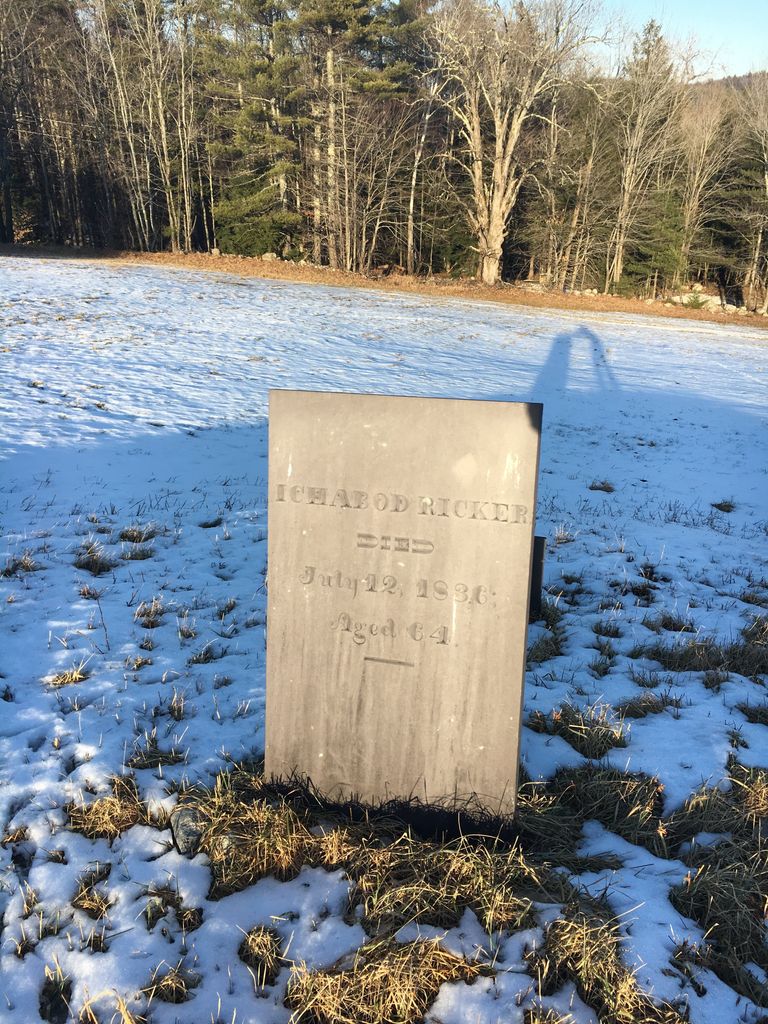
| Description | : | From its intersection with Old County Road, drive east on Dugway Road 0.4 miles. Up on the hill in a pasture to the right (southwest) side of the road is a single gravestone (and footstone) for early settler Ichabod Ricker. It is currently on land owned by the Blake family. It is probable that Ichabod’s 1st wife Sally (Knight) Ricker (1772-1824), their son Timothy (1802-1814) and his second wife Lucy (Martin) Ricker are buried here too. Also probable are son Bradford W. Ricker’s first wife Lucy (Wilson) Ricker (1785-1841) and their daughter Sarah (1827-1828). In the Earle Chamberlain notes... Read More |
frequently asked questions (FAQ):
-
Where is Ricker Cemetery?
Ricker Cemetery is located at Brownfield, Oxford County ,Maine ,USA.
-
Ricker Cemetery cemetery's updated grave count on graveviews.com?
0 memorials
-
Where are the coordinates of the Ricker Cemetery?
Latitude: 43.9061540
Longitude: -70.9425500
Nearby Cemetories:
1. Blake Cemetery
Brownfield, Oxford County, USA
Coordinate: 43.9063988, -70.9514008
2. Quint Cemetery
Brownfield, Oxford County, USA
Coordinate: 43.8984700, -70.9408400
3. Brown-Johnson Cemetery
Brownfield, Oxford County, USA
Coordinate: 43.9163710, -70.9617450
4. Binford Cemetery
Brownfield, Oxford County, USA
Coordinate: 43.8936250, -70.9597380
5. Johnson Cemetery
Brownfield, Oxford County, USA
Coordinate: 43.8880600, -70.9355600
6. Nathaniel Hill Cemetery
Brownfield, Oxford County, USA
Coordinate: 43.8926100, -70.9615000
7. Merrill Cemetery
Brownfield, Oxford County, USA
Coordinate: 43.9284000, -70.9423100
8. Isaac Johnson Cemetery
Brownfield, Oxford County, USA
Coordinate: 43.9321500, -70.9356200
9. Cole Cemetery
Brownfield, Oxford County, USA
Coordinate: 43.8956000, -70.9768700
10. Greenlaw Cemetery
Brownfield, Oxford County, USA
Coordinate: 43.9263992, -70.9677963
11. Wentworth-Brown Cemetery
Brownfield, Oxford County, USA
Coordinate: 43.9317200, -70.9555100
12. Walker-Rounds Cemetery
Brownfield, Oxford County, USA
Coordinate: 43.8909100, -70.9765200
13. Sargent-Rounds Cemetery
Porter, Oxford County, USA
Coordinate: 43.8794200, -70.9224200
14. Joseph Meserve Cemetery
Brownfield, Oxford County, USA
Coordinate: 43.9104300, -70.9854200
15. Edwin Hill Cemetery
Brownfield, Oxford County, USA
Coordinate: 43.9372900, -70.9454100
16. Day Farm Cemetery
Brownfield, Oxford County, USA
Coordinate: 43.8959200, -70.9005900
17. Stanley Cemetery
Porter, Oxford County, USA
Coordinate: 43.8761200, -70.9606900
18. McCartee Cemetery
Porter, Oxford County, USA
Coordinate: 43.8844430, -70.9770440
19. Linscott Cemetery
Brownfield, Oxford County, USA
Coordinate: 43.8984500, -70.9886100
20. Dyer Cemetery
Brownfield, Oxford County, USA
Coordinate: 43.8948700, -70.8974400
21. Porterfield Cemetery
Porterfield, Oxford County, USA
Coordinate: 43.8769700, -70.9130800
22. Cole Cemetery
Porterfield, Oxford County, USA
Coordinate: 43.8838600, -70.9017400
23. George Hart Cemetery
Eaton Center, Carroll County, USA
Coordinate: 43.9161600, -70.9950900
24. Stuart Cemetery
Brownfield, Oxford County, USA
Coordinate: 43.9031500, -70.8863500