
| Memorials | : | 8 |
| Location | : | Brownfield, Oxford County, USA |
| Coordinate | : | 43.8984700, -70.9408400 |
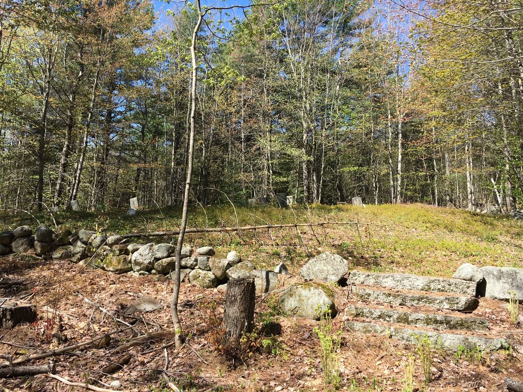
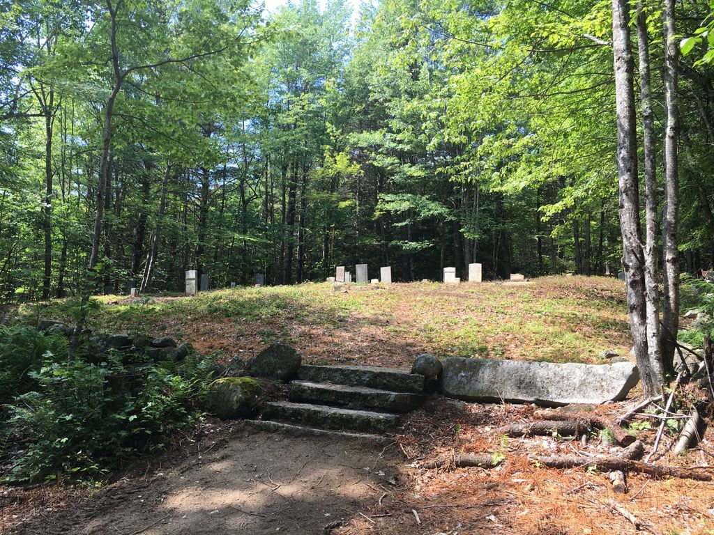
| Description | : | From its intersection with Dugway Road, drive south on Potato Hole Road 0.5 miles. (Note: This road is often not plowed in the winter.) The cemetery is about 100 feet to the right (west) on a hill surrounded by a stone wall. Many stones have fallen. |
frequently asked questions (FAQ):
-
Where is Quint Cemetery?
Quint Cemetery is located at Brownfield, Oxford County ,Maine ,USA.
-
Quint Cemetery cemetery's updated grave count on graveviews.com?
8 memorials
-
Where are the coordinates of the Quint Cemetery?
Latitude: 43.8984700
Longitude: -70.9408400
Nearby Cemetories:
1. Ricker Cemetery
Brownfield, Oxford County, USA
Coordinate: 43.9061540, -70.9425500
2. Blake Cemetery
Brownfield, Oxford County, USA
Coordinate: 43.9063988, -70.9514008
3. Johnson Cemetery
Brownfield, Oxford County, USA
Coordinate: 43.8880600, -70.9355600
4. Binford Cemetery
Brownfield, Oxford County, USA
Coordinate: 43.8936250, -70.9597380
5. Nathaniel Hill Cemetery
Brownfield, Oxford County, USA
Coordinate: 43.8926100, -70.9615000
6. Sargent-Rounds Cemetery
Porter, Oxford County, USA
Coordinate: 43.8794200, -70.9224200
7. Brown-Johnson Cemetery
Brownfield, Oxford County, USA
Coordinate: 43.9163710, -70.9617450
8. Cole Cemetery
Brownfield, Oxford County, USA
Coordinate: 43.8956000, -70.9768700
9. Stanley Cemetery
Porter, Oxford County, USA
Coordinate: 43.8761200, -70.9606900
10. Walker-Rounds Cemetery
Brownfield, Oxford County, USA
Coordinate: 43.8909100, -70.9765200
11. Day Farm Cemetery
Brownfield, Oxford County, USA
Coordinate: 43.8959200, -70.9005900
12. Porterfield Cemetery
Porterfield, Oxford County, USA
Coordinate: 43.8769700, -70.9130800
13. McCartee Cemetery
Porter, Oxford County, USA
Coordinate: 43.8844430, -70.9770440
14. Merrill Cemetery
Brownfield, Oxford County, USA
Coordinate: 43.9284000, -70.9423100
15. Dyer Cemetery
Brownfield, Oxford County, USA
Coordinate: 43.8948700, -70.8974400
16. Cole Cemetery
Porterfield, Oxford County, USA
Coordinate: 43.8838600, -70.9017400
17. Isaac Johnson Cemetery
Brownfield, Oxford County, USA
Coordinate: 43.9321500, -70.9356200
18. Greenlaw Cemetery
Brownfield, Oxford County, USA
Coordinate: 43.9263992, -70.9677963
19. Joseph Meserve Cemetery
Brownfield, Oxford County, USA
Coordinate: 43.9104300, -70.9854200
20. Linscott Cemetery
Brownfield, Oxford County, USA
Coordinate: 43.8984500, -70.9886100
21. Wentworth-Brown Cemetery
Brownfield, Oxford County, USA
Coordinate: 43.9317200, -70.9555100
22. Floyd-Pearl Cemetery
Porter, Oxford County, USA
Coordinate: 43.8627500, -70.9427500
23. Durgin-Walker Cemetery
Porter, Oxford County, USA
Coordinate: 43.8671600, -70.9117400
24. Edwin Hill Cemetery
Brownfield, Oxford County, USA
Coordinate: 43.9372900, -70.9454100