
| Memorials | : | 0 |
| Location | : | Eastbourne, Eastbourne Borough, England |
| Coordinate | : | 50.8039818, 0.3108360 |
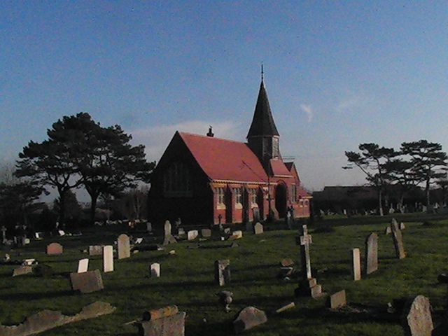
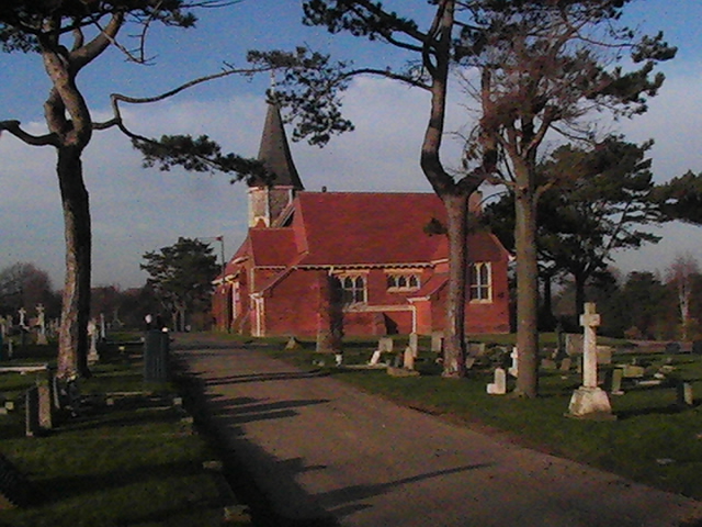
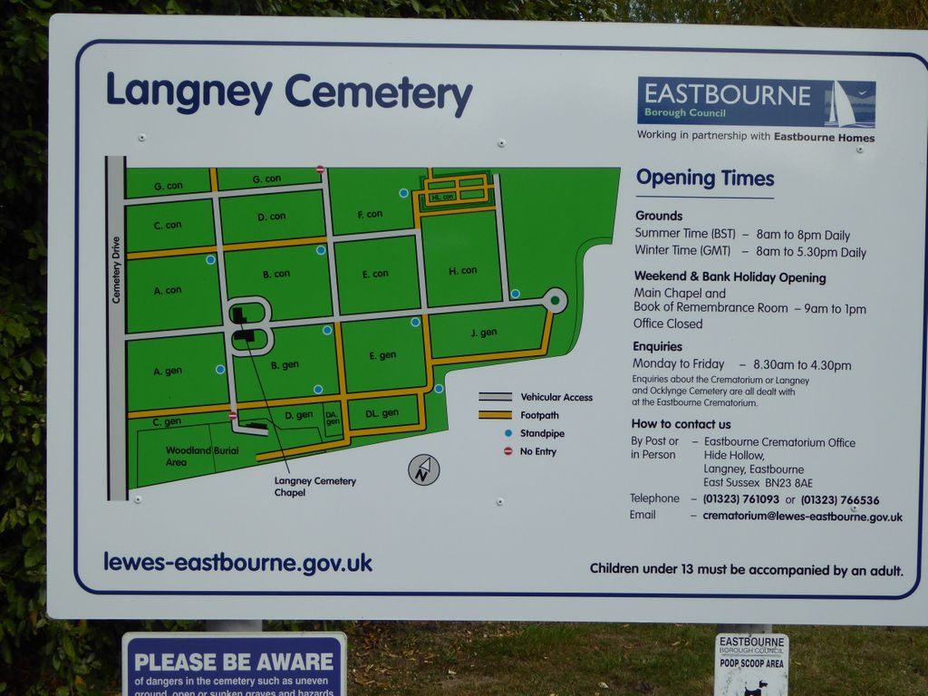
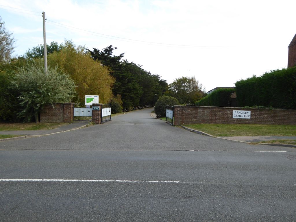
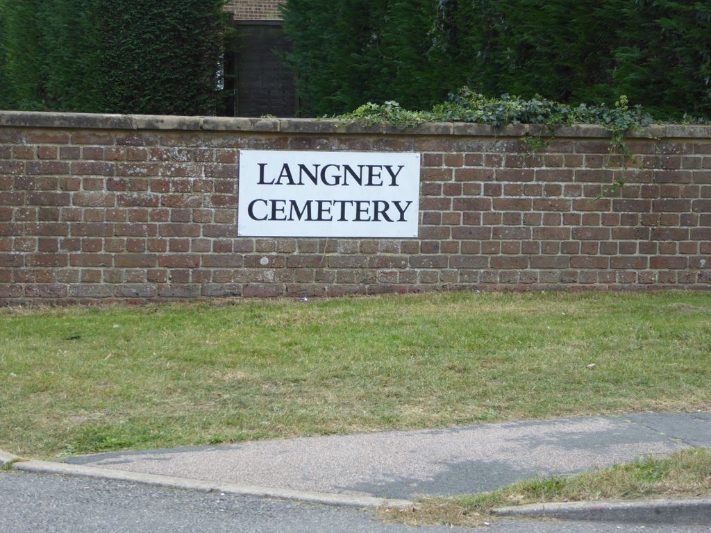
| Description | : | Eastbourne/Langney Cemetery is situated directly behind the Crematorium complex in the Langney area four miles east of Eastbourne town centre. The cemetery chapel is currently closed but services can be held at the nearby crematorium chapel. Within Langney Cemetery is a woodland burial section. This section provides an area for alternative 'green' burial in cardboard coffins, set amongst a selection of native trees and a wildflower meadow. All cemetery records, dating back to 1857, are held at the Bereavement Services offices, which are located nearby at the crematorium. Added by Wertypop |
frequently asked questions (FAQ):
-
Where is Eastbourne Cemetery?
Eastbourne Cemetery is located at Willingdon Road Eastbourne, Eastbourne Borough ,East Sussex , BN23 8AEEngland.
-
Eastbourne Cemetery cemetery's updated grave count on graveviews.com?
0 memorials
-
Where are the coordinates of the Eastbourne Cemetery?
Latitude: 50.8039818
Longitude: 0.3108360
Nearby Cemetories:
1. Eastbourne Crematorium
Eastbourne, Eastbourne Borough, England
Coordinate: 50.8058380, 0.3096420
2. St Mary the Virgin Churchyard
Westham, Wealden District, England
Coordinate: 50.8175410, 0.3292470
3. St Nicholas Churchyard
Pevensey, Wealden District, England
Coordinate: 50.8196250, 0.3367080
4. St. Mary the Virgin Churchyard
Willingdon, Wealden District, England
Coordinate: 50.7997920, 0.2540160
5. Ocklynge Cemetery
Eastbourne, Eastbourne Borough, England
Coordinate: 50.7777410, 0.2649480
6. Willingdon Cemetery
Willingdon, Wealden District, England
Coordinate: 50.8053310, 0.2438660
7. St. Mary's Churchyard
Eastbourne, Eastbourne Borough, England
Coordinate: 50.7726060, 0.2658280
8. St. Margaret's Churchyard
Ditchling, Lewes District, England
Coordinate: 50.8376010, 0.2513120
9. St. Mary Magdalene Churchyard
Wartling, Wealden District, England
Coordinate: 50.8581820, 0.3539830
10. Hailsham Cemetery
Hailsham, Wealden District, England
Coordinate: 50.8537230, 0.2527740
11. St. Andrew's Churchyard
Jevington, Wealden District, England
Coordinate: 50.7920880, 0.2139540
12. St Peter ad Vincula Churchyard
Folkington, Wealden District, England
Coordinate: 50.8127860, 0.2120120
13. Hailsham Baptist Church
Hailsham, Wealden District, England
Coordinate: 50.8608520, 0.2616600
14. All Saints Churchyard
Herstmonceux, Wealden District, England
Coordinate: 50.8678627, 0.3330980
15. St Mary Churchyard
Hailsham, Wealden District, England
Coordinate: 50.8630880, 0.2604170
16. St Oswald Churchyard
Hooe, Wealden District, England
Coordinate: 50.8575970, 0.3895850
17. St. Oswald Anglican Churchyard
Hooe, Wealden District, England
Coordinate: 50.8576960, 0.3899300
18. St. Mary and St. Peter Churchyard
Wilmington, Wealden District, England
Coordinate: 50.8175070, 0.1906410
19. SS Simon & Jude Churchyard
East Dean, Wealden District, England
Coordinate: 50.7580020, 0.2066160
20. East Dean War Memorial
East Dean, Wealden District, England
Coordinate: 50.7589580, 0.2054890
21. St Mary the Virgin Churchyard
Friston, Wealden District, England
Coordinate: 50.7624340, 0.1988280
22. Herstmonceux Free Church
Herstmonceux, Wealden District, England
Coordinate: 50.8855160, 0.3278300
23. St Pancras Churchyard
Arlington, Wealden District, England
Coordinate: 50.8461030, 0.1902540
24. St. Mark's Churchyard
Bexhill-on-Sea, Rother District, England
Coordinate: 50.8456760, 0.4372000