
| Memorials | : | 0 |
| Location | : | Hooe, Wealden District, England |
| Coordinate | : | 50.8576960, 0.3899300 |
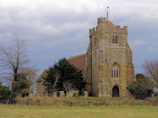
| Description | : | The Church can only be accessed by a footpath and a narrow farm track called Church Lane. |
frequently asked questions (FAQ):
-
Where is St. Oswald Anglican Churchyard?
St. Oswald Anglican Churchyard is located at Church Lane Hooe, Wealden District ,East Sussex ,England.
-
St. Oswald Anglican Churchyard cemetery's updated grave count on graveviews.com?
0 memorials
-
Where are the coordinates of the St. Oswald Anglican Churchyard?
Latitude: 50.8576960
Longitude: 0.3899300
Nearby Cemetories:
1. St Oswald Churchyard
Hooe, Wealden District, England
Coordinate: 50.8575970, 0.3895850
2. St. Mary Magdalene Churchyard
Wartling, Wealden District, England
Coordinate: 50.8581820, 0.3539830
3. St. Mark's Churchyard
Bexhill-on-Sea, Rother District, England
Coordinate: 50.8456760, 0.4372000
4. St. Mary the Virgin Churchyard
Ninfield, Wealden District, England
Coordinate: 50.8848760, 0.4224590
5. All Saints Churchyard
Herstmonceux, Wealden District, England
Coordinate: 50.8678627, 0.3330980
6. Bexhill Cemetery
Bexhill-on-Sea, Rother District, England
Coordinate: 50.8587980, 0.4517460
7. Herstmonceux Free Church
Herstmonceux, Wealden District, England
Coordinate: 50.8855160, 0.3278300
8. St. Peter's Churchyard
Ashburnham, Rother District, England
Coordinate: 50.9056730, 0.4014650
9. St Nicholas Churchyard
Pevensey, Wealden District, England
Coordinate: 50.8196250, 0.3367080
10. St. John the Evangelist Churchyard
Bodle Street Green, Wealden District, England
Coordinate: 50.9041214, 0.3465680
11. St. Laurence Churchyard
Catsfield, Rother District, England
Coordinate: 50.8938230, 0.4563190
12. St Mary the Virgin Churchyard
Westham, Wealden District, England
Coordinate: 50.8175410, 0.3292470
13. St. Peter's Churchyard
Bexhill-on-Sea, Rother District, England
Coordinate: 50.8460530, 0.4787950
14. Ebenezer Baptist Chapel
Bodle Street Green, Wealden District, England
Coordinate: 50.9102250, 0.3438700
15. St Michael the Archangel Churchyard
Penhurst, Rother District, England
Coordinate: 50.9235920, 0.4092830
16. Crowhurst Churchyard
Crowhurst, Rother District, England
Coordinate: 50.8838070, 0.4968630
17. Eastbourne Crematorium
Eastbourne, Eastbourne Borough, England
Coordinate: 50.8058380, 0.3096420
18. Eastbourne Cemetery
Eastbourne, Eastbourne Borough, England
Coordinate: 50.8039818, 0.3108360
19. Hailsham Baptist Church
Hailsham, Wealden District, England
Coordinate: 50.8608520, 0.2616600
20. St Mary Churchyard
Hailsham, Wealden District, England
Coordinate: 50.8630880, 0.2604170
21. Battle Abbey
Battle, Rother District, England
Coordinate: 50.9144940, 0.4875140
22. St Mary the Virgin Churchyard
Battle, Rother District, England
Coordinate: 50.9150690, 0.4883620
23. Hailsham Cemetery
Hailsham, Wealden District, England
Coordinate: 50.8537230, 0.2527740
24. Battle Cemetery
Battle, Rother District, England
Coordinate: 50.9155800, 0.4935500