
| Memorials | : | 0 |
| Location | : | Herstmonceux, Wealden District, England |
| Coordinate | : | 50.8855160, 0.3278300 |
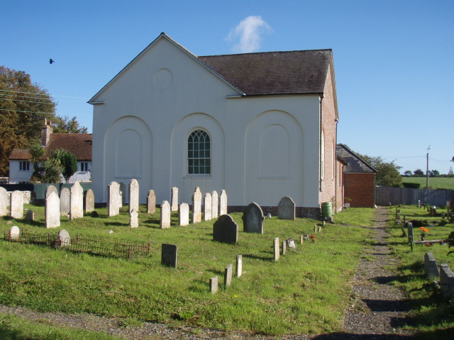
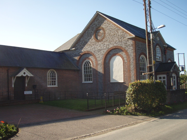
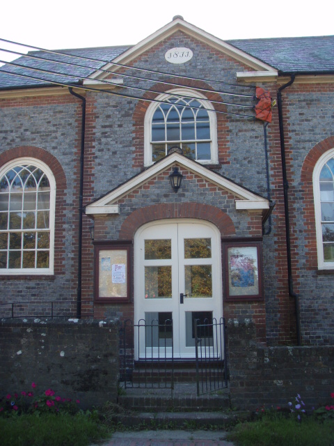
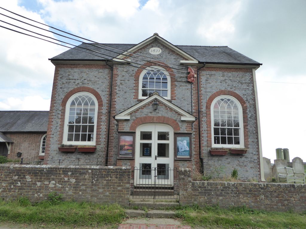
| Description | : | Herstmonceux Congregational Church, located just outside the village on the way to the castle, was erected in 1811 and is now a listed building. |
frequently asked questions (FAQ):
-
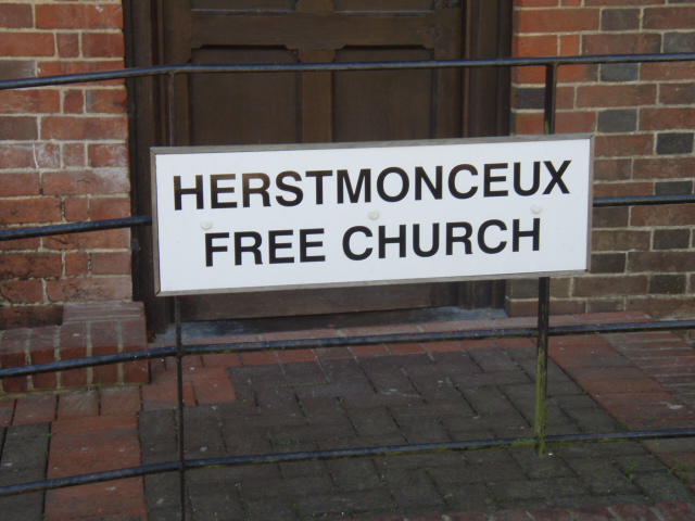
Where is Herstmonceux Free Church?
Herstmonceux Free Church is located at Chapel Row Herstmonceux, Wealden District ,East Sussex , BN27 1REEngland.
-
Herstmonceux Free Church cemetery's updated grave count on graveviews.com?
0 memorials
-
Where are the coordinates of the Herstmonceux Free Church?
Latitude: 50.8855160
Longitude: 0.3278300
Nearby Cemetories:
1. All Saints Churchyard
Herstmonceux, Wealden District, England
Coordinate: 50.8678627, 0.3330980
2. St. John the Evangelist Churchyard
Bodle Street Green, Wealden District, England
Coordinate: 50.9041214, 0.3465680
3. Ebenezer Baptist Chapel
Bodle Street Green, Wealden District, England
Coordinate: 50.9102250, 0.3438700
4. St. Mary Magdalene Churchyard
Wartling, Wealden District, England
Coordinate: 50.8581820, 0.3539830
5. St Oswald Churchyard
Hooe, Wealden District, England
Coordinate: 50.8575970, 0.3895850
6. St. Oswald Anglican Churchyard
Hooe, Wealden District, England
Coordinate: 50.8576960, 0.3899300
7. St Mary Churchyard
Hailsham, Wealden District, England
Coordinate: 50.8630880, 0.2604170
8. Hailsham Baptist Church
Hailsham, Wealden District, England
Coordinate: 50.8608520, 0.2616600
9. St. Peter's Churchyard
Ashburnham, Rother District, England
Coordinate: 50.9056730, 0.4014650
10. St. Peter and St. Paul Churchyard
Hellingly, Wealden District, England
Coordinate: 50.8885260, 0.2460540
11. Hellingly Cemetery
Hellingly, Wealden District, England
Coordinate: 50.8852690, 0.2415280
12. Hailsham Cemetery
Hailsham, Wealden District, England
Coordinate: 50.8537230, 0.2527740
13. St. Mary the Virgin Churchyard
Ninfield, Wealden District, England
Coordinate: 50.8848760, 0.4224590
14. St. Mary the Virgin Churchyard
Warbleton, Wealden District, England
Coordinate: 50.9407250, 0.2885880
15. St Michael the Archangel Churchyard
Penhurst, Rother District, England
Coordinate: 50.9235920, 0.4092830
16. Zoar Baptist Chapel
Lower Dicker, Wealden District, England
Coordinate: 50.8788990, 0.2268400
17. St. Giles' Churchyard
Dallington, Rother District, England
Coordinate: 50.9470960, 0.3585090
18. St Nicholas Churchyard
Pevensey, Wealden District, England
Coordinate: 50.8196250, 0.3367080
19. St Mary the Virgin Churchyard
Westham, Wealden District, England
Coordinate: 50.8175410, 0.3292470
20. St. Margaret's Churchyard
Ditchling, Lewes District, England
Coordinate: 50.8376010, 0.2513120
21. Punnett's Town Chapel Cemetery
Heathfield, Wealden District, England
Coordinate: 50.9617720, 0.2979720
22. St. Mark's Churchyard
Bexhill-on-Sea, Rother District, England
Coordinate: 50.8456760, 0.4372000
23. Holy Trinity Churchyard
Upper Dicker, Wealden District, England
Coordinate: 50.8669500, 0.2040591
24. Eastbourne Crematorium
Eastbourne, Eastbourne Borough, England
Coordinate: 50.8058380, 0.3096420