
| Memorials | : | 0 |
| Location | : | Kyre, Malvern Hills District, England |
| Coordinate | : | 52.2685140, -2.5488360 |
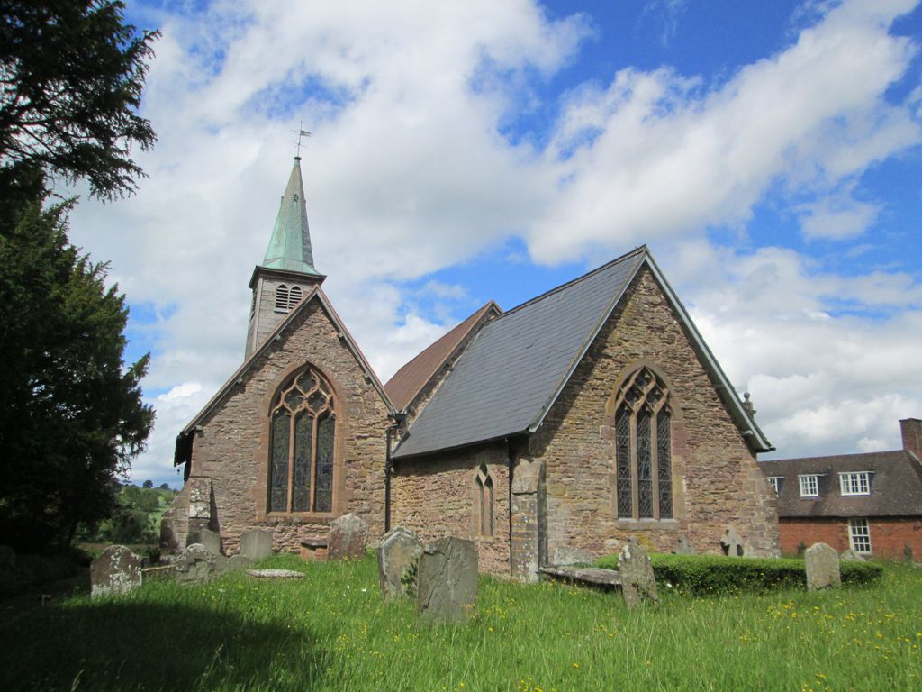
| Description | : | The small rural church of St Mary's is adjacent to Kyre Park House and has an unusual passageway connecting it to the house. The church, which is essentially Norman, is constructed in sandstone with the roof part tile and part slate. The main 12th Century body has a nave and chancel and it retains many of its original features. A Lady Chapel was built on during the 14th Century, and during the 18th Century, a wooden bell tower and spire was added. |
frequently asked questions (FAQ):
-
Where is St Marys Churchyard?
St Marys Churchyard is located at Kyre Park Kyre, Malvern Hills District ,Worcestershire , WR15 8RWEngland.
-
St Marys Churchyard cemetery's updated grave count on graveviews.com?
0 memorials
-
Where are the coordinates of the St Marys Churchyard?
Latitude: 52.2685140
Longitude: -2.5488360
Nearby Cemetories:
1. St. Peter's Churchyard
Stoke Bliss, Malvern Hills District, England
Coordinate: 52.2627200, -2.5121300
2. St Michael and All Angels Churchyard
Tenbury Wells, Malvern Hills District, England
Coordinate: 52.2882600, -2.6137900
3. St Michael and All Angels Churchyard
Rochford, Malvern Hills District, England
Coordinate: 52.3134240, -2.5454090
4. St Michael's Churchyard Extension
Tenbury Wells, Malvern Hills District, England
Coordinate: 52.2941032, -2.6183906
5. St. Mary's Churchyard
Tenbury Wells, Malvern Hills District, England
Coordinate: 52.3120500, -2.5962400
6. St Peter & St Paul Churchyard
Eastham, Malvern Hills District, England
Coordinate: 52.3156100, -2.5046000
7. St. Mary's Church at Edvin Loach Old Church
Bromyard, Herefordshire Unitary Authority, England
Coordinate: 52.2230907, -2.4953840
8. St Mary's Churchyard
Burford, Shropshire Unitary Authority, England
Coordinate: 52.3087670, -2.6126000
9. Edwyn Ralph Churchyard
Bromyard, Herefordshire Unitary Authority, England
Coordinate: 52.2145540, -2.5207470
10. St Michael & All Angels Churchyard
Knighton-on-Teme, Malvern Hills District, England
Coordinate: 52.3260900, -2.5393500
11. St Bartholomew's Church
Lower Sapey, Malvern Hills District, England
Coordinate: 52.2484400, -2.4599300
12. St Lawrence Churchyard
Lindridge, Malvern Hills District, England
Coordinate: 52.3180700, -2.4779300
13. St. Mary's Churchyard
Stanford-on-Teme, Malvern Hills District, England
Coordinate: 52.2887100, -2.4379200
14. St. Mary Magdalene Churchyard
Little Hereford, Herefordshire Unitary Authority, England
Coordinate: 52.3112129, -2.6572039
15. St Kenelms Churchyard
Clifton upon Teme, Malvern Hills District, England
Coordinate: 52.2519700, -2.4189900
16. St. Andrew's Churchyard
Shelsley Walsh, Malvern Hills District, England
Coordinate: 52.2641700, -2.4093500
17. St John the Baptist Churchyard
Mamble, Malvern Hills District, England
Coordinate: 52.3416520, -2.4586520
18. St. James the Less Churchyard
Kimbolton, Herefordshire Unitary Authority, England
Coordinate: 52.2507757, -2.6957349
19. All Saints Churchyard
Shelsley Beauchamp, Malvern Hills District, England
Coordinate: 52.2632200, -2.3953800
20. All Saints Churchyard Extension
Shelsley Beauchamp, Malvern Hills District, England
Coordinate: 52.2634662, -2.3949512
21. St. Peter's Churchyard
Coreley, Shropshire Unitary Authority, England
Coordinate: 52.3627780, -2.5694950
22. Saint James The Great Churchyard
Pensax, Malvern Hills District, England
Coordinate: 52.3181420, -2.4075720
23. St Bartholomews Churchyard
Bayton, Malvern Hills District, England
Coordinate: 52.3562100, -2.4548200
24. St. Mary's Churchyard
Caynham, Shropshire Unitary Authority, England
Coordinate: 52.3558260, -2.6564540