
| Memorials | : | 0 |
| Location | : | Dudleytown, Jackson County, USA |
| Phone | : | (812) 523-8234 |
| Coordinate | : | 38.8487167, -85.9010773 |
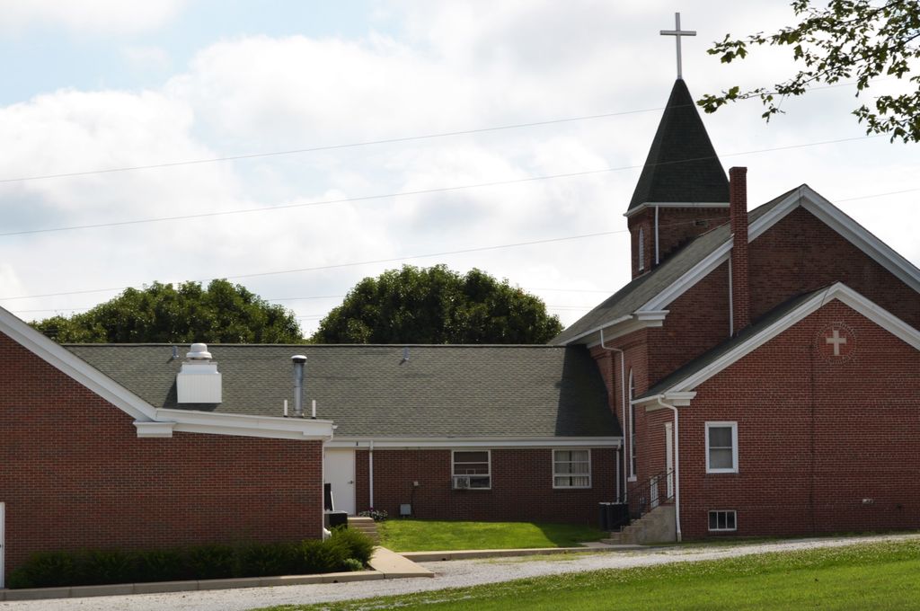
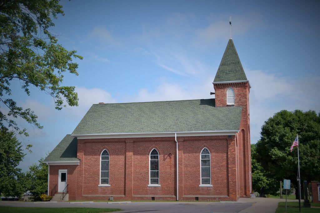
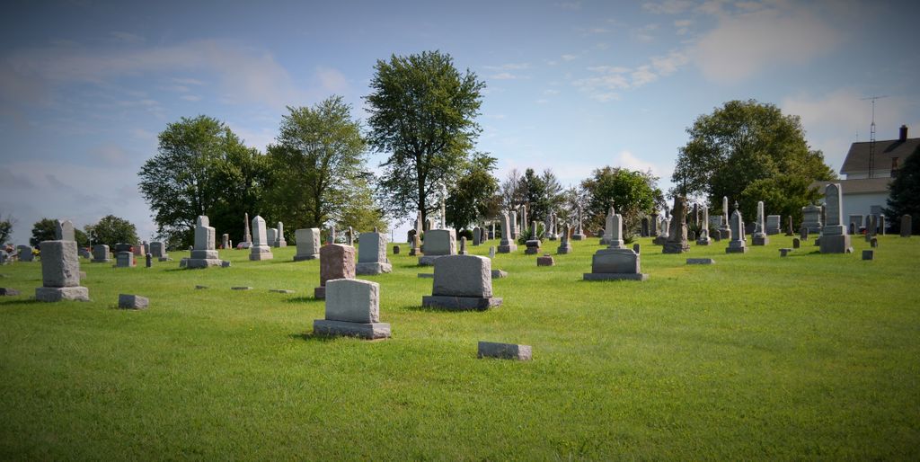
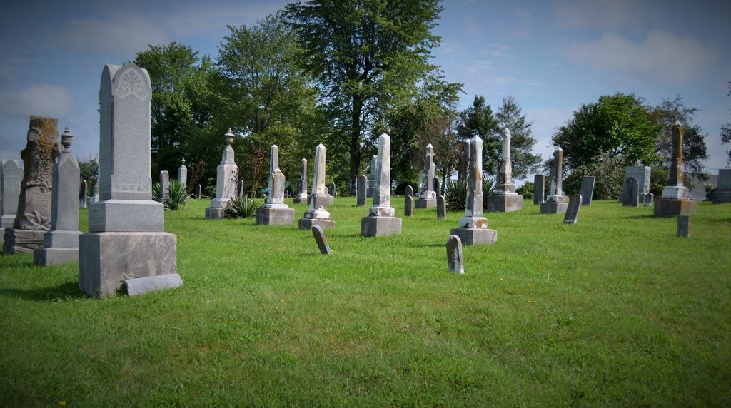
| Description | : | The cemetery is located in Washington Township behind the Emanuel Lutheran Church on the west side of S County Road 750 E about 0.2 miles south of its intersection with Indiana State Highway 250. Indiana Cemetery Locations, Volume 4, published by the Indiana Genealogical Society (April 2009), gives the primary cemetery name as Emanuel Cemetery with an alternate name of Dudleytown Cemetery. The cemetery is listed in the Cemetery and Burial Grounds Registry of the Indiana Department of Natural Resources (DNR) and in the State Historical Architectural and Archaeological Research Database (SHAARD) with Cemetery Record Number CR-36-208 (Emmanuel... Read More |
frequently asked questions (FAQ):
-
Where is Emanuel Lutheran Cemetery?
Emanuel Lutheran Cemetery is located at 2174 S County Road 750 E Dudleytown, Jackson County ,Indiana , 47274USA.
-
Emanuel Lutheran Cemetery cemetery's updated grave count on graveviews.com?
0 memorials
-
Where are the coordinates of the Emanuel Lutheran Cemetery?
Latitude: 38.8487167
Longitude: -85.9010773
Nearby Cemetories:
1. Collings Cemetery
Dudleytown, Jackson County, USA
Coordinate: 38.8264885, -85.9044418
2. Mount Pleasant Cemetery
Tampico, Jackson County, USA
Coordinate: 38.8143997, -85.9119034
3. Chestnut Ridge Cemetery
Dudleytown, Jackson County, USA
Coordinate: 38.8843994, -85.8855972
4. Blair-Johnson Family Cemetery
Jackson County, USA
Coordinate: 38.8099400, -85.9218370
5. Saint Johns Lutheran Church Cemetery
Seymour, Jackson County, USA
Coordinate: 38.8650169, -85.9523087
6. Bedel Cemetery
Uniontown, Jackson County, USA
Coordinate: 38.8652830, -85.8375390
7. Johnson-King Cemetery
Uniontown, Jackson County, USA
Coordinate: 38.8581490, -85.8320830
8. Spall Cemetery
Uniontown, Jackson County, USA
Coordinate: 38.8638590, -85.8319600
9. Moore Cemetery
Jackson County, USA
Coordinate: 38.9058849, -85.8800927
10. Grassy Cemetery
Crothersville, Jackson County, USA
Coordinate: 38.8223400, -85.8318300
11. Uniontown Cemetery
Uniontown, Jackson County, USA
Coordinate: 38.8418200, -85.8232800
12. New Hope Cemetery
Uniontown, Jackson County, USA
Coordinate: 38.8597480, -85.8202990
13. Crothersville Cemetery
Crothersville, Jackson County, USA
Coordinate: 38.7943700, -85.8529000
14. Marling Cemetery
Uniontown, Jackson County, USA
Coordinate: 38.8708440, -85.8193810
15. Stewart Cemetery
Uniontown, Jackson County, USA
Coordinate: 38.8377610, -85.8135680
16. Lubker Cemetery
Jackson County, USA
Coordinate: 38.8231010, -85.9839020
17. Rucker Cemetery
Grassy Fork Township, Jackson County, USA
Coordinate: 38.8119011, -85.9768982
18. Drier Cemetery
Wegan, Jackson County, USA
Coordinate: 38.8489930, -85.9918040
19. First German Reformed Cemetery
Crothersville, Jackson County, USA
Coordinate: 38.7935880, -85.8421700
20. Friends Cemetery
New Farmington, Jackson County, USA
Coordinate: 38.9250980, -85.8783220
21. Russell Chapel Cemetery
Tampico, Jackson County, USA
Coordinate: 38.7783012, -85.9468994
22. Barkman Cemetery
Kriete Corner, Jackson County, USA
Coordinate: 38.8998800, -85.8219700
23. Gardner-Cox Cemetery
Rockford, Jackson County, USA
Coordinate: 38.9233017, -85.8630981
24. Gorrell Cemetery
Crothersville, Jackson County, USA
Coordinate: 38.8031006, -85.8143997