
| Memorials | : | 0 |
| Location | : | Crothersville, Jackson County, USA |
| Coordinate | : | 38.8223400, -85.8318300 |
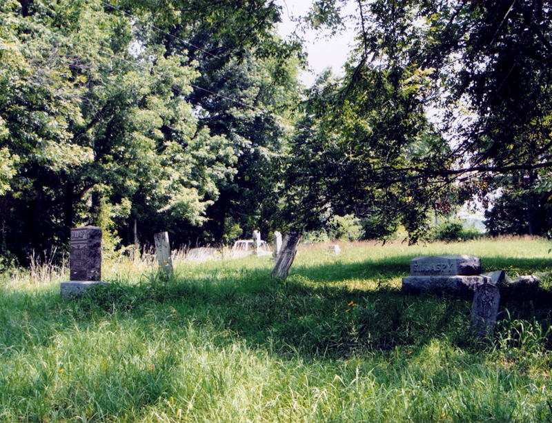
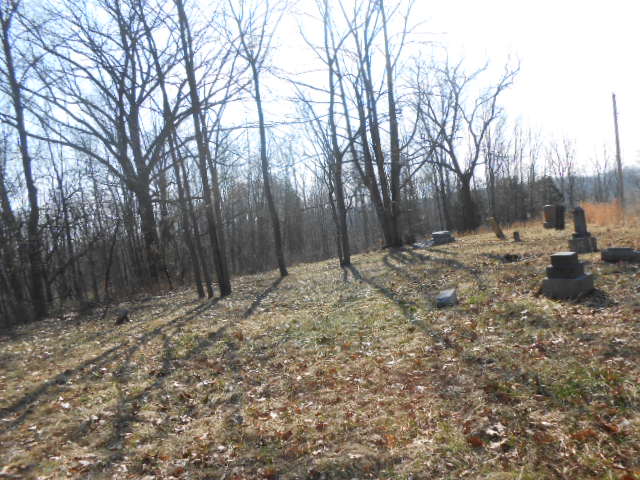
| Description | : | The cemetery is located in Vernon Township on the south side of E County Road 400 S about 0.3 miles east of its intersection with US 31. Indiana Cemetery Locations, Volume 4, published by the Indiana Genealogical Society (April 2009), gives the primary cemetery name as Grassy Cemetery. The cemetery is listed in the Cemetery and Burial Grounds Registry of the Indiana Department of Natural Resources (DNR) and in the State Historical Architectural and Archaeological Research Database (SHAARD) with Cemetery Record Number CR-36-194 (Grassy). The U.S. Geological Survey (USGS) Geographic Names Information System (GNIS) feature ID for the... Read More |
frequently asked questions (FAQ):
-
Where is Grassy Cemetery?
Grassy Cemetery is located at E County Road 400 S Crothersville, Jackson County ,Indiana , 47229USA.
-
Grassy Cemetery cemetery's updated grave count on graveviews.com?
0 memorials
-
Where are the coordinates of the Grassy Cemetery?
Latitude: 38.8223400
Longitude: -85.8318300
Nearby Cemetories:
1. Uniontown Cemetery
Uniontown, Jackson County, USA
Coordinate: 38.8418200, -85.8232800
2. Stewart Cemetery
Uniontown, Jackson County, USA
Coordinate: 38.8377610, -85.8135680
3. Gorrell Cemetery
Crothersville, Jackson County, USA
Coordinate: 38.8031006, -85.8143997
4. First German Reformed Cemetery
Crothersville, Jackson County, USA
Coordinate: 38.7935880, -85.8421700
5. Montgomery Family Cemetery
Jennings County, USA
Coordinate: 38.8136030, -85.7921870
6. Crothersville Cemetery
Crothersville, Jackson County, USA
Coordinate: 38.7943700, -85.8529000
7. Johnson-King Cemetery
Uniontown, Jackson County, USA
Coordinate: 38.8581490, -85.8320830
8. Pierson Family Cemetery
Pleasantville, Jackson County, USA
Coordinate: 38.7907970, -85.8073740
9. Coryell Cemetery
Vernon Township, Jennings County, USA
Coordinate: 38.8421500, -85.7918100
10. Francis Coryell Family Cemetery
Jennings County, USA
Coordinate: 38.8422000, -85.7918000
11. New Hope Cemetery
Uniontown, Jackson County, USA
Coordinate: 38.8597480, -85.8202990
12. Spall Cemetery
Uniontown, Jackson County, USA
Coordinate: 38.8638590, -85.8319600
13. Bedel Cemetery
Uniontown, Jackson County, USA
Coordinate: 38.8652830, -85.8375390
14. Cana Cemetery
Paris Crossing, Jennings County, USA
Coordinate: 38.8409271, -85.7759628
15. Marling Cemetery
Uniontown, Jackson County, USA
Coordinate: 38.8708440, -85.8193810
16. Collings Cemetery
Dudleytown, Jackson County, USA
Coordinate: 38.8264885, -85.9044418
17. Harrod Cemetery
Austin, Scott County, USA
Coordinate: 38.7793999, -85.7825012
18. Emanuel Lutheran Cemetery
Dudleytown, Jackson County, USA
Coordinate: 38.8487167, -85.9010773
19. Bethany Baptist Church Cemetery
Crothersville, Jackson County, USA
Coordinate: 38.7643204, -85.8592834
20. Mount Pleasant Cemetery
Tampico, Jackson County, USA
Coordinate: 38.8143997, -85.9119034
21. Campbell Cemetery
Austin, Scott County, USA
Coordinate: 38.7833366, -85.7586365
22. Wesley Chapel Cemetery
Austin, Scott County, USA
Coordinate: 38.7828255, -85.7565079
23. Blair-Johnson Family Cemetery
Jackson County, USA
Coordinate: 38.8099400, -85.9218370
24. First Marion Baptist Church Cemetery
Commiskey, Jennings County, USA
Coordinate: 38.8607903, -85.7542953