
| Memorials | : | 0 |
| Location | : | Uniontown, Jackson County, USA |
| Coordinate | : | 38.8581490, -85.8320830 |
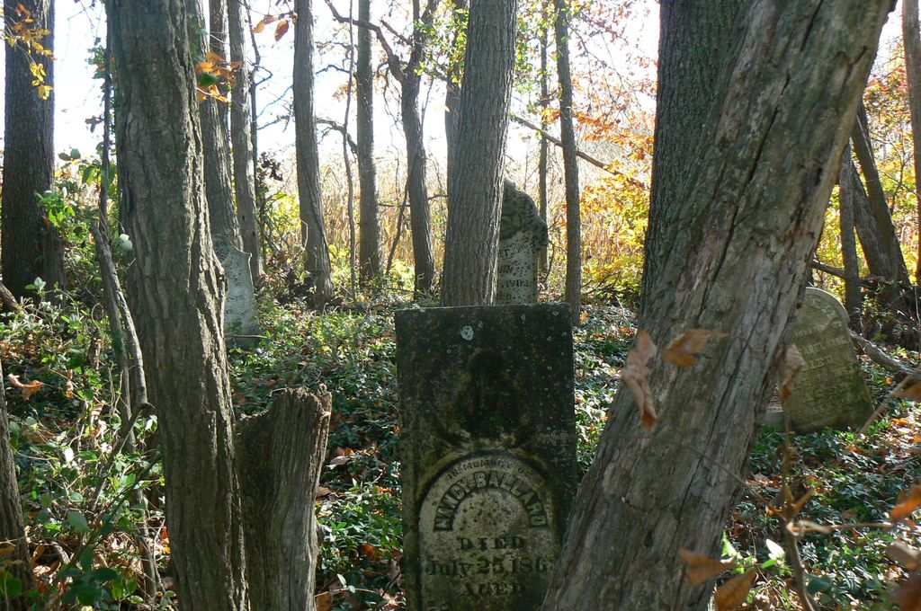
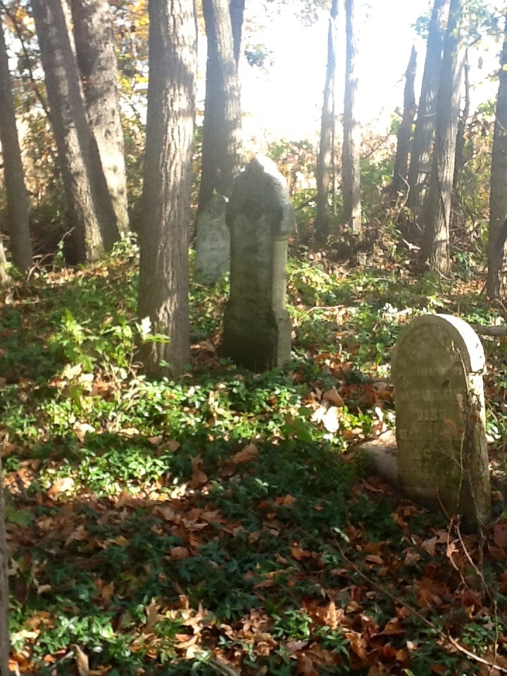
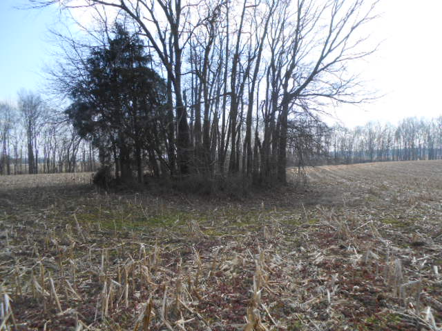
| Description | : | The cemetery is located in Vernon Township (Section 22 Township 5N Range 6E) about 500 feet south of E County Road 150 S at the point the road turns north and becomes S County Road 100 E. Indiana Cemetery Locations, Volume 4, published by the Indiana Genealogical Society (April 2009), gives the primary cemetery name as Johnson Cemetery with an alternate name of King Cemetery. The cemetery is listed in the Cemetery and Burial Grounds Registry of the Indiana Department of Natural Resources (DNR) and in the State Historical Architectural and Archaeological Research Database (SHAARD) with Cemetery Record... Read More |
frequently asked questions (FAQ):
-
Where is Johnson-King Cemetery?
Johnson-King Cemetery is located at E County Road 150 S Uniontown, Jackson County ,Indiana , 47274USA.
-
Johnson-King Cemetery cemetery's updated grave count on graveviews.com?
0 memorials
-
Where are the coordinates of the Johnson-King Cemetery?
Latitude: 38.8581490
Longitude: -85.8320830
Nearby Cemetories:
1. Spall Cemetery
Uniontown, Jackson County, USA
Coordinate: 38.8638590, -85.8319600
2. Bedel Cemetery
Uniontown, Jackson County, USA
Coordinate: 38.8652830, -85.8375390
3. New Hope Cemetery
Uniontown, Jackson County, USA
Coordinate: 38.8597480, -85.8202990
4. Marling Cemetery
Uniontown, Jackson County, USA
Coordinate: 38.8708440, -85.8193810
5. Uniontown Cemetery
Uniontown, Jackson County, USA
Coordinate: 38.8418200, -85.8232800
6. Stewart Cemetery
Uniontown, Jackson County, USA
Coordinate: 38.8377610, -85.8135680
7. Francis Coryell Family Cemetery
Jennings County, USA
Coordinate: 38.8422000, -85.7918000
8. Coryell Cemetery
Vernon Township, Jennings County, USA
Coordinate: 38.8421500, -85.7918100
9. Grassy Cemetery
Crothersville, Jackson County, USA
Coordinate: 38.8223400, -85.8318300
10. Barkman Cemetery
Kriete Corner, Jackson County, USA
Coordinate: 38.8998800, -85.8219700
11. Cana Cemetery
Paris Crossing, Jennings County, USA
Coordinate: 38.8409271, -85.7759628
12. Chestnut Ridge Cemetery
Dudleytown, Jackson County, USA
Coordinate: 38.8843994, -85.8855972
13. Montgomery Family Cemetery
Jennings County, USA
Coordinate: 38.8136030, -85.7921870
14. Emanuel Lutheran Cemetery
Dudleytown, Jackson County, USA
Coordinate: 38.8487167, -85.9010773
15. Gorrell Cemetery
Crothersville, Jackson County, USA
Coordinate: 38.8031006, -85.8143997
16. Myers Cemetery
Jennings County, USA
Coordinate: 38.9053001, -85.7838974
17. Moore Cemetery
Jackson County, USA
Coordinate: 38.9058849, -85.8800927
18. First Marion Baptist Church Cemetery
Commiskey, Jennings County, USA
Coordinate: 38.8607903, -85.7542953
19. Collings Cemetery
Dudleytown, Jackson County, USA
Coordinate: 38.8264885, -85.9044418
20. First German Reformed Cemetery
Crothersville, Jackson County, USA
Coordinate: 38.7935880, -85.8421700
21. Crothersville Cemetery
Crothersville, Jackson County, USA
Coordinate: 38.7943700, -85.8529000
22. Gardner-Cox Cemetery
Rockford, Jackson County, USA
Coordinate: 38.9233017, -85.8630981
23. Pierson Family Cemetery
Pleasantville, Jackson County, USA
Coordinate: 38.7907970, -85.8073740
24. Barkman Cemetery
Jennings County, USA
Coordinate: 38.9263140, -85.7947040