
| Memorials | : | 0 |
| Location | : | Knob Lick, Metcalfe County, USA |
| Coordinate | : | 37.0999670, -85.6700440 |
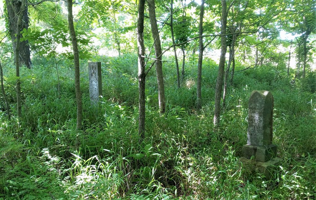
| Description | : | From Knob Lick go northeast on Highway 70 for 1.4 miles. Turn left on the Bill Poynter Road and go 0.9 mile. Turn left at a house and travel to the end of the road or 0.3 mile. The cemetery is on the farm in back of the North Metcalfe School. Thirteen marked graves; about fifteen unmarked. |
frequently asked questions (FAQ):
-
Where is Embree Cemetery?
Embree Cemetery is located at Bill Poynter Road (Kentucky State Highway 1408) Knob Lick, Metcalfe County ,Kentucky , 42129USA.
-
Embree Cemetery cemetery's updated grave count on graveviews.com?
0 memorials
-
Where are the coordinates of the Embree Cemetery?
Latitude: 37.0999670
Longitude: -85.6700440
Nearby Cemetories:
1. Kinser Grave
Knob Lick, Metcalfe County, USA
Coordinate: 37.0975130, -85.6680540
2. Douglas Cemetery
Knob Lick, Metcalfe County, USA
Coordinate: 37.0962070, -85.6755610
3. Edwards-McMurray Cemetery
Knob Lick, Metcalfe County, USA
Coordinate: 37.1038970, -85.6794380
4. Bailey-Bass Cemetery
Sulphur Well, Metcalfe County, USA
Coordinate: 37.0953210, -85.6610160
5. Royse Cemetery
Knob Lick, Metcalfe County, USA
Coordinate: 37.0953110, -85.6608680
6. Malone Cemetery
Sulphur Well, Metcalfe County, USA
Coordinate: 37.1058650, -85.6619580
7. Muriell Bailey Cemetery
Sulphur Well, Metcalfe County, USA
Coordinate: 37.0922990, -85.6592250
8. Scott Cemetery
Sulphur Well, Metcalfe County, USA
Coordinate: 37.1122340, -85.6772310
9. Spencer Cemetery
Knob Lick, Metcalfe County, USA
Coordinate: 37.0975430, -85.6868980
10. Chapman-Cox Cemetery
Sulphur Well, Metcalfe County, USA
Coordinate: 37.0850100, -85.6722260
11. Price Cemetery
Knob Lick, Metcalfe County, USA
Coordinate: 37.1150050, -85.6735980
12. Lee Cemetery
Sulphur Well, Metcalfe County, USA
Coordinate: 37.0834990, -85.6746260
13. Williams Cemetery
Sulphur Well, Metcalfe County, USA
Coordinate: 37.1087770, -85.6507440
14. Embree Cemetery
Knob Lick, Metcalfe County, USA
Coordinate: 37.0861380, -85.6841560
15. Huffman Cemetery
Metcalfe County, USA
Coordinate: 37.1183250, -85.6786310
16. Withers-True Cemetery
Knob Lick, Metcalfe County, USA
Coordinate: 37.1106650, -85.6910570
17. Thompson Cemetery
Knob Lick, Metcalfe County, USA
Coordinate: 37.0847450, -85.6516670
18. Smith Cemetery
Sulphur Well, Metcalfe County, USA
Coordinate: 37.1026880, -85.6427970
19. Slinker Cemetery
Center, Metcalfe County, USA
Coordinate: 37.1207100, -85.6835640
20. Edwards Family Cemetery
Center, Metcalfe County, USA
Coordinate: 37.1052820, -85.6404790
21. Lambirth-Peafowl-Shuffit Cemetery
Sulphur Well, Metcalfe County, USA
Coordinate: 37.1189640, -85.6888480
22. Thompson Cemetery
Sulphur Well, Metcalfe County, USA
Coordinate: 37.1076520, -85.6994870
23. Antioch Missionary Baptist Cemetery
Knob Lick, Metcalfe County, USA
Coordinate: 37.0800540, -85.6896200
24. Caffee Cemetery
Sulphur Well, Metcalfe County, USA
Coordinate: 37.0973560, -85.6375380