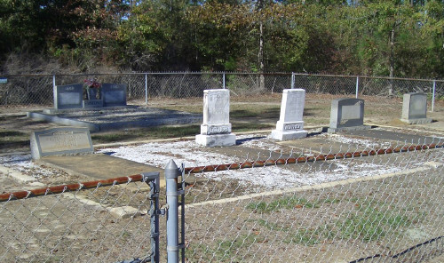
| Memorials | : | 0 |
| Location | : | Escambia County, USA |
| Coordinate | : | 31.1644001, -87.3000031 |
| Description | : | There are actually two burial plots, the old Emmons Cemetery, and the new Emmons Cemetery. The two are divided by Hwy-113. Eastward off 113 on Rawls Road is the older Emmons Cemetery. Westward off 113 on Hendricks-Emmons Road is the new Emmons Cemetery. For less confusion the two plots are locally referred to as "Emmons Cemetery East" and "Emmons Cemetery West". The old Emmons Cemetery contains family names other than Emmons, but the new Emmons Cemetery contains only the Emmons family name. The establishment of two cemeteries came about due to the considerable distance... Read More |
frequently asked questions (FAQ):
-
Where is Emmons Cemetery West?
Emmons Cemetery West is located at Escambia County ,Alabama ,USA.
-
Emmons Cemetery West cemetery's updated grave count on graveviews.com?
0 memorials
-
Where are the coordinates of the Emmons Cemetery West?
Latitude: 31.1644001
Longitude: -87.3000031
Nearby Cemetories:
1. Magnolia Cemetery
Escambia County, USA
Coordinate: 31.1536007, -87.3388977
2. Emmons Cemetery East
Escambia County, USA
Coordinate: 31.1849995, -87.2549973
3. Halls Creek Church Cemetery
Escambia County, USA
Coordinate: 31.1219006, -87.2767029
4. Hammac Cemetery
Escambia County, USA
Coordinate: 31.1154000, -87.2890000
5. Red Oak Missionary Baptist Church Cemetery
Escambia County, USA
Coordinate: 31.1186660, -87.2763130
6. Gravel Hill Baptist Church Cemetery
Barnett Crossroads, Escambia County, USA
Coordinate: 31.2132000, -87.2820200
7. Pineview Church Cemetery
Pineview, Escambia County, USA
Coordinate: 31.1242008, -87.2574997
8. Hawkins Cemetery
Escambia County, USA
Coordinate: 31.2266998, -87.3000031
9. New Bethlehem Baptist Church Cemetery
Barnett Crossroads, Escambia County, USA
Coordinate: 31.2268500, -87.3001300
10. Blue Springs Cemetery
Escambia County, USA
Coordinate: 31.2173760, -87.2596790
11. Moyeville Church Cemetery
Stanley Crossroads, Escambia County, USA
Coordinate: 31.1072006, -87.3435974
12. Hammac Cemetery
Foshee, Escambia County, USA
Coordinate: 31.1251160, -87.2257080
13. Canaan Freewill Baptist Church Cemetery
Barnett Crossroads, Escambia County, USA
Coordinate: 31.2414000, -87.3233000
14. Wallace Church Cemetery
Escambia County, USA
Coordinate: 31.2096996, -87.2213974
15. Pleasant Hill Cemetery
Brewton, Escambia County, USA
Coordinate: 31.1655998, -87.2031021
16. Miller Cemetery
Stanley Crossroads, Escambia County, USA
Coordinate: 31.1427994, -87.3974991
17. Little Rock Church Assemblies of the Lord Jesus Ch
Little Rock, Escambia County, USA
Coordinate: 31.1182995, -87.3893967
18. Poston Cemetery
Foshee, Escambia County, USA
Coordinate: 31.0820600, -87.2573400
19. Boutwell-Lambeth Cemetery
Flomaton, Escambia County, USA
Coordinate: 31.0701020, -87.2970200
20. Pleasant Grove Church Cemetery
Escambia County, USA
Coordinate: 31.1578007, -87.4105988
21. Emmons Cemetery
Appleton, Escambia County, USA
Coordinate: 31.0702991, -87.2769012
22. Smith Plantation Cemetery
Wallace, Escambia County, USA
Coordinate: 31.2418900, -87.2115820
23. Conway Cemetery
Escambia County, USA
Coordinate: 31.1148120, -87.4136960
24. Travelers Rest Cemetery
Flomaton, Escambia County, USA
Coordinate: 31.0499992, -87.3005981

