
| Memorials | : | 0 |
| Location | : | Stanley Crossroads, Escambia County, USA |
| Coordinate | : | 31.1072006, -87.3435974 |
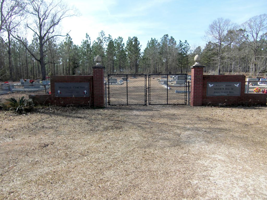
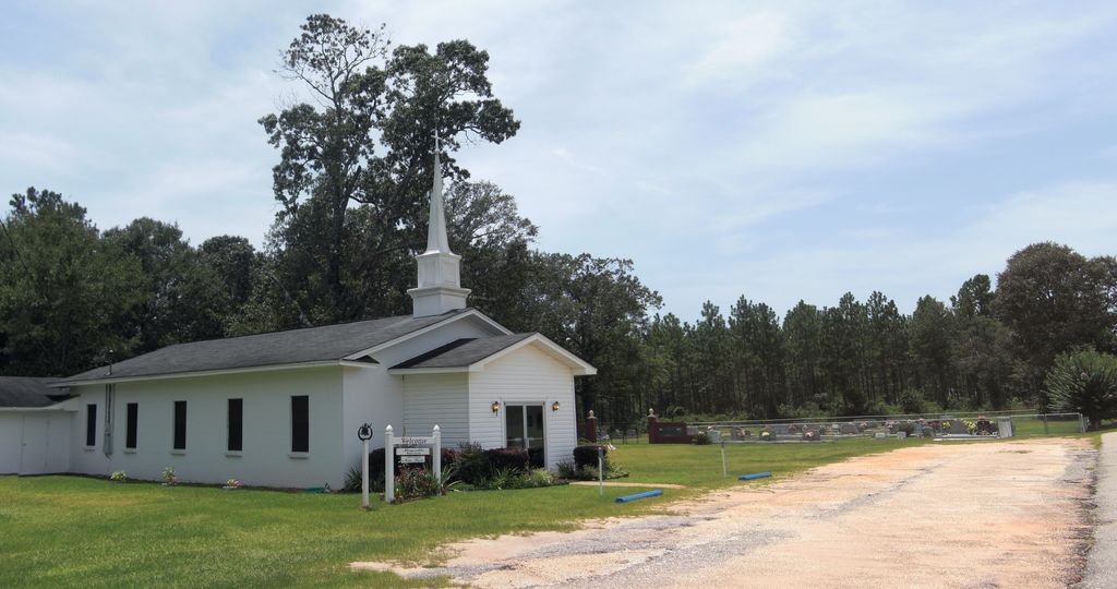
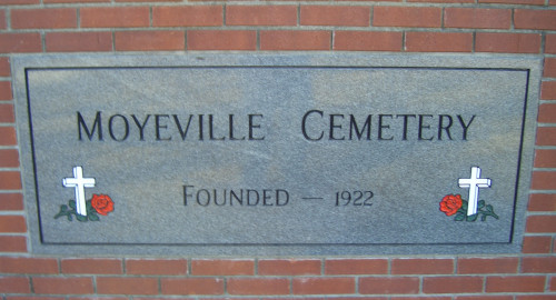
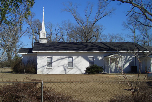
| Description | : | To drive to the Moyeville Baptist Church and Cemetery when traveling on I-65 north, exit at #69 (Flomaton-Wallace). Turn right onto CR-113 for about 300 yards. Turn right again onto CR-17 (known as Old Atmore Road or Stanley Road). At a distance of about 4 miles you come to a 4-way crossing. Continue through the crossing (Stanley Road now becomes CR-25, which is also known as Upper Creek Road) and drive another 1.5 miles. The Moyeville Church is on the right and can be seen clearly. The cemetery is on the west side of... Read More |
frequently asked questions (FAQ):
-
Where is Moyeville Church Cemetery?
Moyeville Church Cemetery is located at Stanley Crossroads, Escambia County ,Alabama ,USA.
-
Moyeville Church Cemetery cemetery's updated grave count on graveviews.com?
0 memorials
-
Where are the coordinates of the Moyeville Church Cemetery?
Latitude: 31.1072006
Longitude: -87.3435974
Nearby Cemetories:
1. Little Rock Church Assemblies of the Lord Jesus Ch
Little Rock, Escambia County, USA
Coordinate: 31.1182995, -87.3893967
2. Magnolia Cemetery
Escambia County, USA
Coordinate: 31.1536007, -87.3388977
3. Hammac Cemetery
Escambia County, USA
Coordinate: 31.1154000, -87.2890000
4. Boutwell-Lambeth Cemetery
Flomaton, Escambia County, USA
Coordinate: 31.0701020, -87.2970200
5. Miller Cemetery
Stanley Crossroads, Escambia County, USA
Coordinate: 31.1427994, -87.3974991
6. Red Oak Missionary Baptist Church Cemetery
Escambia County, USA
Coordinate: 31.1186660, -87.2763130
7. Halls Creek Church Cemetery
Escambia County, USA
Coordinate: 31.1219006, -87.2767029
8. Conway Cemetery
Escambia County, USA
Coordinate: 31.1148120, -87.4136960
9. Emmons Cemetery
Appleton, Escambia County, USA
Coordinate: 31.0702991, -87.2769012
10. Travelers Rest Cemetery
Flomaton, Escambia County, USA
Coordinate: 31.0499992, -87.3005981
11. Emmons Cemetery West
Escambia County, USA
Coordinate: 31.1644001, -87.3000031
12. Pineview Church Cemetery
Pineview, Escambia County, USA
Coordinate: 31.1242008, -87.2574997
13. Sardis Cemetery
Wawbeek, Escambia County, USA
Coordinate: 31.0308304, -87.3452835
14. Pleasant Grove Church Cemetery
Escambia County, USA
Coordinate: 31.1578007, -87.4105988
15. Robinsonville Church Cemetery
Atmore, Escambia County, USA
Coordinate: 31.0713997, -87.4238968
16. Poston Cemetery
Foshee, Escambia County, USA
Coordinate: 31.0820600, -87.2573400
17. Bowman Cemetery
Wawbeek, Escambia County, USA
Coordinate: 31.0303000, -87.3681000
18. Canoe United Methodist Church Cemetery
Robinsonville, Escambia County, USA
Coordinate: 31.0599995, -87.4377975
19. Myrick Family Cemetery
Canoe, Escambia County, USA
Coordinate: 31.0353490, -87.4145650
20. Mize Wadkins Cemetery
Flomaton, Escambia County, USA
Coordinate: 31.0363998, -87.2592010
21. Hammac Cemetery
Foshee, Escambia County, USA
Coordinate: 31.1251160, -87.2257080
22. Canaan Freewill Cemetery
Canoe, Escambia County, USA
Coordinate: 31.0272007, -87.4207993
23. Hall Family Cemetery
Atmore, Escambia County, USA
Coordinate: 31.0256004, -87.4191971
24. Springhill Cemetery
Flomaton, Escambia County, USA
Coordinate: 31.0046860, -87.3101310