
| Memorials | : | 19 |
| Location | : | Grayson County, USA |
| Coordinate | : | 36.5810680, -81.0902480 |
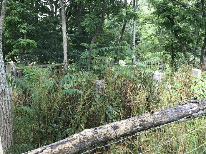
| Description | : | aka Alexander-Gentry Cemetery. Location: East of Independence near the mouth of Peach Bottom Creek. Directions: From Grayson Parkway (US 58) about 3 miles east of Independence go south on Pleasant Grove Road (Route 698) at the western junction with Pleasant Grove Road with From Grayson Parkway. About 0.4 mile later, just past the Pleasant Grove Church and cemetery continue straight on Church Hill Road another 0.9 mile to Beaver Dam Road (Route 697). Turn left (SE) on Beaver Dam Road and go about 1 mile to the junction with Old River Road (Route 700). From this junction go east (left)... Read More |
frequently asked questions (FAQ):
-
Where is Ephraim Gentry Cemetery?
Ephraim Gentry Cemetery is located at Old River Lane (Route 700) Grayson County ,Virginia ,USA.
-
Ephraim Gentry Cemetery cemetery's updated grave count on graveviews.com?
0 memorials
-
Where are the coordinates of the Ephraim Gentry Cemetery?
Latitude: 36.5810680
Longitude: -81.0902480
Nearby Cemetories:
1. Lt. David Cox Cemetery
Baywood, Grayson County, USA
Coordinate: 36.5711000, -81.0961000
2. Lt George Reeves Cemetery
Grayson County, USA
Coordinate: 36.5782260, -81.1094430
3. Little Sam Cox Cemetery
Peach Bottom, Grayson County, USA
Coordinate: 36.5906800, -81.0717700
4. Berry Anders Cemetery
Independence, Grayson County, USA
Coordinate: 36.5841060, -81.1155000
5. Cox-Shaw Cemetery
Grayson County, USA
Coordinate: 36.5902290, -81.0661090
6. Andrew Hampton Cemetery
Grayson County, USA
Coordinate: 36.6044000, -81.0760100
7. Coomes Cemetery
Baywood, Grayson County, USA
Coordinate: 36.5808970, -81.0565870
8. Pleasant Grove Baptist Church Cemetery
Independence, Grayson County, USA
Coordinate: 36.6088660, -81.0972000
9. Jackie Blevins Family Cemetery
Delhart, Grayson County, USA
Coordinate: 36.5955020, -81.0539700
10. Old Bethel Church Cemetery
Independence, Grayson County, USA
Coordinate: 36.5949010, -81.1312190
11. John Blevins Cemetery
Peach Bottom, Grayson County, USA
Coordinate: 36.5954100, -81.0493300
12. Adam Wagoner Cemetery
Independence, Grayson County, USA
Coordinate: 36.5848440, -81.1371210
13. Elliott Cemetery
Independence, Grayson County, USA
Coordinate: 36.5947810, -81.1373240
14. David Nichols Family Cemetery
Baywood, Grayson County, USA
Coordinate: 36.5726960, -81.0402210
15. Chesley Cheek Cemetery
Edwards Crossroads, Alleghany County, USA
Coordinate: 36.5614720, -81.0427220
16. Johnson Family Farm Cemetery
Oldtown, Grayson County, USA
Coordinate: 36.5709160, -81.0348010
17. Hardin Reeves Family Cemetery
Independence, Grayson County, USA
Coordinate: 36.5710400, -81.1475930
18. Wayne Reeves Cemetery
Independence, Grayson County, USA
Coordinate: 36.5783570, -81.1491890
19. Austin-Murray Cemetery
Baywood, Grayson County, USA
Coordinate: 36.5888900, -81.0277800
20. Meredith Cheek Cemetery
Edwards Crossroads, Alleghany County, USA
Coordinate: 36.5625100, -81.0311900
21. Rock Creek Primitive Baptist Church Cemetery
Independence, Grayson County, USA
Coordinate: 36.6311000, -81.1061900
22. Hall Cemetery
Grayson County, USA
Coordinate: 36.6285830, -81.1168500
23. Thomas Anders Family Cemetery
Independence, Grayson County, USA
Coordinate: 36.5760100, -81.1549830
24. Anders Family Cemetery (Defunct)
Independence, Grayson County, USA
Coordinate: 36.5760000, -81.1550000