
| Memorials | : | 1 |
| Location | : | Epsom, Rice County, USA |
| Coordinate | : | 44.2610730, -93.0558130 |
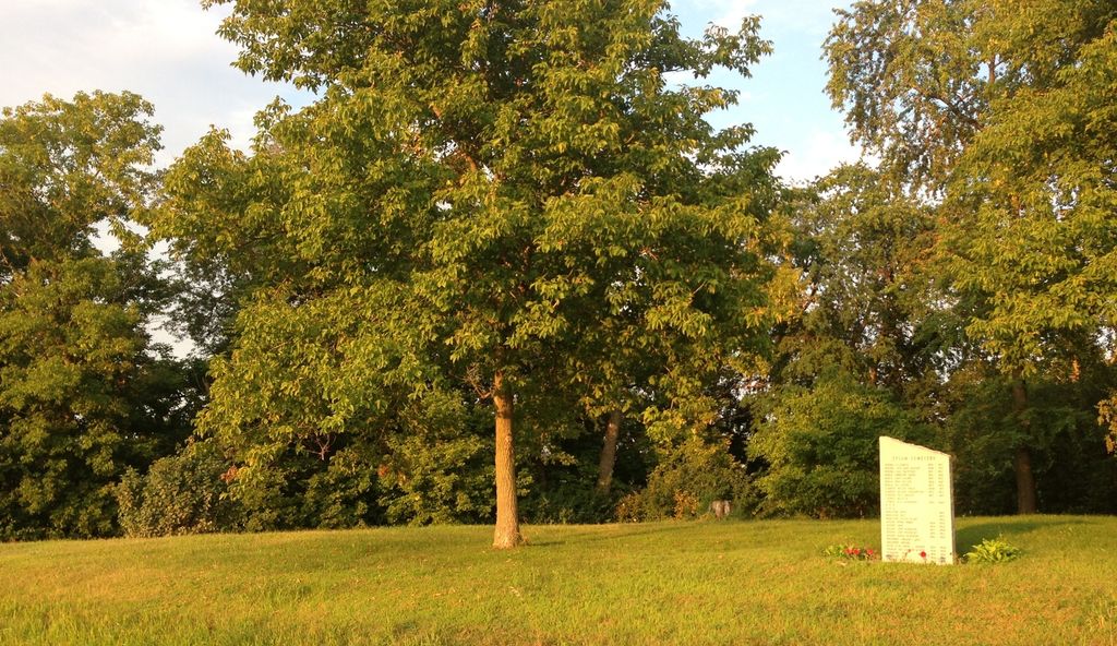
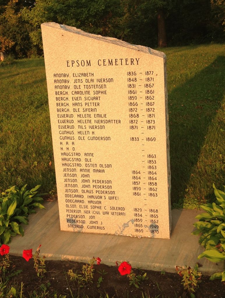
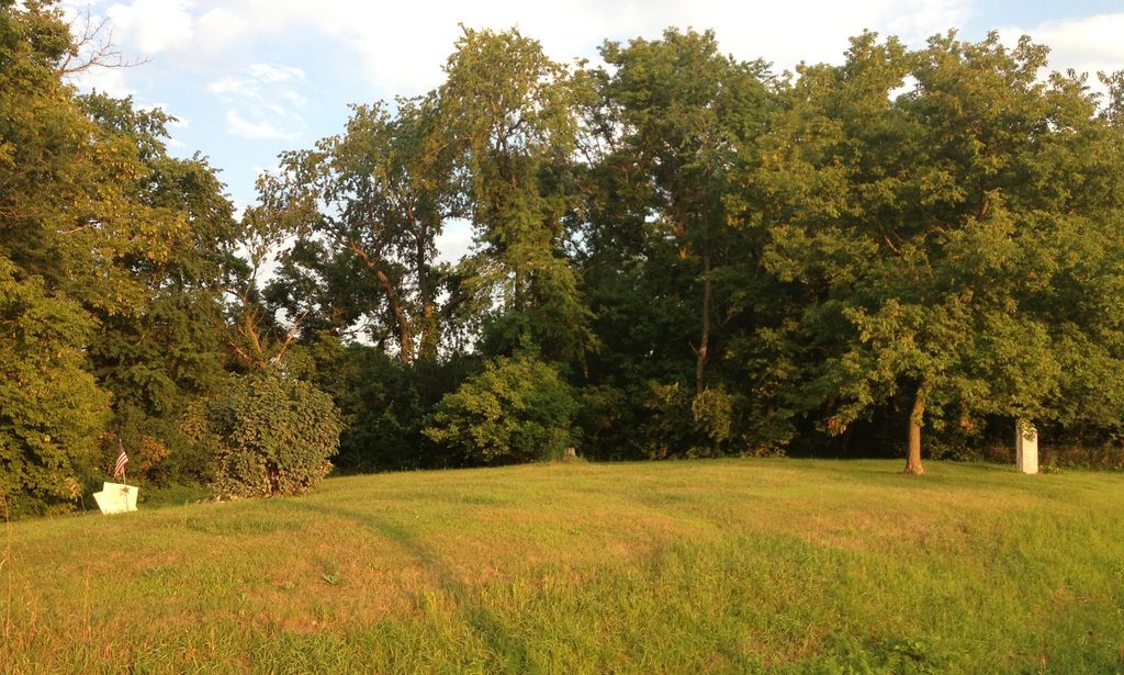
| Description | : | Abandoned cemetery. Notes Rice County Genealogical Society has a family cemetery recorded at this site. Twelve burials 1861-1869, mostly members of Bergh family. Others were Gunhus, Haugstad, Odegaard, Snesrud, and Pederson. One stone found, that of Iver Pedersen, died April 1865. Driving Directions Hwy 60 east of Faribault to Co Rd 26, south on 26 for about a mile; cemetery is on left side. From Minnesota Cemetery Project - Rice Couny |
frequently asked questions (FAQ):
-
Where is Epsom Pioneer Cemetery?
Epsom Pioneer Cemetery is located at 22637 Larson Ave Epsom, Rice County ,Minnesota , 55946USA.
-
Epsom Pioneer Cemetery cemetery's updated grave count on graveviews.com?
1 memorials
-
Where are the coordinates of the Epsom Pioneer Cemetery?
Latitude: 44.2610730
Longitude: -93.0558130
Nearby Cemetories:
1. Hauge Cemetery
Kenyon, Goodhue County, USA
Coordinate: 44.2555618, -93.0213928
2. Gol Lutheran Church Cemetery
Kenyon, Goodhue County, USA
Coordinate: 44.2713318, -93.0106964
3. Prairieville United Methodist Cemetery
Faribault, Rice County, USA
Coordinate: 44.2833786, -93.1132278
4. Saint Edwards Catholic Cemetery
Epsom, Rice County, USA
Coordinate: 44.2413010, -93.1164130
5. Kenyon Cemetery
Kenyon, Goodhue County, USA
Coordinate: 44.2762299, -92.9813995
6. Greenwood Cemetery
Faribault, Rice County, USA
Coordinate: 44.2116600, -93.0913600
7. Saint Johns United Church of Christ Cemetery
Faribault, Rice County, USA
Coordinate: 44.3120728, -93.1027679
8. Bethany-Moland Cemetery
Rice County, USA
Coordinate: 44.1969590, -93.0655560
9. Evangelical Cemetery
Nerstrand, Rice County, USA
Coordinate: 44.3269005, -93.0419006
10. Knoll Cemetery
Goodhue County, USA
Coordinate: 44.3269005, -93.0252991
11. Saint Michaels Cemetery
Kenyon, Goodhue County, USA
Coordinate: 44.2980995, -92.9700012
12. Richland Union Cemetery
Faribault, Rice County, USA
Coordinate: 44.2405340, -93.1567680
13. Richland Cemetery
Rice County, USA
Coordinate: 44.2182999, -93.1425018
14. Moland Cemetery
Moland, Steele County, USA
Coordinate: 44.1819382, -93.0666733
15. Little Cannon Cemetery
Dennison, Goodhue County, USA
Coordinate: 44.3272209, -92.9805603
16. Nerstrand Cemetery
Nerstrand, Rice County, USA
Coordinate: 44.3493996, -93.0658035
17. Eklund Cemetery
Rice County, USA
Coordinate: 44.2182999, -93.1772003
18. Old Prairieville Cemetery
Prairieville, Rice County, USA
Coordinate: 44.2841680, -93.1903270
19. Vang Lutheran Church Cemetery
Dennison, Goodhue County, USA
Coordinate: 44.3566895, -92.9994812
20. Valley Grove Cemetery
Nerstrand, Rice County, USA
Coordinate: 44.3619000, -93.1011000
21. Merton Cemetery
Steele County, USA
Coordinate: 44.1643982, -93.1222000
22. Hegre Church Cemetery
Goodhue County, USA
Coordinate: 44.1974983, -92.9253006
23. Old Hauge Cemetery
Kenyon, Goodhue County, USA
Coordinate: 44.3706700, -92.9751800
24. Cannon City Cemetery
Cannon City, Rice County, USA
Coordinate: 44.3232040, -93.2098083