
| Memorials | : | 1 |
| Location | : | Faribault, Rice County, USA |
| Coordinate | : | 44.3120728, -93.1027679 |
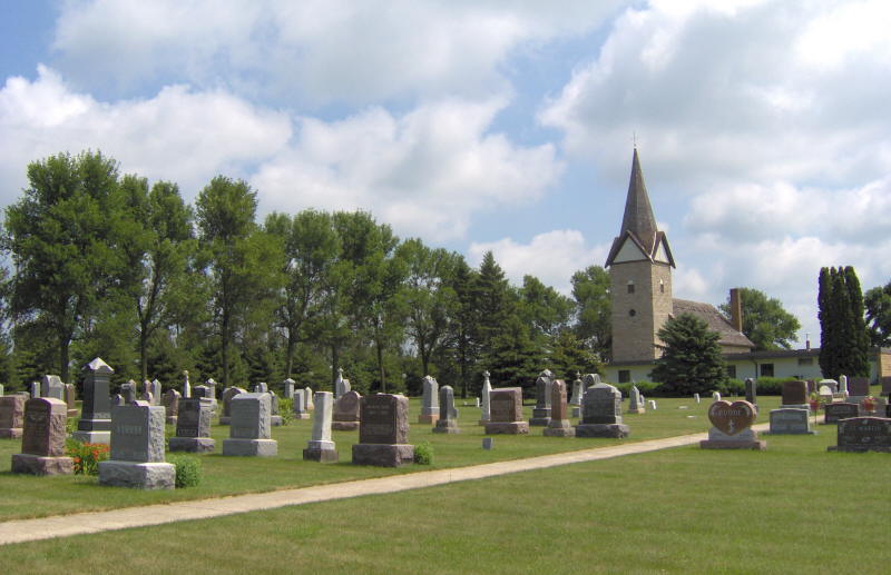
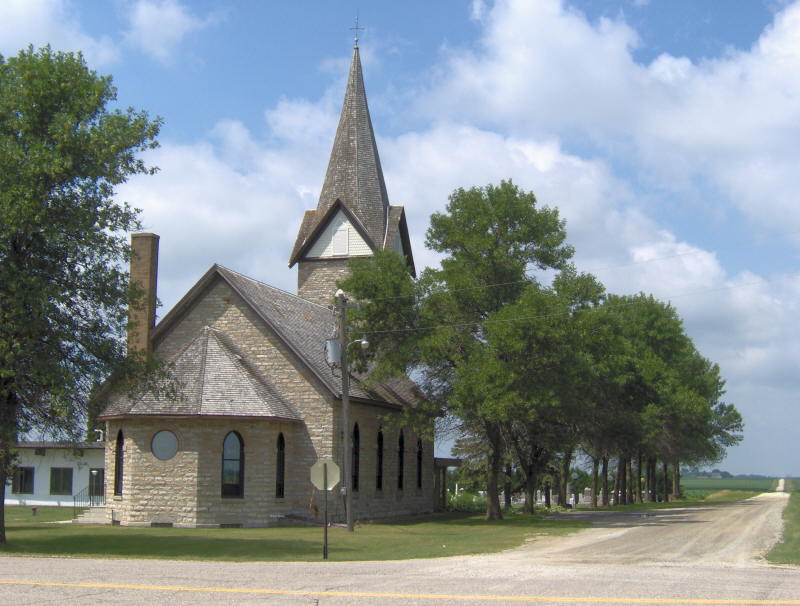
| Description | : | Wheeling Township. 1900 Plat Book of Rice County lists it as German Evangelical Cemetery. |
frequently asked questions (FAQ):
-
Where is Saint Johns United Church of Christ Cemetery?
Saint Johns United Church of Christ Cemetery is located at 16086 Jacobs Avenue Faribault, Rice County ,Minnesota , 55021USA.
-
Saint Johns United Church of Christ Cemetery cemetery's updated grave count on graveviews.com?
1 memorials
-
Where are the coordinates of the Saint Johns United Church of Christ Cemetery?
Latitude: 44.3120728
Longitude: -93.1027679
Nearby Cemetories:
1. Prairieville United Methodist Cemetery
Faribault, Rice County, USA
Coordinate: 44.2833786, -93.1132278
2. Nerstrand Cemetery
Nerstrand, Rice County, USA
Coordinate: 44.3493996, -93.0658035
3. Evangelical Cemetery
Nerstrand, Rice County, USA
Coordinate: 44.3269005, -93.0419006
4. Valley Grove Cemetery
Nerstrand, Rice County, USA
Coordinate: 44.3619000, -93.1011000
5. Knoll Cemetery
Goodhue County, USA
Coordinate: 44.3269005, -93.0252991
6. Epsom Pioneer Cemetery
Epsom, Rice County, USA
Coordinate: 44.2610730, -93.0558130
7. Old Prairieville Cemetery
Prairieville, Rice County, USA
Coordinate: 44.2841680, -93.1903270
8. Saint Edwards Catholic Cemetery
Epsom, Rice County, USA
Coordinate: 44.2413010, -93.1164130
9. Cannon City Cemetery
Cannon City, Rice County, USA
Coordinate: 44.3232040, -93.2098083
10. Gol Lutheran Church Cemetery
Kenyon, Goodhue County, USA
Coordinate: 44.2713318, -93.0106964
11. Hauge Cemetery
Kenyon, Goodhue County, USA
Coordinate: 44.2555618, -93.0213928
12. Richland Union Cemetery
Faribault, Rice County, USA
Coordinate: 44.2405340, -93.1567680
13. Vang Lutheran Church Cemetery
Dennison, Goodhue County, USA
Coordinate: 44.3566895, -92.9994812
14. Little Cannon Cemetery
Dennison, Goodhue County, USA
Coordinate: 44.3272209, -92.9805603
15. Kenyon Cemetery
Kenyon, Goodhue County, USA
Coordinate: 44.2762299, -92.9813995
16. Prairie Creek Cemetery
Northfield, Rice County, USA
Coordinate: 44.4072000, -93.0966000
17. Saint Michaels Cemetery
Kenyon, Goodhue County, USA
Coordinate: 44.2980995, -92.9700012
18. Richland Cemetery
Rice County, USA
Coordinate: 44.2182999, -93.1425018
19. Greenwood Cemetery
Faribault, Rice County, USA
Coordinate: 44.2116600, -93.0913600
20. Eklund Cemetery
Rice County, USA
Coordinate: 44.2182999, -93.1772003
21. Old Hauge Cemetery
Kenyon, Goodhue County, USA
Coordinate: 44.3706700, -92.9751800
22. Faribault Regional Center East Cemetery
Walcott, Rice County, USA
Coordinate: 44.2824783, -93.2493744
23. Cemetery of the Good Shepherd
Faribault, Rice County, USA
Coordinate: 44.3147200, -93.2611080
24. North Grove Cemetery
Faribault, Rice County, USA
Coordinate: 44.3519402, -93.2572174