
| Memorials | : | 11 |
| Location | : | Estancia, Torrance County, USA |
| Coordinate | : | 34.7406006, -106.0796967 |
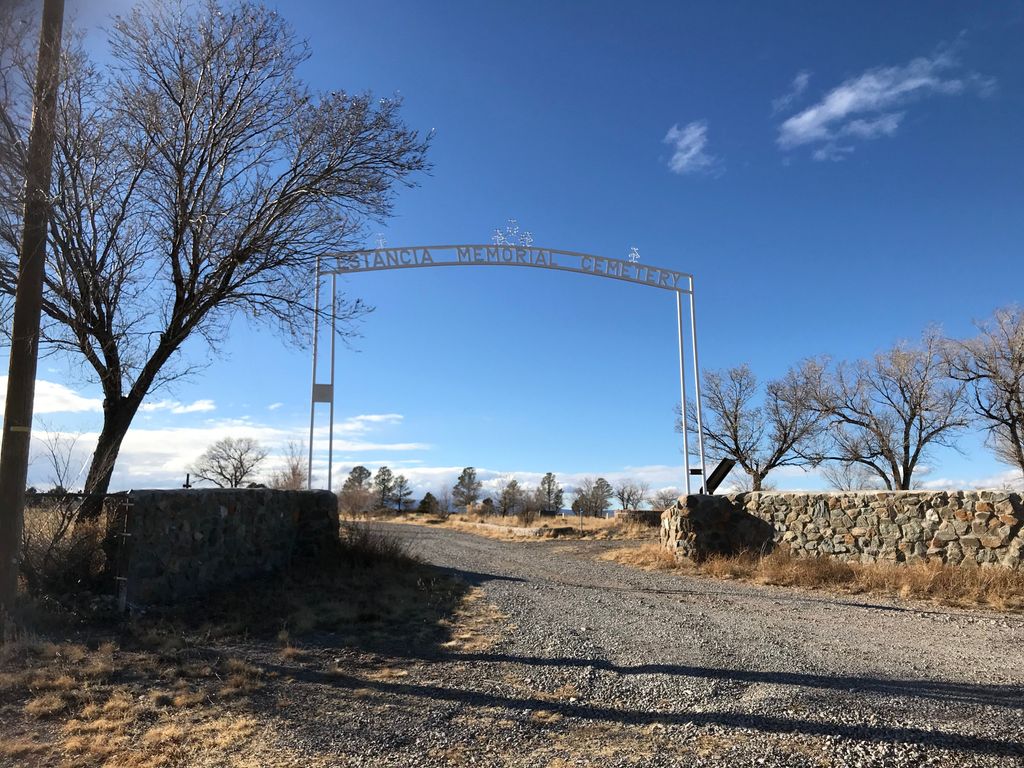
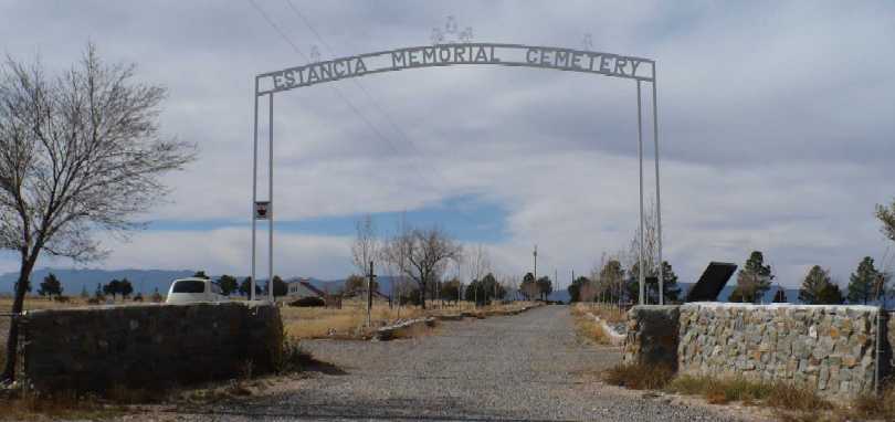
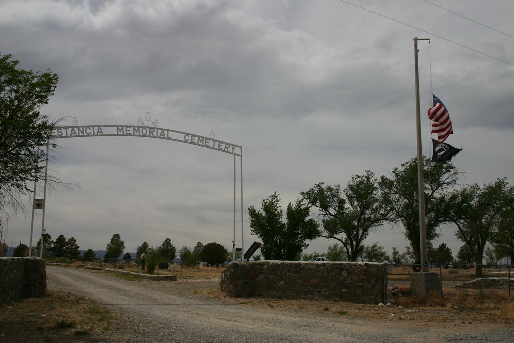
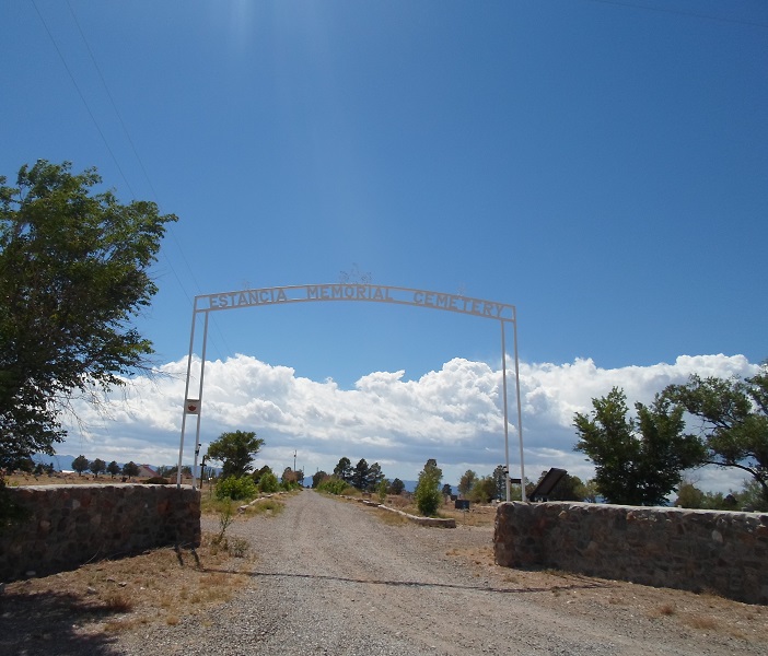
| Description | : | Inside the main entrance of the Estancia Memorial Cemetery (immediately on the left/South) is the Estancia Catholic Cemetery also known as the "Saints Peter and Paul Catholic Cemetery". The primary cemetery is managed by the Town of Estancia, but the quadrant in the SouthEast corner is managed by the Catholic Parish. There are no fences, etc. that separate the two cemeteries. Each cemetery has its own roadway naming and plot numbering system. Many memorials posted in Find A Grave indicate in the plot information the helpful additional descriptor of "SS Peter and Paul Catholic". |
frequently asked questions (FAQ):
-
Where is Estancia Memorial Cemetery?
Estancia Memorial Cemetery is located at Estancia, Torrance County ,New Mexico ,USA.
-
Estancia Memorial Cemetery cemetery's updated grave count on graveviews.com?
9 memorials
-
Where are the coordinates of the Estancia Memorial Cemetery?
Latitude: 34.7406006
Longitude: -106.0796967

Nearby Cemetories:
1. McIntosh Cemetery
Torrance County, USA
Coordinate: 34.8647003, -106.0511017
2. Garland Cemetery
Torrance County, USA
Coordinate: 34.7972220, -106.2352780
3. El Rosario Cemetery
Willard, Torrance County, USA
Coordinate: 34.6044006, -106.0306015
4. Our Lady Of Sorrows Church Cemetery
Willard, Torrance County, USA
Coordinate: 34.5976900, -106.0339500
5. Protestant Cemetery
Willard, Torrance County, USA
Coordinate: 34.5957985, -106.0330963
6. Willard Cemetery
Willard, Torrance County, USA
Coordinate: 34.5957985, -106.0330963
7. Urban Family Ranch Cemetery
Estancia, Torrance County, USA
Coordinate: 34.7808126, -106.2597102
8. CLL Ranch Cemetery
Torreon, Torrance County, USA
Coordinate: 34.7207494, -106.2703326
9. Mount Calvary Cemetery
Torrance County, USA
Coordinate: 34.6343994, -106.2358017
10. Glover Ranch Cemetery
Tajique, Torrance County, USA
Coordinate: 34.7561500, -106.2866720
11. Farmer Cemetery
Willard, Torrance County, USA
Coordinate: 34.5745440, -106.0268070
12. Tajique Catholic Church Cemetery
Tajique, Torrance County, USA
Coordinate: 34.7513640, -106.2884370
13. Torreon Cemetery
Torreon, Torrance County, USA
Coordinate: 34.7211900, -106.2997140
14. Torreon Catholic Cemetery
Torreon, Torrance County, USA
Coordinate: 34.7213210, -106.2997510
15. Chilili New Cemetery
Chilili, Bernalillo County, USA
Coordinate: 34.8839800, -106.2229200
16. Saint John Nepomucene Cemetery
Torrance County, USA
Coordinate: 34.8894005, -106.2322006
17. Chilili Cemetery
Chilili, Bernalillo County, USA
Coordinate: 34.8894005, -106.2322006
18. San Juan Nepomoceno
Chilili, Bernalillo County, USA
Coordinate: 34.8893350, -106.2326730
19. La Morada Cemetery
Chilili, Bernalillo County, USA
Coordinate: 34.8891700, -106.2337160
20. Punta de Agua Community Cemetery
Punta de Agua, Torrance County, USA
Coordinate: 34.5978080, -106.2794970
21. Saint Vincent De Paul Catholic Church Cemetery
Mountainair, Torrance County, USA
Coordinate: 34.5999985, -106.2833023
22. Lucy Cemetery
Lucy, Torrance County, USA
Coordinate: 34.6390340, -105.8333340
23. Manzano Hills Cemetery
Torrance County, USA
Coordinate: 34.6467018, -106.3443985
24. Our Lady of Sorrows Catholic Cemetery
Manzano, Torrance County, USA
Coordinate: 34.6467018, -106.3443985