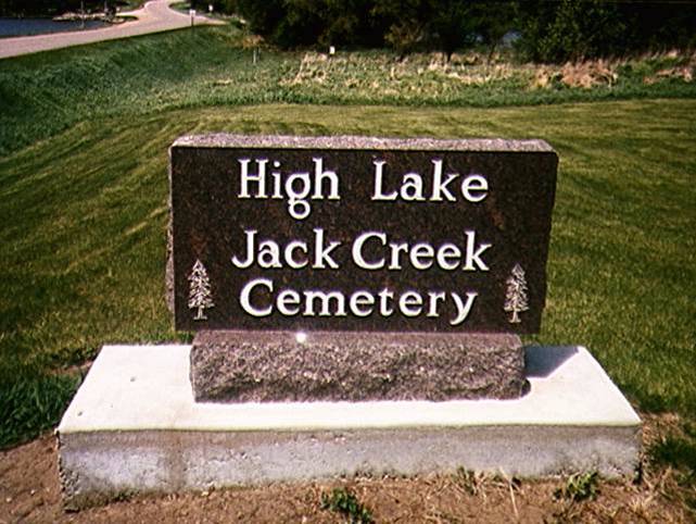
| Memorials | : | 1 |
| Location | : | Wallingford, Emmet County, USA |
| Coordinate | : | 43.3006500, -94.7000620 |
| Description | : | High Lake-Jack Creek Cemetery is located in High Lake Township; 2380 450th Avenue; Wallingford, Emmet County, Iowa. The High Lake - Jack Creek Cemetery is located in the SE part of Section 14 in High Lake Township in Emmet County Iowa. OR from Wallingford, IA about 5 miles east on N34. First Burial 1862. |
frequently asked questions (FAQ):
-
Where is High Lake Jack Creek Cemetery?
High Lake Jack Creek Cemetery is located at Wallingford, Emmet County ,Iowa ,USA.
-
High Lake Jack Creek Cemetery cemetery's updated grave count on graveviews.com?
1 memorials
-
Where are the coordinates of the High Lake Jack Creek Cemetery?
Latitude: 43.3006500
Longitude: -94.7000620
Nearby Cemetories:
1. Wallingford Lutheran Cemetery
Wallingford, Emmet County, USA
Coordinate: 43.3128014, -94.7731018
2. Valley View Cemetery
Walnut Township, Palo Alto County, USA
Coordinate: 43.2428000, -94.7212000
3. Center Township Cemetery
Emmet County, USA
Coordinate: 43.3608000, -94.6790000
4. Saint Jacobs Cemetery
Graettinger, Palo Alto County, USA
Coordinate: 43.2546997, -94.7705994
5. Graettinger City Cemetery
Graettinger, Palo Alto County, USA
Coordinate: 43.2550011, -94.7722015
6. Swan Lake Township Cemetery
Maple Hill, Emmet County, USA
Coordinate: 43.3850746, -94.6381378
7. Saint Patricks Cemetery
Estherville, Emmet County, USA
Coordinate: 43.3843994, -94.8283005
8. Saint Paul Lutheran Cemetery
Walnut Township, Palo Alto County, USA
Coordinate: 43.1866740, -94.7872050
9. Vernon Township Cemetery
Vernon Township, Palo Alto County, USA
Coordinate: 43.1840000, -94.6185000
10. East Side Cemetery
Estherville, Emmet County, USA
Coordinate: 43.4068985, -94.8264008
11. Lost Island Lutheran Cemetery
Lost Island Township, Palo Alto County, USA
Coordinate: 43.1980000, -94.8375000
12. Oak Hill Cemetery
Estherville, Emmet County, USA
Coordinate: 43.3986015, -94.8518982
13. Prosser Cemetery
Estherville, Emmet County, USA
Coordinate: 43.4422000, -94.7783000
14. Lincoln Township Cemetery
Dolliver, Emmet County, USA
Coordinate: 43.4441986, -94.6204987
15. East Side Memorial Cemetery
Estherville, Emmet County, USA
Coordinate: 43.4267750, -94.8265600
16. Norwegian Cemetery
Estherville, Emmet County, USA
Coordinate: 43.4291992, -94.8261032
17. Estherville Lutheran Cemetery
Estherville, Emmet County, USA
Coordinate: 43.4298000, -94.8263000
18. Memorial Cemetery
Ringsted, Emmet County, USA
Coordinate: 43.3009070, -94.4814670
19. Saint John Lutheran Cemetery
Ringsted, Emmet County, USA
Coordinate: 43.3004080, -94.4812520
20. Mount Calvary Cemetery
Armstrong, Emmet County, USA
Coordinate: 43.3850000, -94.5028000
21. Fairview Cemetery
Terril, Dickinson County, USA
Coordinate: 43.2977982, -94.9349976
22. Saint Marys Catholic Cemetery
Armstrong, Emmet County, USA
Coordinate: 43.3980000, -94.5048000
23. Armstrong Grove Cemetery
Armstrong, Emmet County, USA
Coordinate: 43.3985696, -94.5041425
24. Saint Pauls Lutheran Cemetery
Ringsted, Emmet County, USA
Coordinate: 43.3120000, -94.4620000

