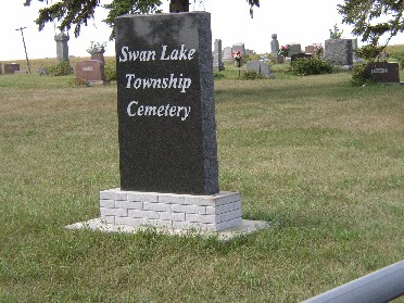
| Memorials | : | 21 |
| Location | : | Maple Hill, Emmet County, USA |
| Coordinate | : | 43.3850746, -94.6381378 |
| Description | : | The Swan Lake Cemetery is located in the Northwest part of Section 21 of Swan Lake Township, in Emmet County Iowa OR from Estherville, IA is located 11 miles east on Hwy 9 to Blacktop N 52, 1 mile south and 1/2 mile west, south side of the road, on 180th Street. The first burial is 1880. |
frequently asked questions (FAQ):
-
Where is Swan Lake Township Cemetery?
Swan Lake Township Cemetery is located at Maple Hill, Emmet County ,Iowa ,USA.
-
Swan Lake Township Cemetery cemetery's updated grave count on graveviews.com?
21 memorials
-
Where are the coordinates of the Swan Lake Township Cemetery?
Latitude: 43.3850746
Longitude: -94.6381378
Nearby Cemetories:
1. Center Township Cemetery
Emmet County, USA
Coordinate: 43.3608000, -94.6790000
2. Lincoln Township Cemetery
Dolliver, Emmet County, USA
Coordinate: 43.4441986, -94.6204987
3. High Lake Jack Creek Cemetery
Wallingford, Emmet County, USA
Coordinate: 43.3006500, -94.7000620
4. Saint Marys Catholic Cemetery
Armstrong, Emmet County, USA
Coordinate: 43.3980000, -94.5048000
5. Armstrong Grove Cemetery
Armstrong, Emmet County, USA
Coordinate: 43.3985696, -94.5041425
6. Mount Calvary Cemetery
Armstrong, Emmet County, USA
Coordinate: 43.3850000, -94.5028000
7. Palestine Cemetery
Dolliver, Emmet County, USA
Coordinate: 43.4880000, -94.6408000
8. Prosser Cemetery
Estherville, Emmet County, USA
Coordinate: 43.4422000, -94.7783000
9. Wallingford Lutheran Cemetery
Wallingford, Emmet County, USA
Coordinate: 43.3128014, -94.7731018
10. Ellsworth Cemetery
Emmet County, USA
Coordinate: 43.5005989, -94.7249985
11. Saint Patricks Cemetery
Estherville, Emmet County, USA
Coordinate: 43.3843994, -94.8283005
12. East Side Cemetery
Estherville, Emmet County, USA
Coordinate: 43.4068985, -94.8264008
13. Memorial Cemetery
Ringsted, Emmet County, USA
Coordinate: 43.3009070, -94.4814670
14. Saint John Lutheran Cemetery
Ringsted, Emmet County, USA
Coordinate: 43.3004080, -94.4812520
15. East Side Memorial Cemetery
Estherville, Emmet County, USA
Coordinate: 43.4267750, -94.8265600
16. Norwegian Cemetery
Estherville, Emmet County, USA
Coordinate: 43.4291992, -94.8261032
17. Estherville Lutheran Cemetery
Estherville, Emmet County, USA
Coordinate: 43.4298000, -94.8263000
18. Saint Pauls Lutheran Cemetery
Ringsted, Emmet County, USA
Coordinate: 43.3120000, -94.4620000
19. Tenhassen Cemetery
Ceylon, Martin County, USA
Coordinate: 43.5293999, -94.5877991
20. Lake Belt Cemetery
Ceylon, Martin County, USA
Coordinate: 43.5353012, -94.6742020
21. Valley View Cemetery
Walnut Township, Palo Alto County, USA
Coordinate: 43.2428000, -94.7212000
22. Oak Hill Cemetery
Estherville, Emmet County, USA
Coordinate: 43.3986015, -94.8518982
23. Saint Jacobs Cemetery
Graettinger, Palo Alto County, USA
Coordinate: 43.2546997, -94.7705994
24. Graettinger City Cemetery
Graettinger, Palo Alto County, USA
Coordinate: 43.2550011, -94.7722015

