
| Memorials | : | 1 |
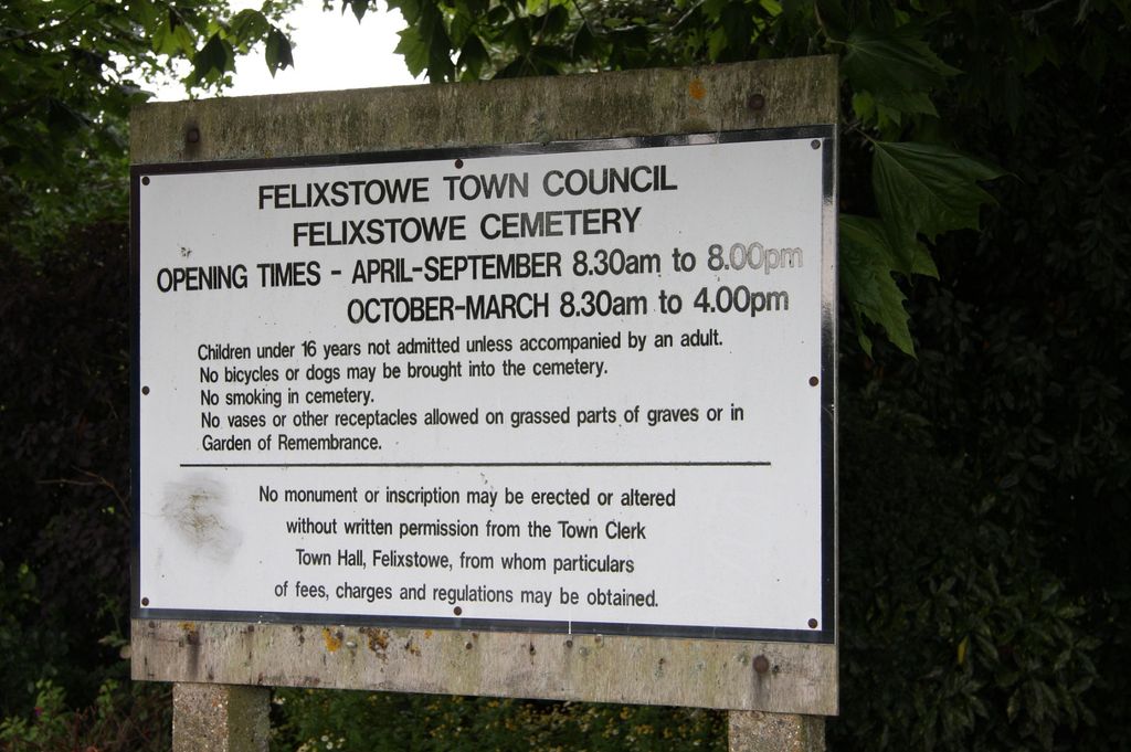
| Location | : | Felixstowe, Suffolk Coastal District, England |
| Coordinate | : | 51.9649780, 1.3368740 |
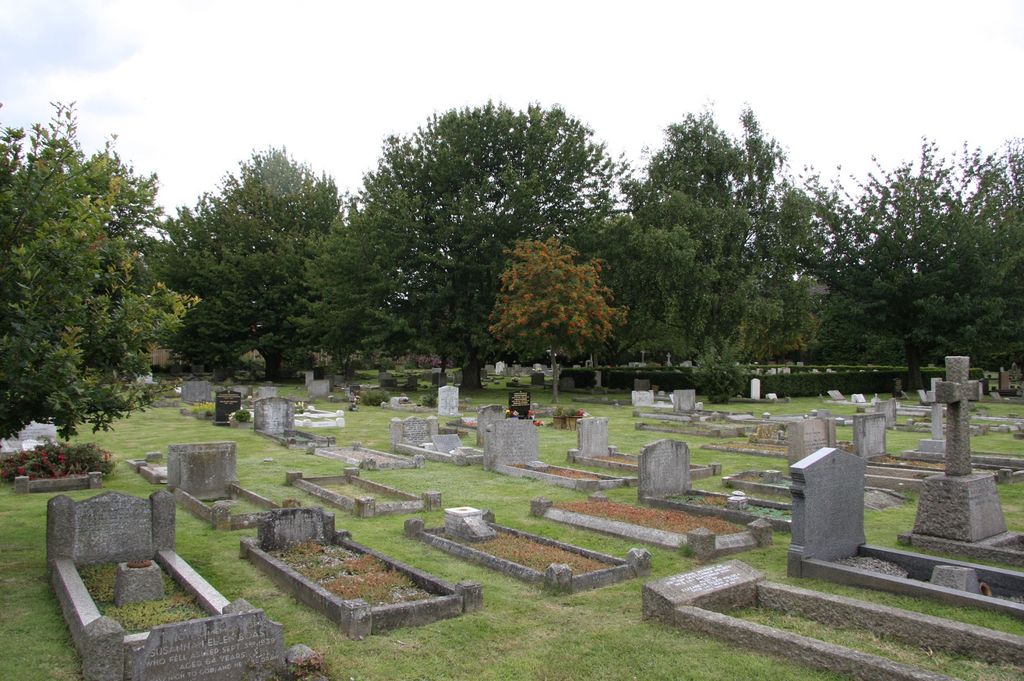
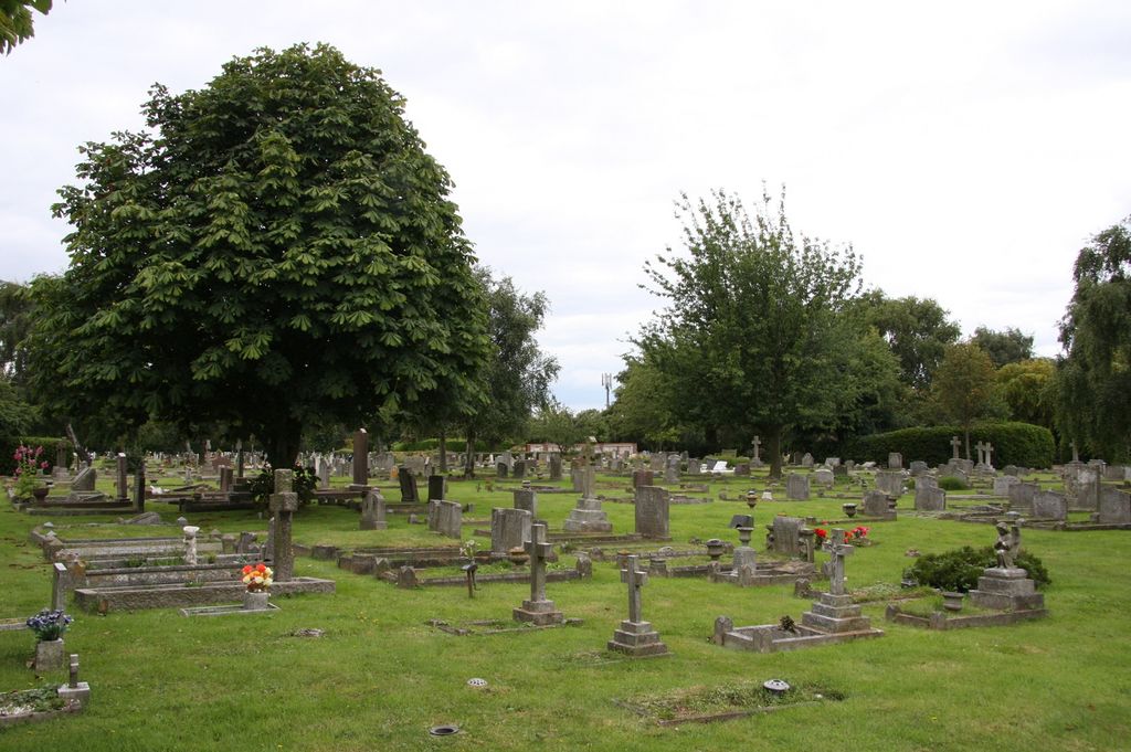
| Description | : | There are 64 Commonwealth burials of the 1914-18 war, including 1 unidentified Royal Navy sailor who was buried on 26th March 1917, in B. 71. There are a further 44 burials of the 1939-45 war including 9 unidentified seamen of the Merchant Navy. There are also 8 foreign national war burials including 1 unidentified German airman, and 3 non-war service burials. |
frequently asked questions (FAQ):
-
Where is Felixstowe Cemetery?
Felixstowe Cemetery is located at Langley Avenue Felixstowe, Suffolk Coastal District ,Suffolk , IP11 2NAEngland.
-
Felixstowe Cemetery cemetery's updated grave count on graveviews.com?
1 memorials
-
Where are the coordinates of the Felixstowe Cemetery?
Latitude: 51.9649780
Longitude: 1.3368740
Nearby Cemetories:
1. Walton Cemetery
Felixstowe, Suffolk Coastal District, England
Coordinate: 51.9723000, 1.3412500
2. War Memorial
Felixstowe, Suffolk Coastal District, England
Coordinate: 51.9593220, 1.3493472
3. Ss Peter and Paul Churchyard
Felixstowe, Suffolk Coastal District, England
Coordinate: 51.9716420, 1.3678780
4. St. Mary's Parish Churchyard
Trimley St Mary, Suffolk Coastal District, England
Coordinate: 51.9846250, 1.3145370
5. St. Martin Churchyard
Trimley St Martin, Suffolk Coastal District, England
Coordinate: 51.9851680, 1.3142220
6. Landguard Fort Graveyard
Felixstowe, Suffolk Coastal District, England
Coordinate: 51.9405105, 1.3199968
7. St Nicholas Churchyard
Harwich, Tendring District, England
Coordinate: 51.9457150, 1.2886510
8. St Ethelbert Churchyard
Falkenham, Suffolk Coastal District, England
Coordinate: 52.0023900, 1.3401700
9. St. Mary and St. Martin Church Cemetery
Kirton, Suffolk Coastal District, England
Coordinate: 52.0090070, 1.3226860
10. Shotley Royal Naval Cemetery
Shotley, Babergh District, England
Coordinate: 51.9780006, 1.2569460
11. St. Mary's Church Cemetery
Shotley, Babergh District, England
Coordinate: 51.9773400, 1.2562500
12. St Mary Churchyard
Shotley, Babergh District, England
Coordinate: 51.9776180, 1.2558960
13. Parkeston Cemetery
Parkeston, Tendring District, England
Coordinate: 51.9384300, 1.2579700
14. All Saints Churchyard
Dovercourt, Tendring District, England
Coordinate: 51.9334060, 1.2546450
15. Dovercourt Cemetery
Dovercourt, Tendring District, England
Coordinate: 51.9317800, 1.2499130
16. St Peter's Churchyard
Levington, Suffolk Coastal District, England
Coordinate: 52.0047690, 1.2539900
17. St Mary's Church
Erwarton (Arwarton), Babergh District, England
Coordinate: 51.9661220, 1.2315200
18. All Saints Churchyard
Ramsholt, Suffolk Coastal District, England
Coordinate: 52.0294500, 1.3617700
19. St. Mary's Churchyard
Bawdsey, Suffolk Coastal District, England
Coordinate: 52.0098980, 1.4177850
20. All Saints Parish Church
Hemley, Suffolk Coastal District, England
Coordinate: 52.0324550, 1.3304610
21. St. Andrew's Churchyard
Alderton, Suffolk Coastal District, England
Coordinate: 52.0239900, 1.4136300
22. St. Mary's Churchyard
Newbourne, Suffolk Coastal District, England
Coordinate: 52.0392970, 1.3127700
23. St. Michael and All Angels Churchyard
Ramsey, Tendring District, England
Coordinate: 51.9282100, 1.2252700
24. St Mary Churchyard
Bucklesham, Suffolk Coastal District, England
Coordinate: 52.0316100, 1.2699200