
| Memorials | : | 0 |
| Location | : | Felixstowe, Suffolk Coastal District, England |
| Coordinate | : | 51.9716420, 1.3678780 |
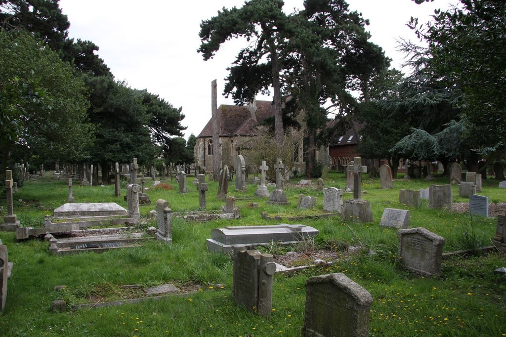
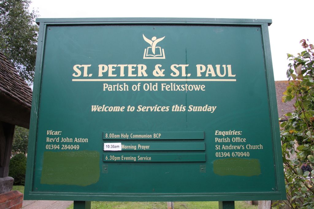
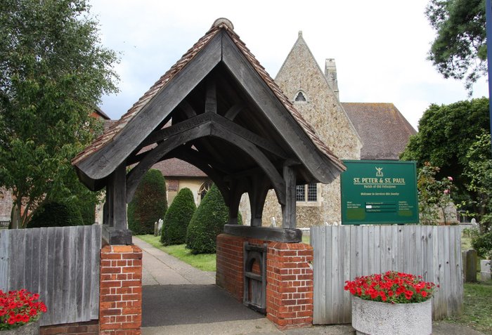
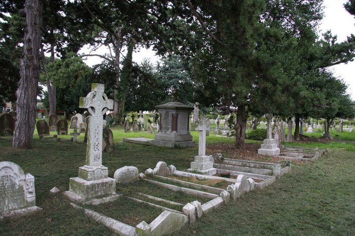
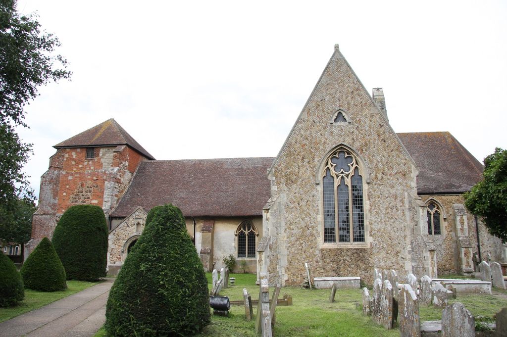
| Description | : | The full designation for this church, following mergers with other parishes is now St Peter & St Paul with St Andrew & St Nicholas. Until a couple of hundred years ago, this was a small church in the middle of a tiny, straggling village. It was an outpost of the much larger village of Walton, a couple of miles to the south. Now, Felixstowe has reached out and engulfed Walton, becoming Suffolk's fourth largest town, home to not far short of 40,000 people. Walton parish church sits on the edge of Felixstowe's modern town centre, but the church that is Felixstowe's... Read More |
frequently asked questions (FAQ):
-
Where is Ss Peter and Paul Churchyard?
Ss Peter and Paul Churchyard is located at Church Rd Felixstowe, Suffolk Coastal District ,Suffolk , IP11 9NFEngland.
-
Ss Peter and Paul Churchyard cemetery's updated grave count on graveviews.com?
0 memorials
-
Where are the coordinates of the Ss Peter and Paul Churchyard?
Latitude: 51.9716420
Longitude: 1.3678780
Nearby Cemetories:
1. Walton Cemetery
Felixstowe, Suffolk Coastal District, England
Coordinate: 51.9723000, 1.3412500
2. War Memorial
Felixstowe, Suffolk Coastal District, England
Coordinate: 51.9593220, 1.3493472
3. Felixstowe Cemetery
Felixstowe, Suffolk Coastal District, England
Coordinate: 51.9649780, 1.3368740
4. St Ethelbert Churchyard
Falkenham, Suffolk Coastal District, England
Coordinate: 52.0023900, 1.3401700
5. St. Mary's Parish Churchyard
Trimley St Mary, Suffolk Coastal District, England
Coordinate: 51.9846250, 1.3145370
6. St. Martin Churchyard
Trimley St Martin, Suffolk Coastal District, England
Coordinate: 51.9851680, 1.3142220
7. Landguard Fort Graveyard
Felixstowe, Suffolk Coastal District, England
Coordinate: 51.9405105, 1.3199968
8. St. Mary and St. Martin Church Cemetery
Kirton, Suffolk Coastal District, England
Coordinate: 52.0090070, 1.3226860
9. St. Mary's Churchyard
Bawdsey, Suffolk Coastal District, England
Coordinate: 52.0098980, 1.4177850
10. St Nicholas Churchyard
Harwich, Tendring District, England
Coordinate: 51.9457150, 1.2886510
11. All Saints Churchyard
Ramsholt, Suffolk Coastal District, England
Coordinate: 52.0294500, 1.3617700
12. St. Andrew's Churchyard
Alderton, Suffolk Coastal District, England
Coordinate: 52.0239900, 1.4136300
13. All Saints Parish Church
Hemley, Suffolk Coastal District, England
Coordinate: 52.0324550, 1.3304610
14. Shotley Royal Naval Cemetery
Shotley, Babergh District, England
Coordinate: 51.9780006, 1.2569460
15. St. Mary's Church Cemetery
Shotley, Babergh District, England
Coordinate: 51.9773400, 1.2562500
16. St Mary Churchyard
Shotley, Babergh District, England
Coordinate: 51.9776180, 1.2558960
17. Parkeston Cemetery
Parkeston, Tendring District, England
Coordinate: 51.9384300, 1.2579700
18. St. Mary's Churchyard
Newbourne, Suffolk Coastal District, England
Coordinate: 52.0392970, 1.3127700
19. St Peter's Churchyard
Levington, Suffolk Coastal District, England
Coordinate: 52.0047690, 1.2539900
20. All Saints Churchyard
Dovercourt, Tendring District, England
Coordinate: 51.9334060, 1.2546450
21. St. Margaret's Churchyard
Shottisham, Suffolk Coastal District, England
Coordinate: 52.0520710, 1.3841940
22. Dovercourt Cemetery
Dovercourt, Tendring District, England
Coordinate: 51.9317800, 1.2499130
23. St Mary's Church
Erwarton (Arwarton), Babergh District, England
Coordinate: 51.9661220, 1.2315200
24. All Saints Churchyard
Hollesley, Suffolk Coastal District, England
Coordinate: 52.0473600, 1.4304300